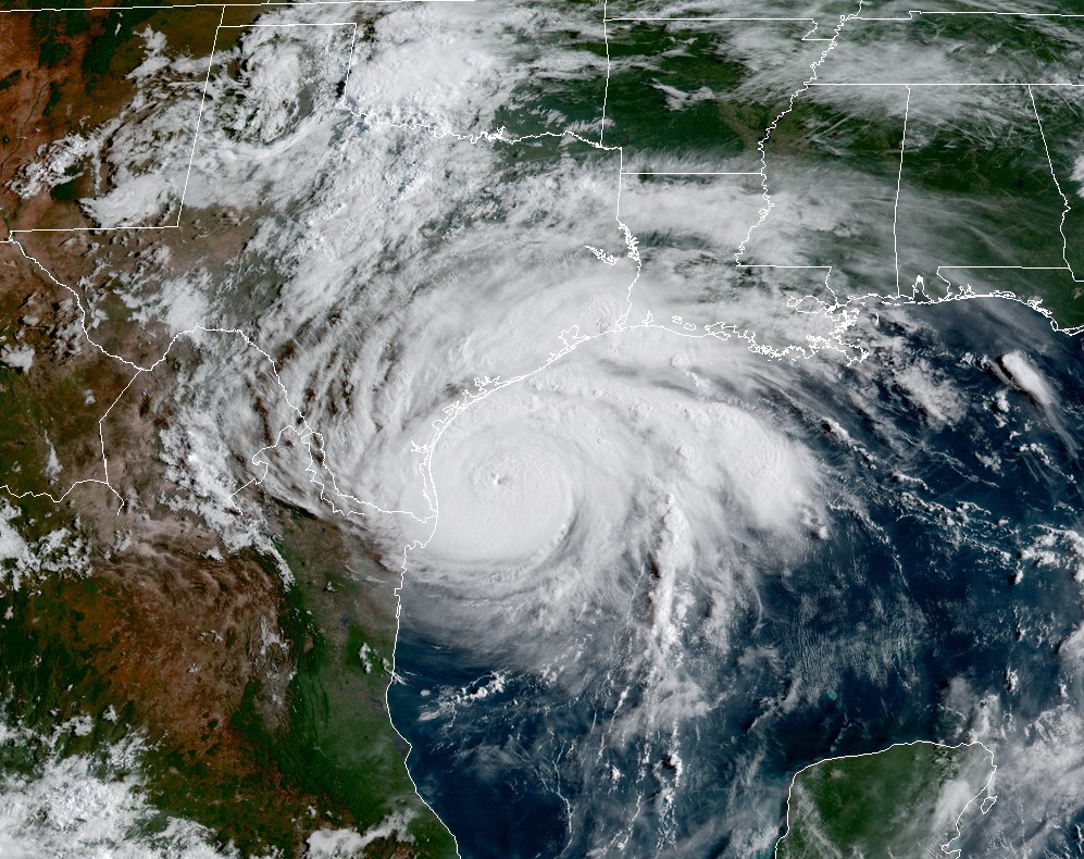
And so it begins … Texas suffered its first major blows from Hurricane Harvey on Friday, as the storm neared the coast and, instead of slowing down, kept moving right along and plowed into the Central Texas coast. It came inland shortly before 10 pm CT as an intense Category 4 hurricane. The early meteorology reports out of Corpus Christi and Rockport are pretty grim. Harvey should now gradually weaken, so long as it remains inland.
What happens now
I understand that some of you appreciate dark humor during these dark times, so I present you with this evening’s spaghetti plot of track models that were initialized at 6pm CT, and came out shortly thereafter. They are nonsensical. I posted them to Twitter with this comment: “Great to see that the latest forecast models are finally getting a good handle on Harvey’s inland track.”
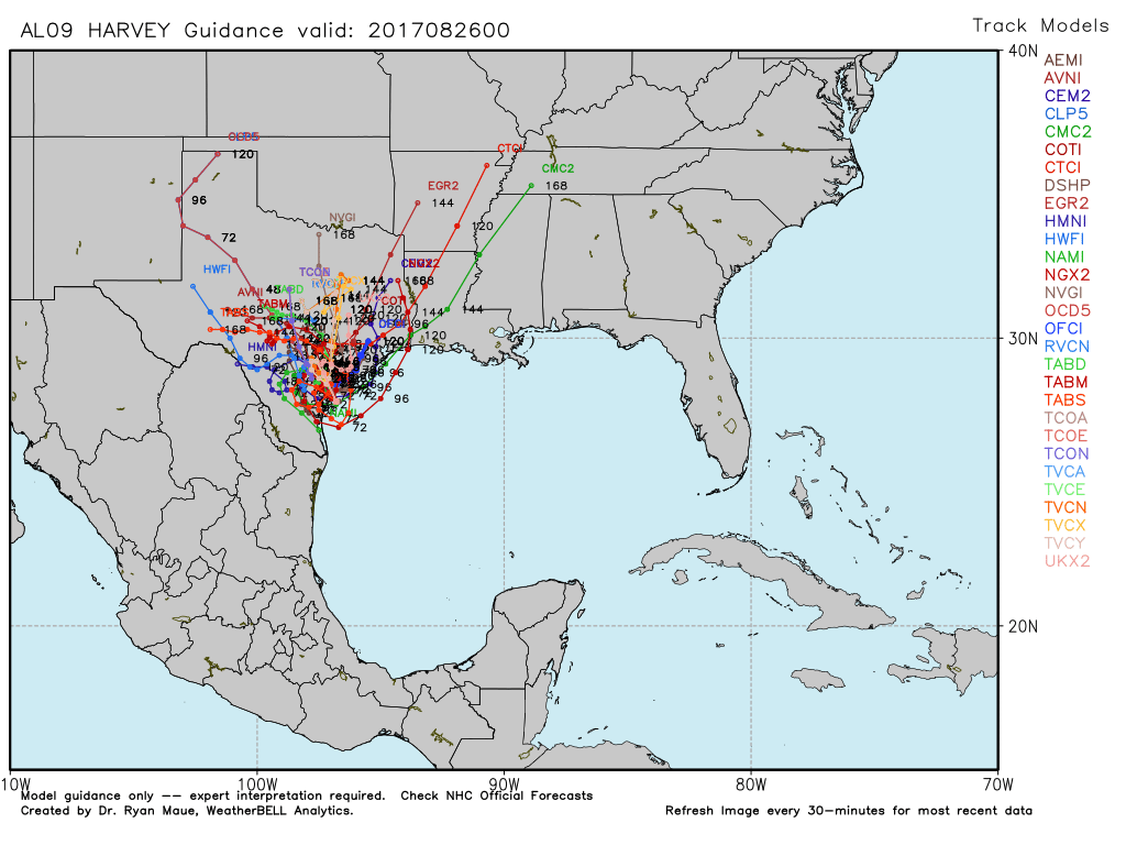
You have to laugh at times like these, because for a lot of us, the uncertainty, the stress, it can kind of become unbearable. In any case, be glad you’re not a meteorologist trying to make sense of a mess like that. But I am, and so I shall. The first thing to do is simply to ignore that plot.
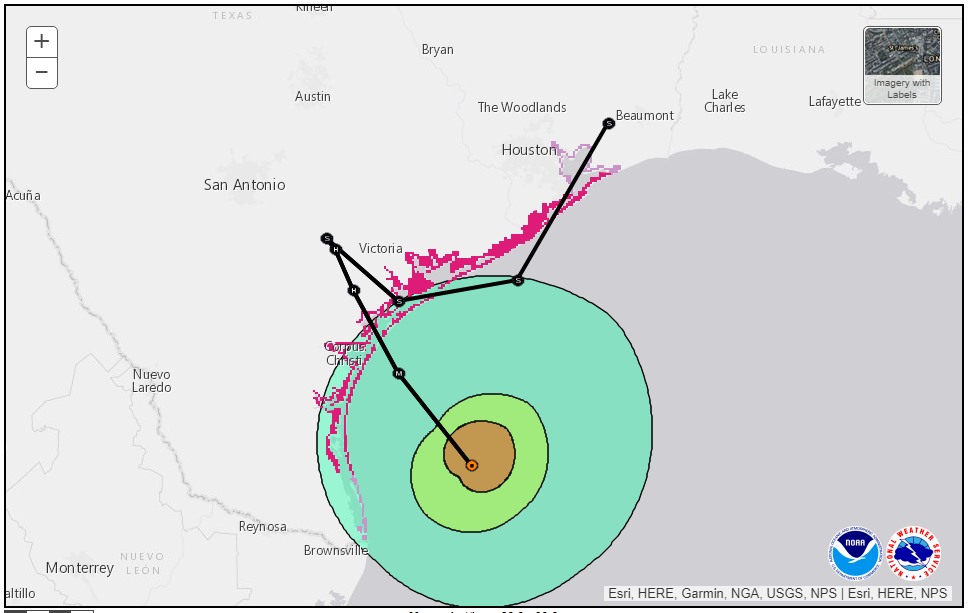
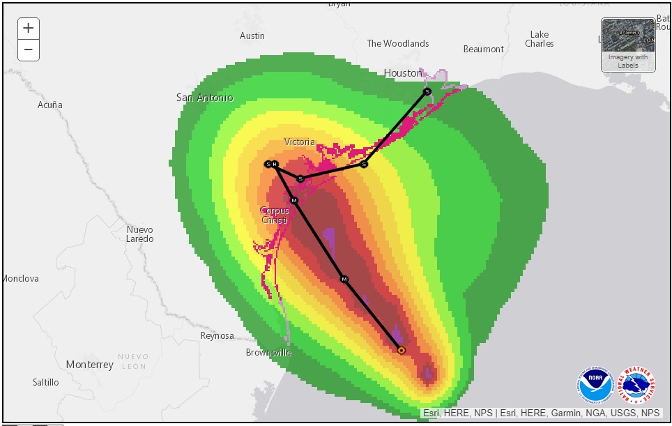
Secondly, when you look at the major global models, and their ensembles, it seems pretty clear that they think Harvey is going to loop around South Texas, somewhere between Corpus Christi, Victoria, Laredo and South Padre Island, for the next 24 to 48 hours (and dropping prodigious amounts of rain there). After that, the picture becomes more cloudy. When faced with such uncertainty, if you’ve been reading me for any amount of time, you’ll know the way I like to address that is through probability. Let’s revisit last night’s scenarios, shall we?