Last night was quite active in parts of the area. In other parts of the area? Yeah, it felt like a flop.
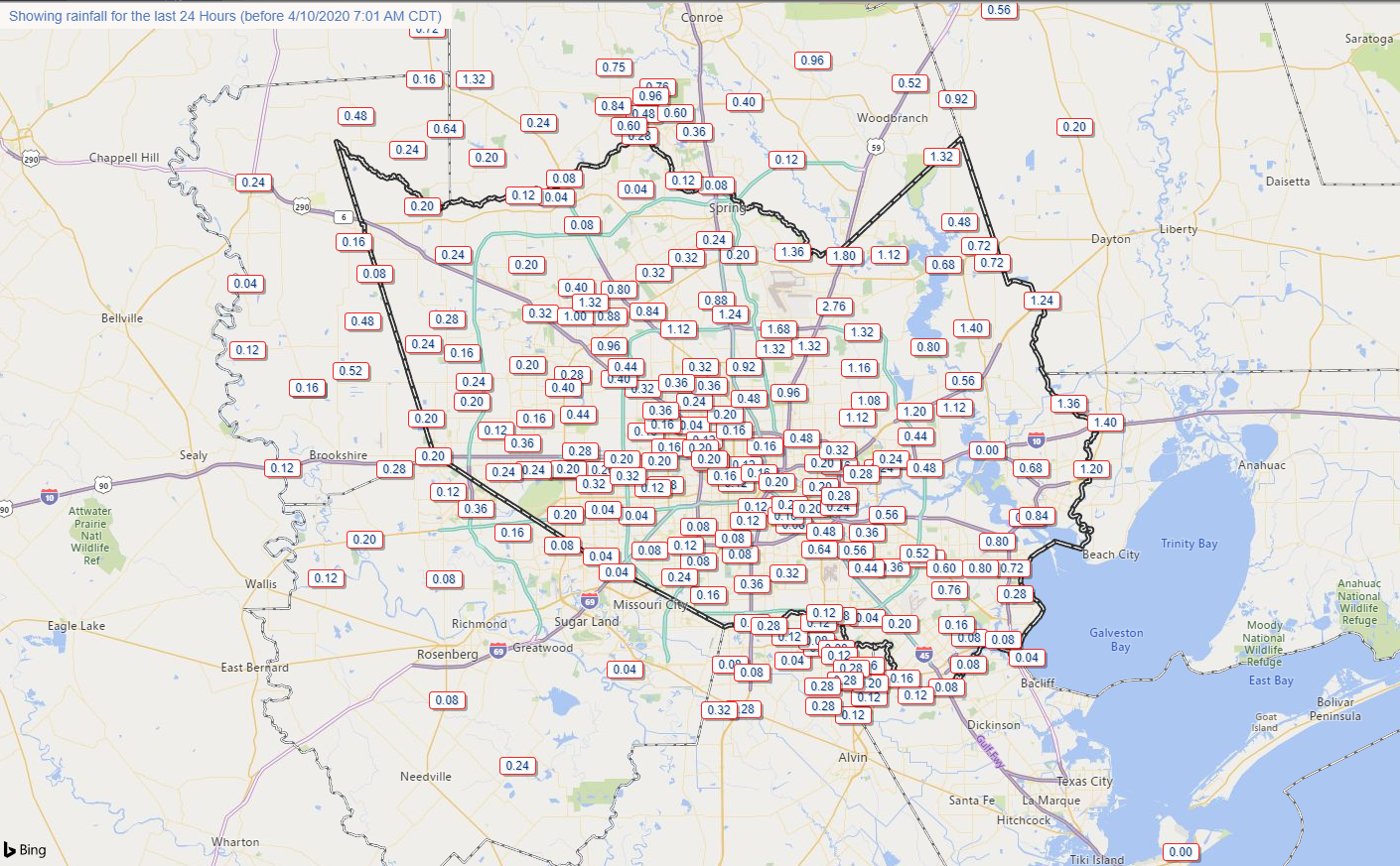
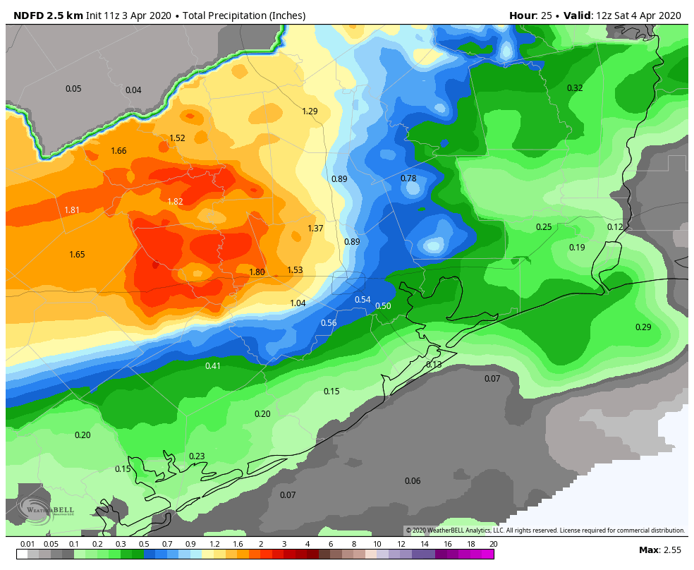
Rain totals were quite erratic. Southern areas saw low amounts. Northern areas saw variable amounts. A gage just east of IAH Airport between Will Clayton Parkway and the Beltway along Garners Bayou nearly received 3″ of rain. But that was very much the exception yesterday. Rain totals elsewhere were less than a quarter inch in many places like Tomball, Cypress, Katy, and Sugar Land. The Woodlands saw a pretty good storm, but even there, it moved fast enough that rain totals were generally under an inch.
Severe weather was not really an issue in the Houston area either. Most reports yesterday came from the Brazos Valley and back west toward Austin and even those were few.
Anyway, with that in the rear-view mirror, we can start talking about the next round.
Today
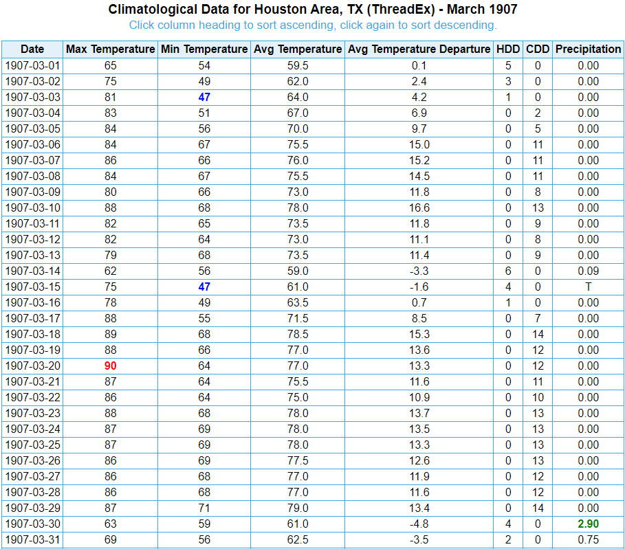
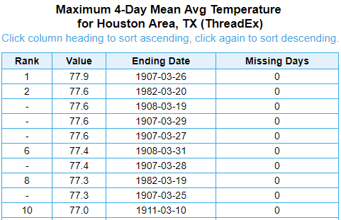
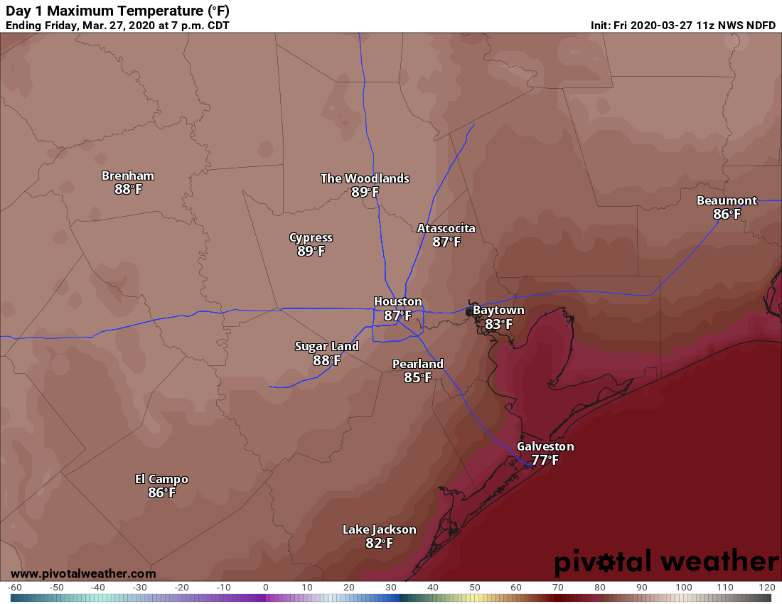
First off, today looks quiet. We will have clouds for the bulk of the day, but it will feel refreshing after yesterday’s record heat (91° at Hobby was a new record, 91° at Bush fell a degree short). Look for highs mostly in the 70s today. It will also be a good bit breezy at times with winds out of the east or northeast around 15 mph with higher gusts, especially over the bays and Gulf.
Saturday through Sunday morning
For Saturday, morning, lows will be in the low-60s or even upper-50s, but temperatures will rebound into the middle 70s through the day. An approaching warm front will send humidity up through the day as well.
The biggest question on Saturday revolves around rain and thunderstorms. Let’s work through this in order of likely outcomes. Scattered showers are likely Saturday morning and afternoon. Many of us may not see rain, but some of us will. Models differ in opinion on where rain will arrive, with a couple suggesting coastal areas and Houston will see a good deal of showers tomorrow morning. Others keep those areas mainly dry and focus development off to the north and west of Houston. We will call it scattered showers and go from there. A thunderstorm is also a good possibility too. For the most part, we do not expect significant severe weather Saturday morning or afternoon in Houston.
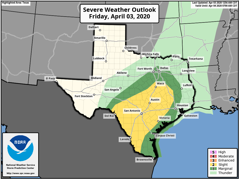
Severe weather on Saturday afternoon will probably begin in Hill Country or west of San Antonio toward Del Rio and the Rio Grande Valley.
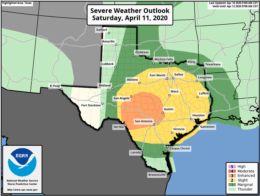
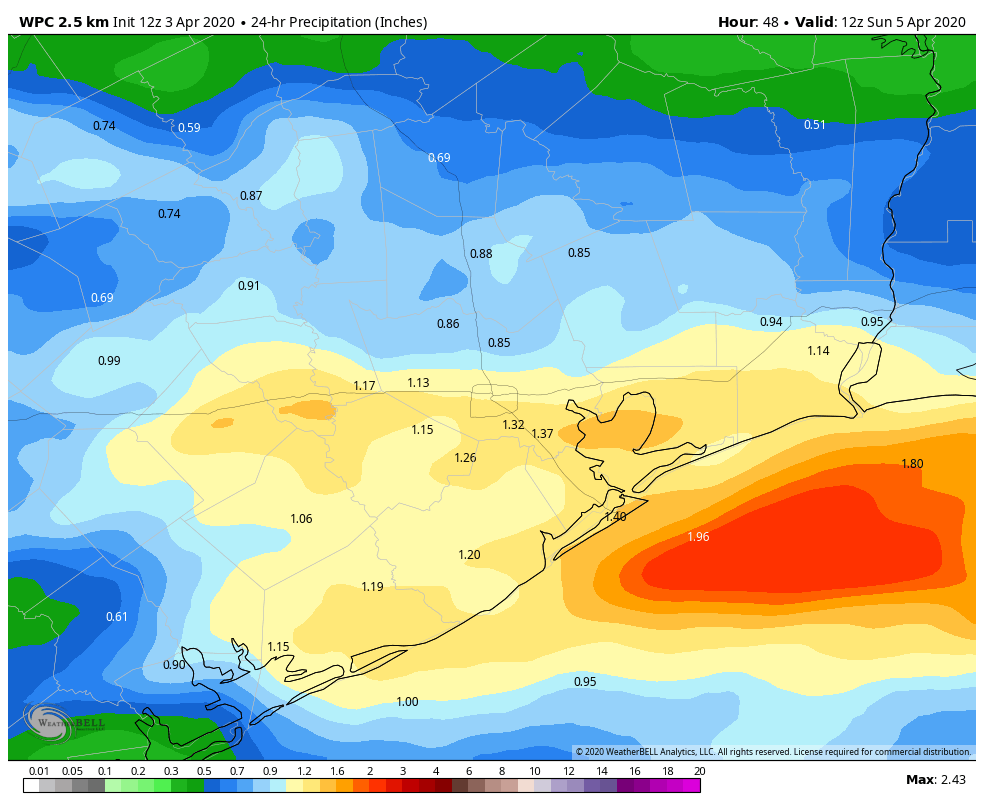
Heading into Saturday night, with a warm front in the neighborhood and ample moisture in place with a strong disturbance approaching, that’s typically a recipe for thunderstorms to develop. There are still a lot of questions as to exactly how Saturday night is going to play out. There should be strong to severe thunderstorms in Central Texas moving into East Texas, especially north of I-10. We could see additional development of storms ahead of that off the Gulf. At this time, that looks more concerning east of the Houston area, more into Louisiana. But with a good bit of uncertainty still in play and a Sunday severe weather outlook that is still pretty aggressive nearby, I don’t want to rule anything out at this point.
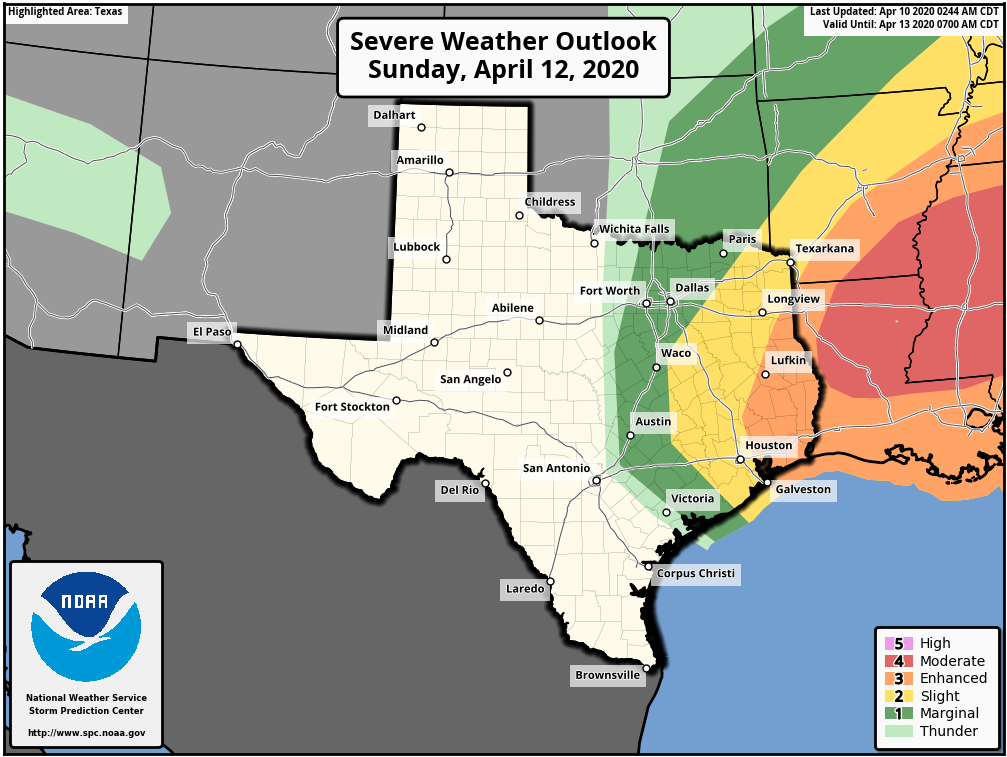
Bottom line on Saturday night/Sunday early morning: Expect showers and potential for some thunderstorms. Some severe weather is possible, but odds may be highest north and east of Downtown Houston. Eric or myself will keep you posted this weekend if things get more serious.
There will be a couple boundaries pushing through Houston on Sunday. The boundary with storms should push out, ending the rain by 10-11 AM or so. The first cold front will follow around 12-2 PM or so. That will flip winds out of the west, and they should increase as well back to the 15 to 20 mph range, with higher gusts.