The forecast today will be one of heat, followed by a somewhat uncertain outlook this weekend. Let’s walk through things, and then we will touch on Louisiana and Barry.
Today
The expectation right now is that today will be a mostly dry day in Houston. That said, I cannot entirely rule out some showers late this afternoon coming in off the Gulf along the coast or out of Louisiana for folks east of I-45. As long as it stays mostly dry though, it’s going to be awfully hot once again today. We should make a run for the upper-90s.
Heat advisory criteria may come close to being met in parts of the area, so if you’ll be outdoors, please take it easy. Also, keep that in mind if you’ll be on the beach today, as high temperatures in Galveston will likely make a run for the mid-90s with mostly offshore winds.
Tonight
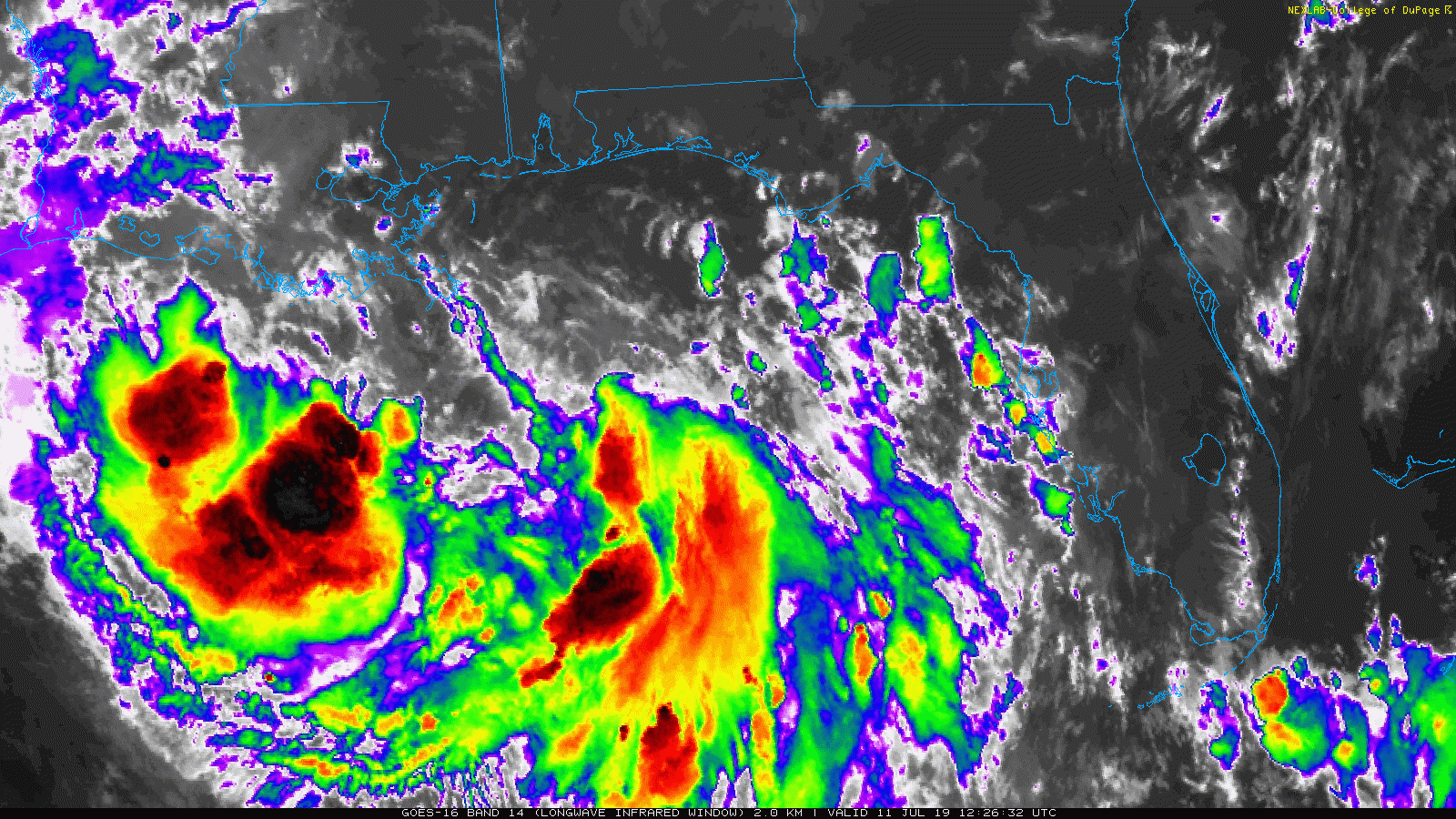
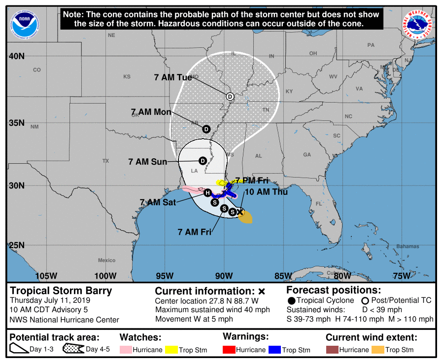
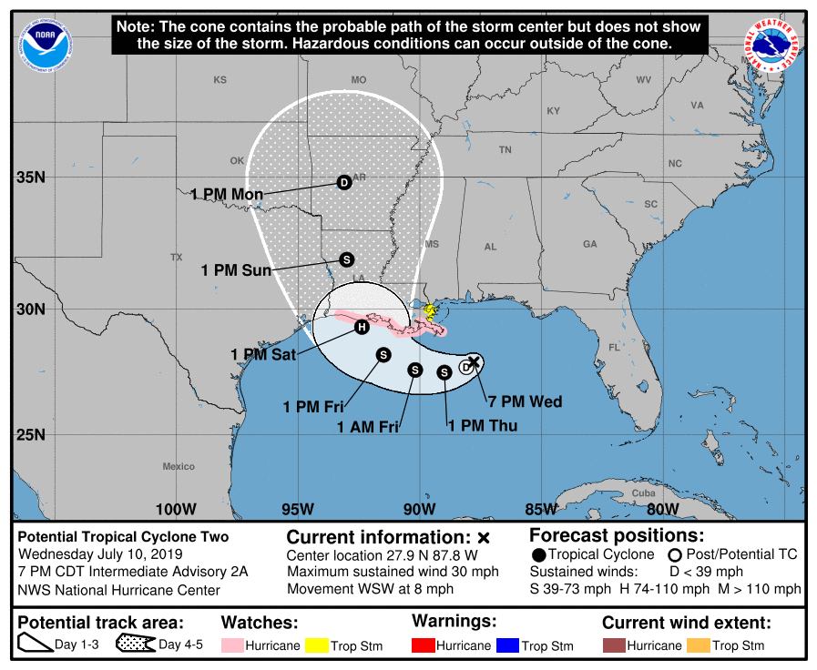
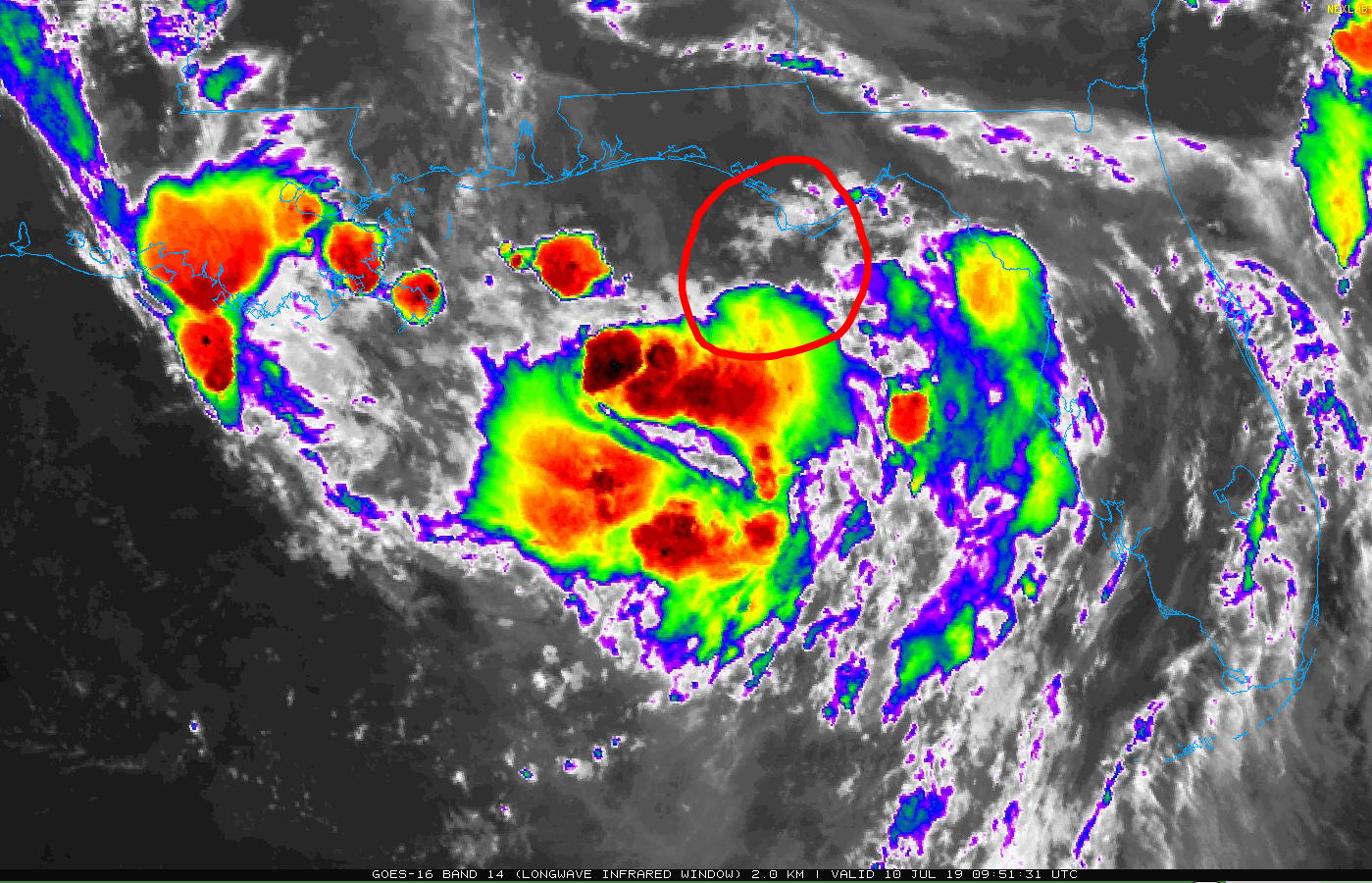
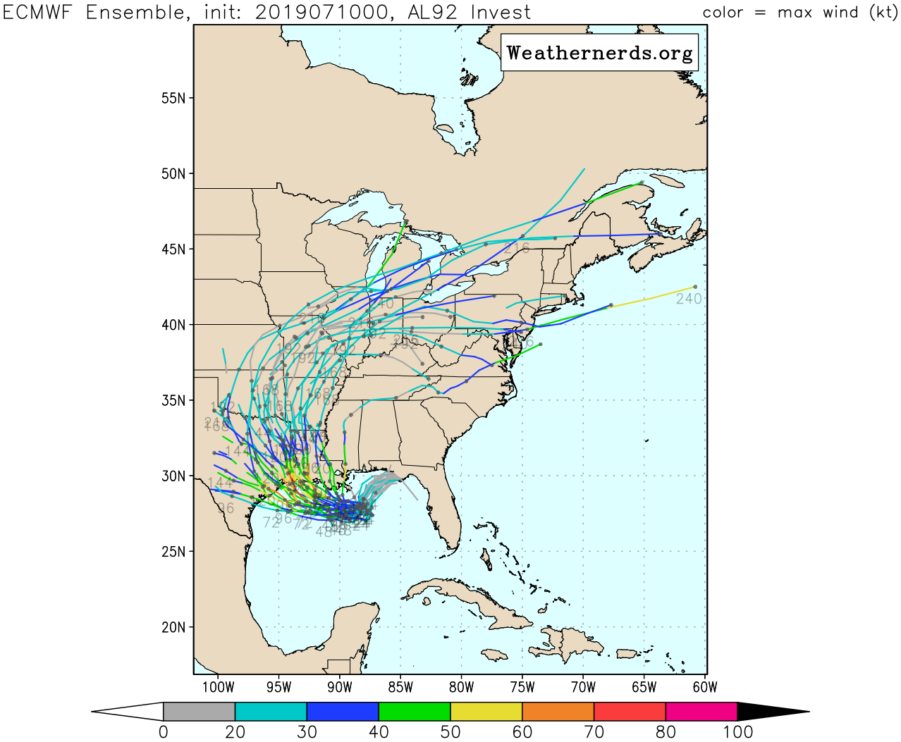
Given the somewhat erratic nature of storms around Barry (see below), as it begins to approach Louisiana tonight, some of the outer fringe that has been fairly supportive of occasional clusters of storms may graze our area. So we will call it partly to mostly cloudy tonight, with a very slight chance of thunderstorms, virtually at anytime. We should know more about those prospects later this afternoon and will update you then.
Saturday
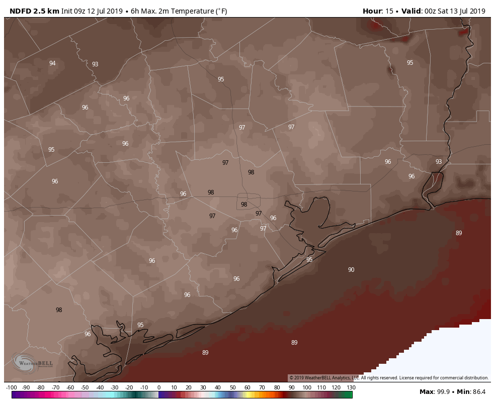
We could have a tale of two types of weather across the Houston area Saturday. For simplicity, we will use I-45 as our dividing line; the reality is it could be more to the east or west of that line, but it works for a generalization. West of I-45 could be partly sunny and hot. High temperatures may approach the mid- to upper-90s again. This would be most likely in places like Navasota, Katy, or Rosenberg. East of I-45 might be susceptible to more outer bands of Barry, which could yield occasional showers and thunderstorms and temperatures more erratic, ranging from the low-80s to mid-90s depending on who sees rain. This would be most likely for places like Galveston, Baytown, or Liberty.
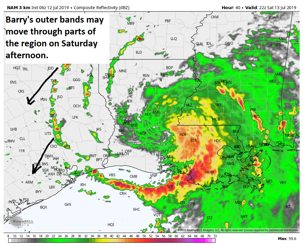
The general rule? The more to the east you go or closer to the coast you are, the more likely you will be to see showers or storms. Galveston will see a good chance for at least some storms, so stay lightning aware if you’ll be on the beach. Also keep in mind that any rain could be heavy at times.