Good evening. It’s just a wee bit hot out there this evening, so we hope folks are taking it easy. In this update, we will discuss the latest on the developing tropical system in the Gulf (Invest 92L or “Future Barry”) and what the latest model guidance has suggested.
One sentence summary: Our disturbance is finally heading into the Gulf and will spend the next 24 hours or so slowly figuring out where exactly it wants the center to form before heading west, which means there is still a good deal of uncertainty regarding the final outcome of this system.
Now
Invest 92L is somewhere over the Florida Panhandle or just offshore; there isn’t quite a defined center just yet. This is half the challenge with the forecast. We are relying on models to tell us where the center will form, not basing the forecast off an actual center. So there is some inherent uncertainty in the forecast because of this.
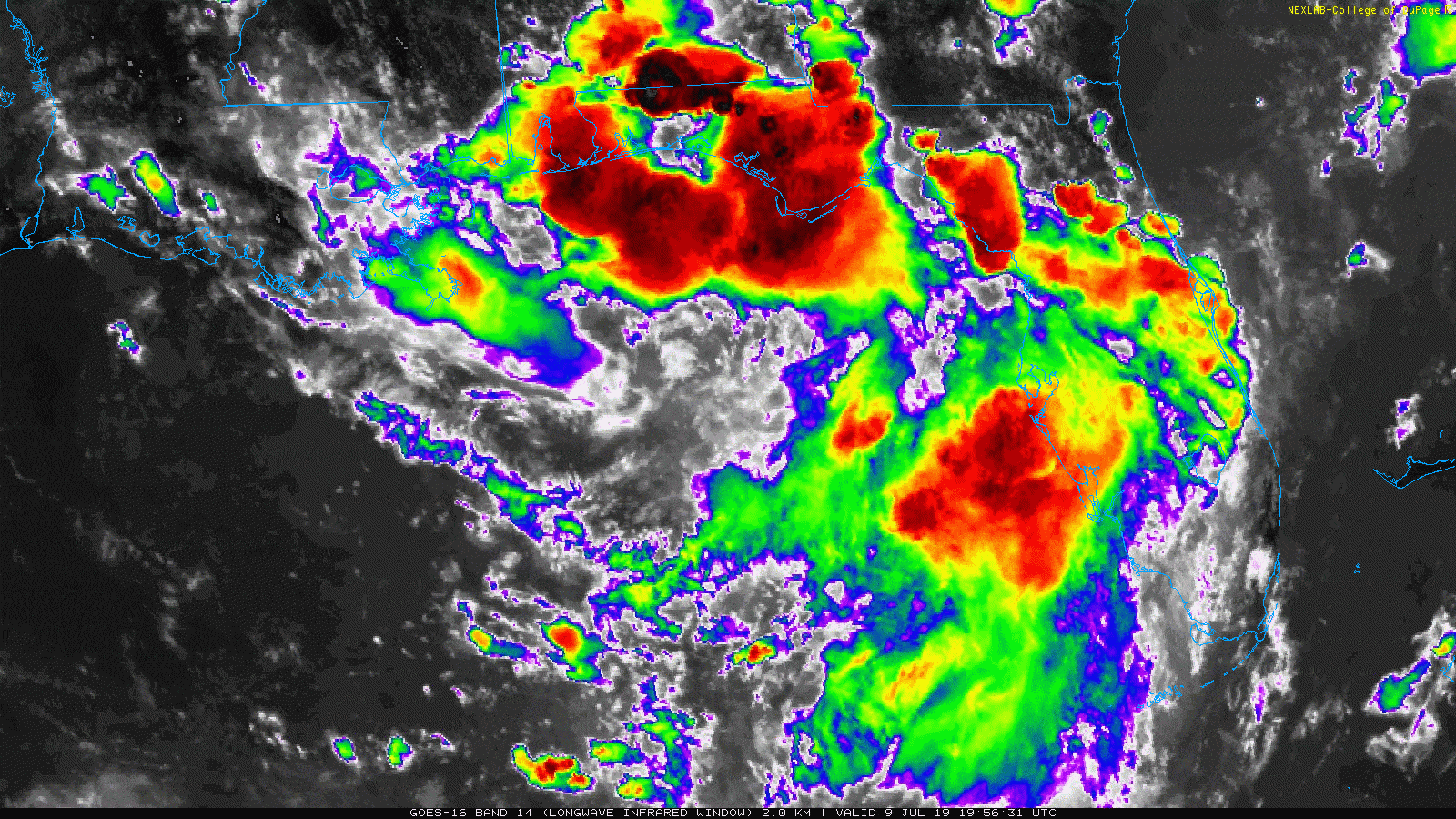
With that in mind, there are clearly plenty of storms along the eastern Gulf Coast, and these will slowly meander offshore tonight, allowing for 92L to figure out where it wants its center to form and how that relates to what is happening above it in the atmosphere. We should see a small uptick in track forecast confidence tomorrow morning, followed by perhaps a stronger uptick in confidence tomorrow afternoon.
Today’s modeling
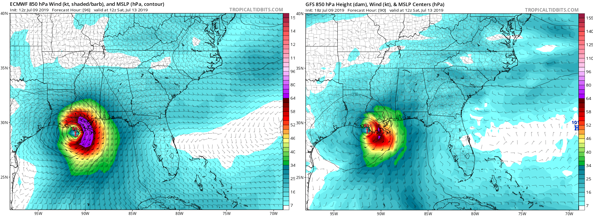
In a nutshell, the Euro held firm, while the GFS trended toward the Euro. Both deterministic models indicate a storm tracking toward and arriving somewhere between Jefferson County, TX and Vermilion Bay, LA. Should that actually happen, impacts in the Houston area will be minimal, but Louisiana would take quite a hit from rainfall and some wind at the coast.
But, as I have to hammer home: Deterministic models are never the right tool to use when making a 4 to 5 day forecast, particularly for tropical storms. You need to look at ensembles. As I did yesterday evening, here is a look at the European ensemble’s track density forecast from the University of Albany.
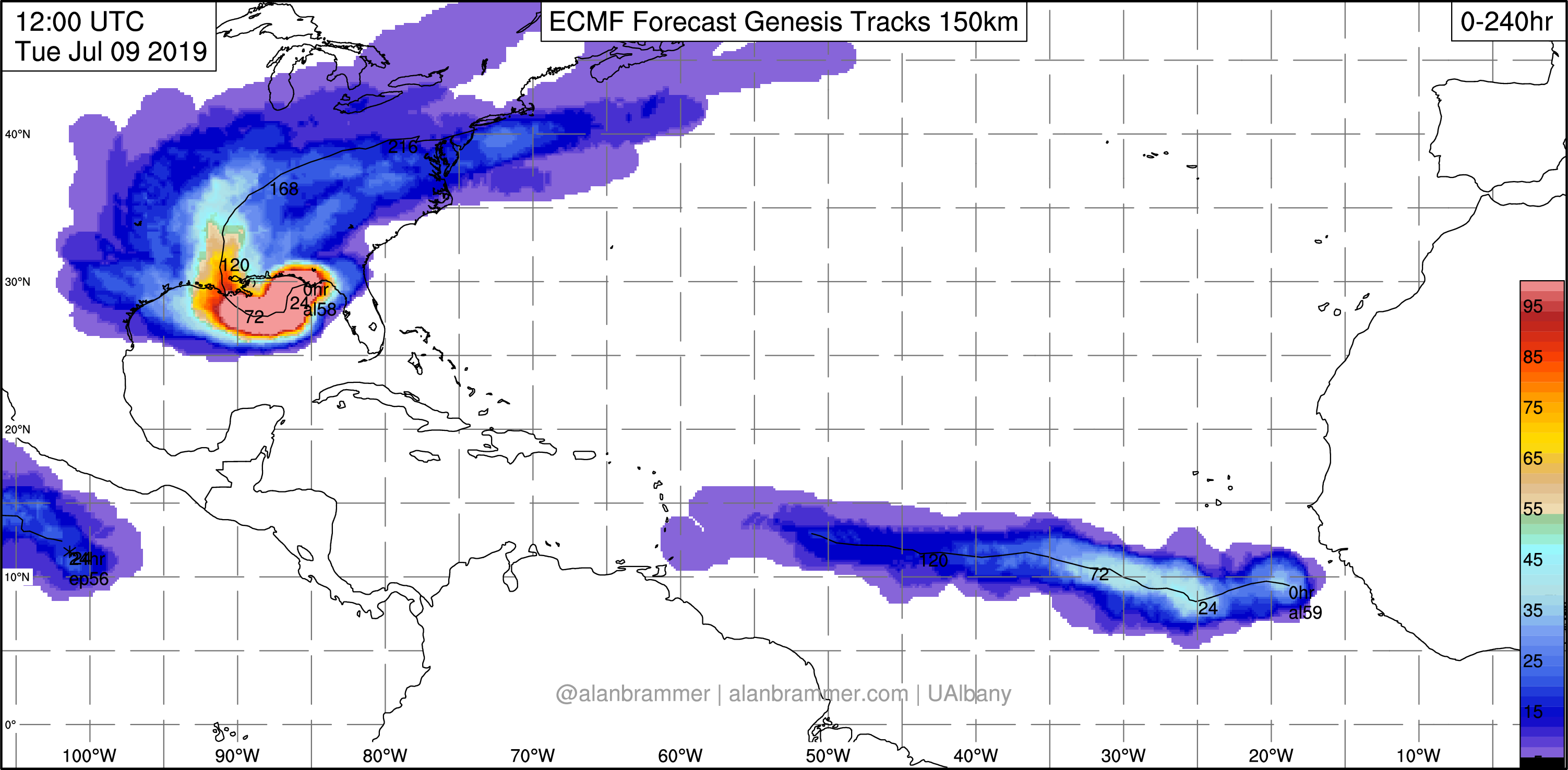
This takes the forecast tracks of the 51 ensemble members of the Euro and gives you a “spray” chart to see where clustering for higher confidence may occur, and we clearly see that something like 60 to 70 percent of the ensembles bring this toward Louisiana. But there is still a persistent, call it 20 to 25 percent minority of these ensembles that insist this will come to Texas. Until the center forms, and I can see what modeling is saying at that point, I want to be cautious about being too optimistic that we are going to miss out on impacts from future Barry.
Why the faster turn north on the models today? Some of it may have to do with how 92L’s organization has gone so far, but some of it also likely has to do with the fact that over the last two to three model cycles, this trough over the Great Lakes and Midwest has trended a little stronger.
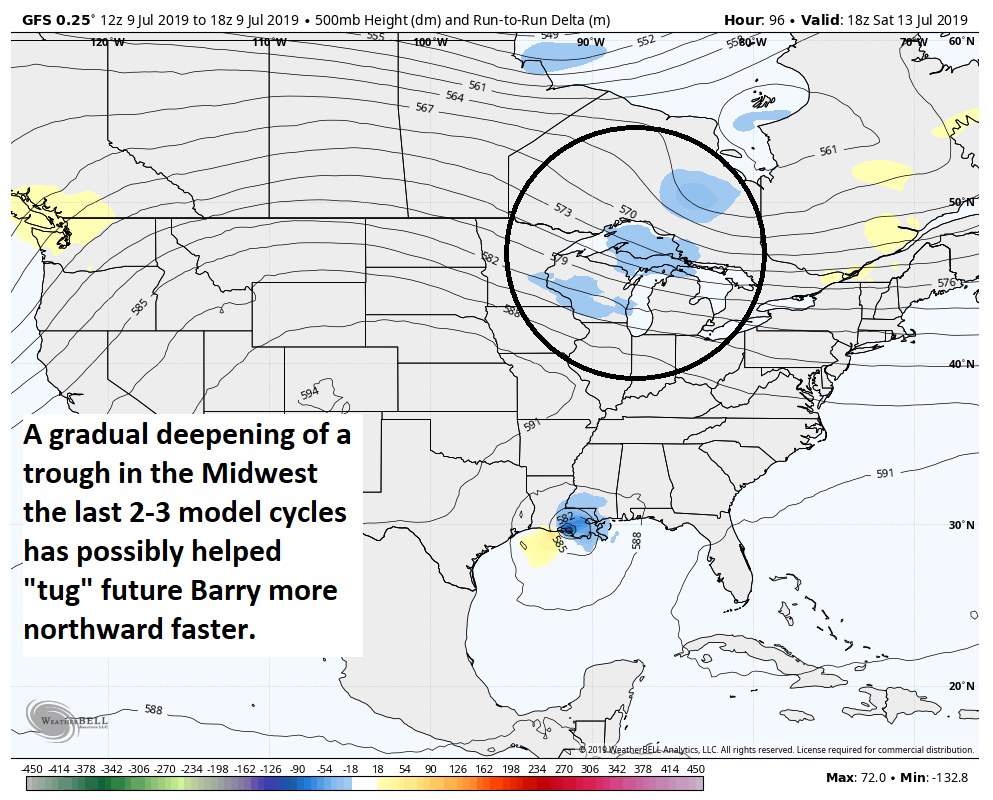
The stronger that trough is, the more ability it will have to “tug” 92L or Barry to the north. It may not necessarily capture it, but it could allow it to gain enough latitude fast enough to avoid a date with Texas or even western Louisiana. So that has been helpful for us. But again, until we know where that center is going to establish, we have to treat all individual model runs cautiously.
One final note: Weather modeling did shift a bit stronger with this system as it made landfall, which could indicate that while the ceiling on intensity for this storm may not be at an elite level, it could come ashore as a strengthening tropical storm or even low-end hurricane. So let’s hope that today’s track trends are accurate for us here in Houston.
So the bottom line this evening:
- Invest 92L is gradually emerging in the northeast Gulf as expected. Over the next 24 hours or so, it will gradually develop a center of circulation that we can lock in on to allow us to gain forecast confidence on track.
- Weather modeling held on to a shift to the east today, focusing the center and most impacts in Louisiana.
- However, a notable minority of reliable data continues to cling to a potential further west scenario, closer to Houston. It’s because of this that we will be keeping our guard up until we get a sense of where the physical center of the storm is going to develop.
- Modeling also trended a bit stronger with the storm, keeping the idea in play of a strong tropical storm or even low-end hurricane at landfall, regardless of where it goes; another reason to not yet call an all-clear.
We will have another update for you in the morning. Meanwhile, stay tuned in and vigilant and take one final opportunity to make sure your hurricane kits and plans are up to date, just to be safe.