As Eric has been conveying, this weekend is not going to be the most optimal for the Houston area. We’ve got rain chances in abundance. Thankfully, we don’t anticipate any serious problems from the rain, but if you have outdoor plans this weekend, you may need some alternative options. Let’s walk through it.
Today
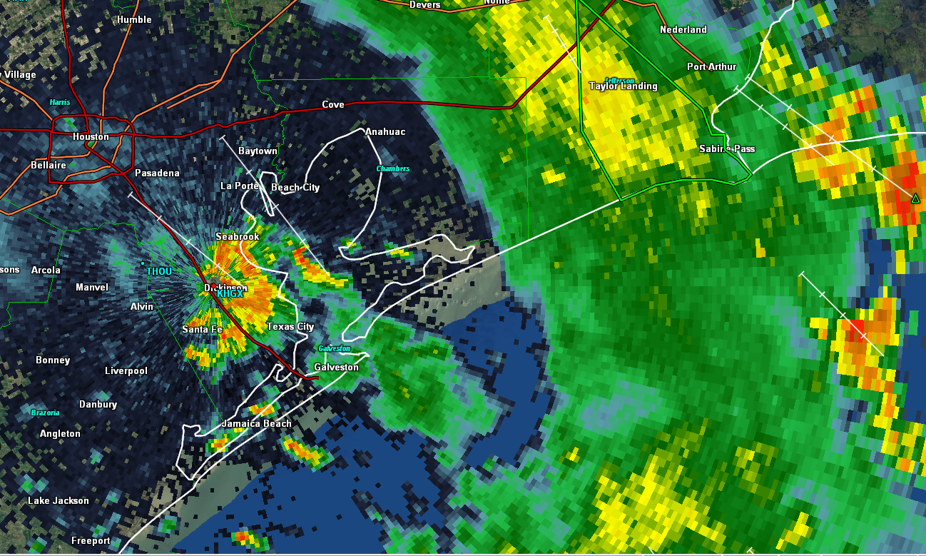
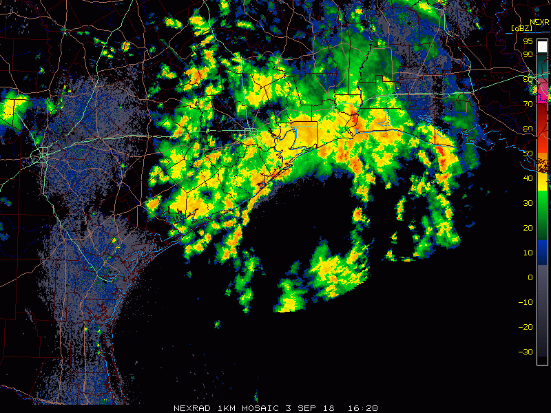
Yesterday saw a good bit of rain mostly south of the metro area, down toward Wharton and Angleton and west toward Brookshire, with a few storms here and there elsewhere.So far, quiet this morning, with just a few showers down in Matagorda County. As the day goes on, I would expect scattered showers and storms to fire up with daytime heating, beginning at the coast and spreading inland. Not everyone will see rain, but those that do could pick up a quick half-inch to inch of rain in a cooling downpour.
Expect highs near 90°, but a little cooler if it happens to rain a bit more at your location.
Weekend & Monday
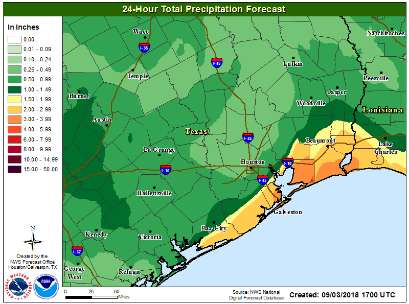
So, let’s start with this: I don’t think this weekend will be a complete washout. If you have outdoor plans, I might not completely abandon them. But I would absolutely have an alternative in place. I think Saturday may be a better day than Sunday, unless you live northwest of Houston. It won’t rain all the time and everywhere this weekend, but where it does rain, it may be heavy at times with some patchy street flooding possible.
Who are we expecting to see the most rain on which day? There will be a weak cold front draped inland over Texas. No, it won’t usher in cool, dry air, but it will act as a focal point for the rains. On Saturday it may be well north and west of the city, out toward Columbus and north to College Station and over into Walker or Madison Counties. By Sunday, it creeps closer to Houston.
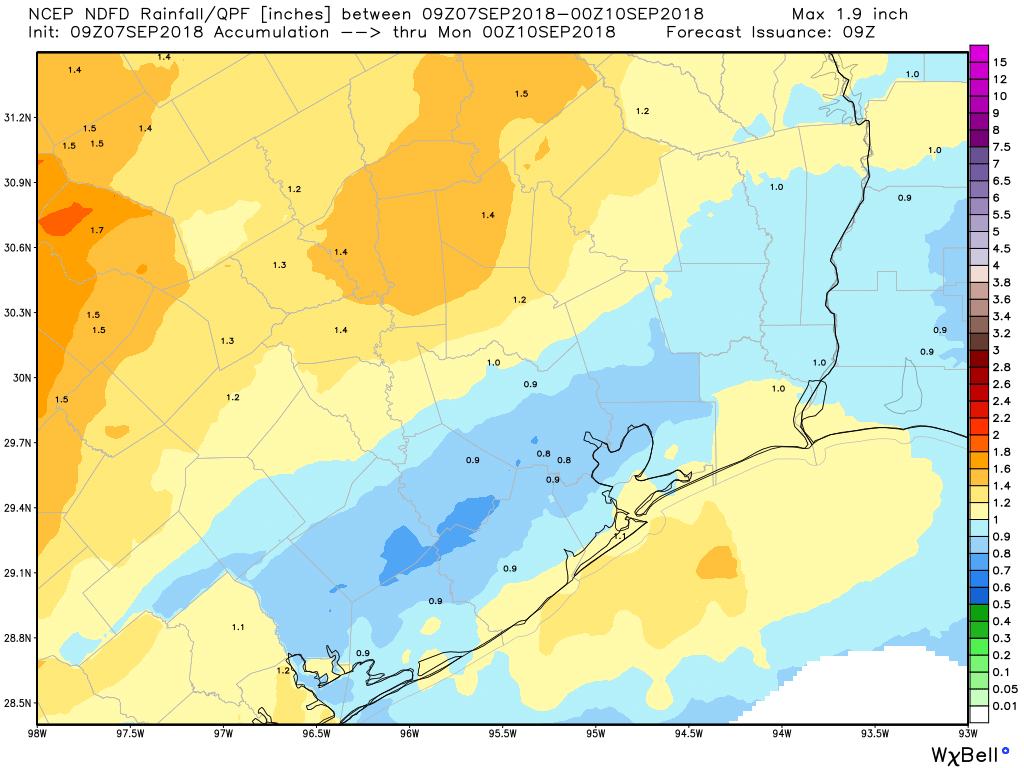
I still think the focus of showers on Sunday may be to the northwest of Houston, but perhaps out toward Katy and up to The Woodlands and toward Livingston, so a bit closer. So it’s conceivable that both days, the majority of the rainfall stays northwest of the Houston area. We’ll still see some scattered showers and storms regardless though.
On Monday that front may creep through the area while falling apart. So, again, scattered to numerous showers and storms with daytime heating, now across the Houston area. Look for temperatures to top off in the upper-80s most days on average (90+ if you don’t see rain, cooler if you see a good deal of it), with lows in the mid-70s.