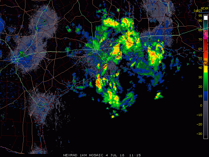
The worst of the rain is now over as of early this afternoon in Houston. Heavier rains have migrated west toward the Sealy area, which has seen 1-3″ of rainfall over the last hour or two.
2:05 PM radar update shows the worst of the rain has exited #Houston. Residual street flooding will continue for several hours, so travel is discouraged. Heavy rains near Sealy are likely causing road flooding out that way also. pic.twitter.com/vJdbcpbTAA
— Matt Lanza (@mattlanza) July 4, 2018
A Flash Flood Warning remains in effect there. Houston’s Flash Flood Warnings will expire soon, but with street flooding likely to continue, travel within the city through the late afternoon is discouraged. We’d advise people to just stay put through late day if possible. Road and weather conditions will improve this evening.
Significant flooding on I-69 and Westpark Tollway interchange in Southwest Houston this road has at least 17’ of water in some places. @JeffLindner1 #houwx pic.twitter.com/fhaVJUzLoJ
— Ian Shelton (@IanShelton1997) July 4, 2018
While weather conditions will generally improve area-wide this afternoon and evening, there will still be a few showers and storms scattered about the region. So I can’t promise the evening will be entirely dry. But it should be mostly cleared out. Still, a sub-optimal July 4th overall.
No change in thinking from earlier this morning regarding tomorrow and into the weekend, as additional showers and storms will be possible each day.
Total rainfall from this storm will top 8″ in parts of Houston, centered just west of downtown.
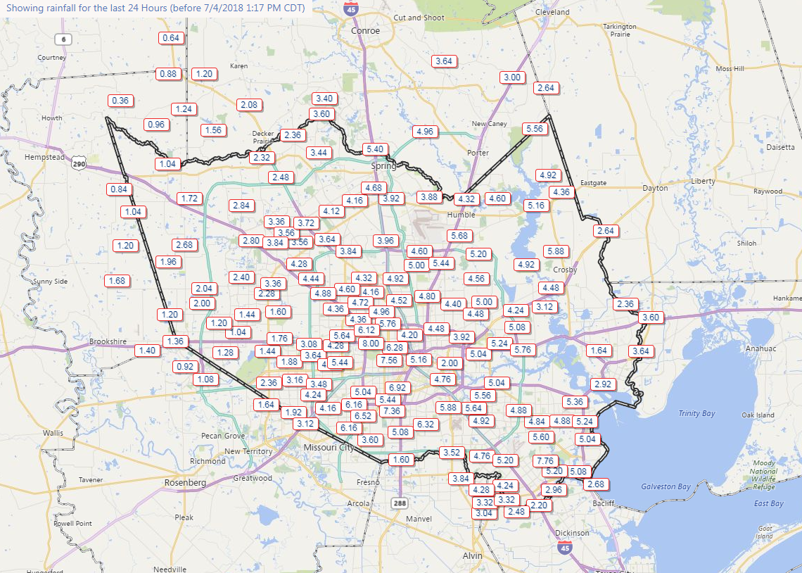
On average about 4-8″ inside the Loop and down near Clear Lake. Surrounding that, about 1-4″ fell. Most bayous are in their banks, but a few have come out in spots, exacerbating flooding in those neighborhoods. You can see rain totals and inundation maps from Harris County Flood Control here.
Unless something changes, that’s it for today, and we’ll be back with more in the morning.