Good morning, and happy birthday America! It’s a damp one for many of us this morning, though I imagine some others are asking if it will ever rain at their homes. Let’s walk through the forecast.
Now & this morning
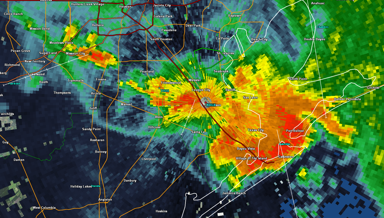
As of 8:15 AM, radar shows pockets of heavy rain and thunderstorms gradually pivoting toward Houston from the east. Areas west of the city have seen little rain since yesterday. Eventually some of this will indeed get there.
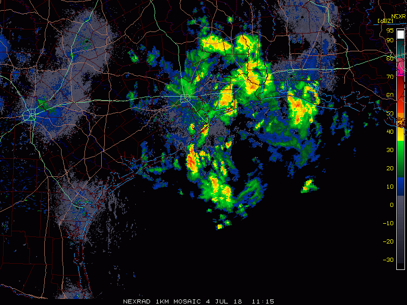
So through about midday, expect rain to become more frequent in the area. The heaviest will continue to hug the coast south and east of Houston.
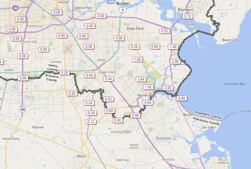
Rain totals to this point have been manageable, though there has been almost 1.5″ of rain in the last hour along Vince Bayou in Pasadena. An urban flood advisory is posted for southeast Harris, Galveston, Chambers, and eastern Brazoria Counties until 11:45 AM, meaning street flooding is likely in spots.

As rain slowly winds through the area this morning, be prepared for more pockets of localized street flooding in areas of poor drainage, along frontage roads, etc., especially south and east of Houston, where it has rained more and is raining harder. We aren’t expect anything too significant today, but be aware of street flooding potential and never drive through a flooded road. We’ll keep you posted if things escalate.
Timing the end of the rain
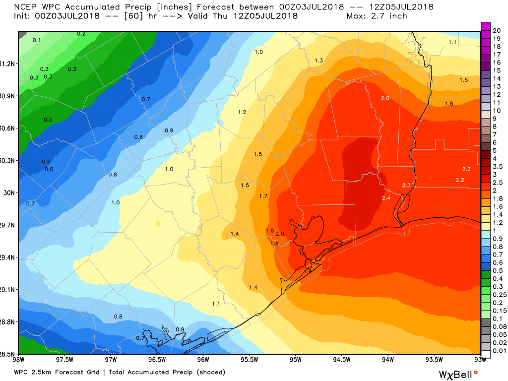
So expect periods of showers, heavy rain, and thunderstorms for much of this morning and early afternoon, especially southeast of Houston. When does it end? Model guidance has slowed things down a bit unfortunately. The good news is that the heaviest, most concentrated rains should be west of the area by about 2-4 PM. There will be isolated, hit or miss downpours still around the region however through 6-8 PM. I still think most evening events should go off without a ton of issues, but you may want to include an umbrella (assuming that’s allowed at your event) with your other items if you’ll be out and about.
Rain summary
So just to sum things up:
- Heaviest rains south and east of Houston this morning, with rain rates of 1-3″ per hour possible at times.
- Rains will expand north and west and everyone should get at least some rain.
- Localized street flooding is likely in spots, again mainly south and east of Houston.
- The steadiest rain should taper off this afternoon, but scattered showers will remain in spots (not everywhere) through early evening.