Welcome back to Houston winter. Today will be a rude awakening for anyone who enjoyed our 70s yesterday. Let’s jump in.
Today
First off, the cold front is through the entire area already this morning. Temperatures aren’t going very far today. We’ve sunk into the 40s, and we should stay there for the balance of the day, though we may go from mid-40s this morning to upper-40s this afternoon. Either way, have a coat available today.
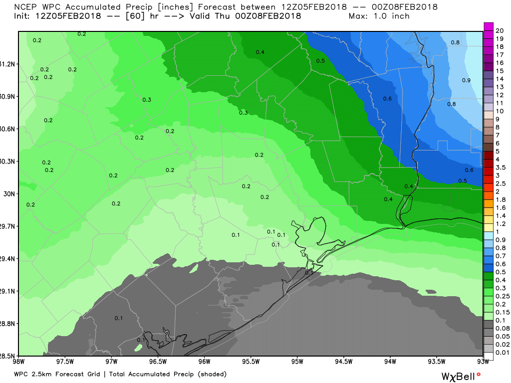
Also, have an umbrella. Rain and and a few thunderstorms will be likely throughout the day. Coverage is sporadic this morning, and that should actually increase as the day goes on. I wouldn’t rule out some small hail in any thunderstorms today with cold temps in place. Rain totals will be variable, with some folks seeing as much as a half inch, while others may only see a tenth of an inch or two. It will also be a bit breezy today.
Tonight & Thursday
Rain should end this evening. Skies may clear out tonight in spots well north. But I think we’ll stay mostly cloudy in Houston. This will help us avoid a light freeze. Folks up near Conroe or Crockett may see temperatures get into the lower 30s, but that won’t happen in Houston. Expect lows in the city to bottom out in the upper 30s to near 40 degrees or so. Just a little wind around tonight will make it a bit colder.
On Thursday, we start the warm up process again, so expect clouds to stay mostly in place, though we hopefully see some sunny breaks. The better chance of sunshine tomorrow may be north of I-10. But overall, the day should be dry and quiet. Temperatures will make a respectable effort to get close to 60 degrees, but likely come up short.