Good morning, everyone. The National Weather Service in Houston has posted a Flash Flood Watch for the entire region through tomorrow evening. As expected, conditions will become more favorable for flooding to occur in the hardest hit parts of the area as we go deeper into today, tonight, and tomorrow.
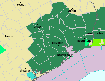
The NWS hazards map as of 8:30 AM shows a Flash Flood Watch posted for just about the entire region through Sunday evening. (NWS)
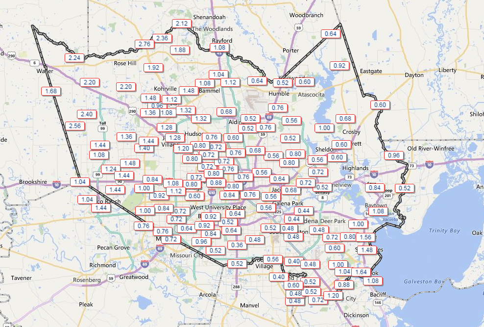
Rainfall since yesterday afternoon across the area has been mostly manageable to this point. Northwest Harris County has seen 1-3″, while central and southeast portions of the county have received about a half inch to perhaps up to 1.5″ of rainfall.
An average of about 1-2″ of rain has fallen over much of the area since yesterday. (Harris County Flood Control)
Outside of Harris County, Galveston has already set a daily rainfall record for today with over 4″ reported as of the 8 AM observation.
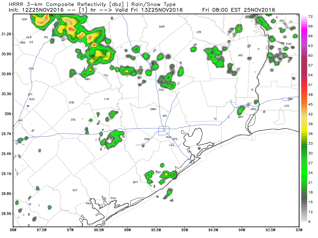
We’ll be quiet for most of the morning today, but clouds will gradually thicken up overhead. Rain showers should begin to break out to our south and west by midday, spreading north and east through afternoon.
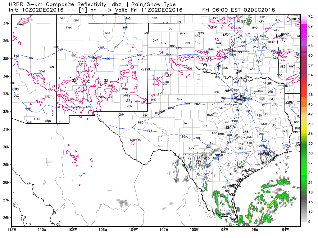
Short term HRRR model shows numerous showers developing across Texas today. Some will move into Houston later this afternoon and tonight. (Weather Bell)
A patchwork of scattered showers should be strung out around Houston by the evening commute.
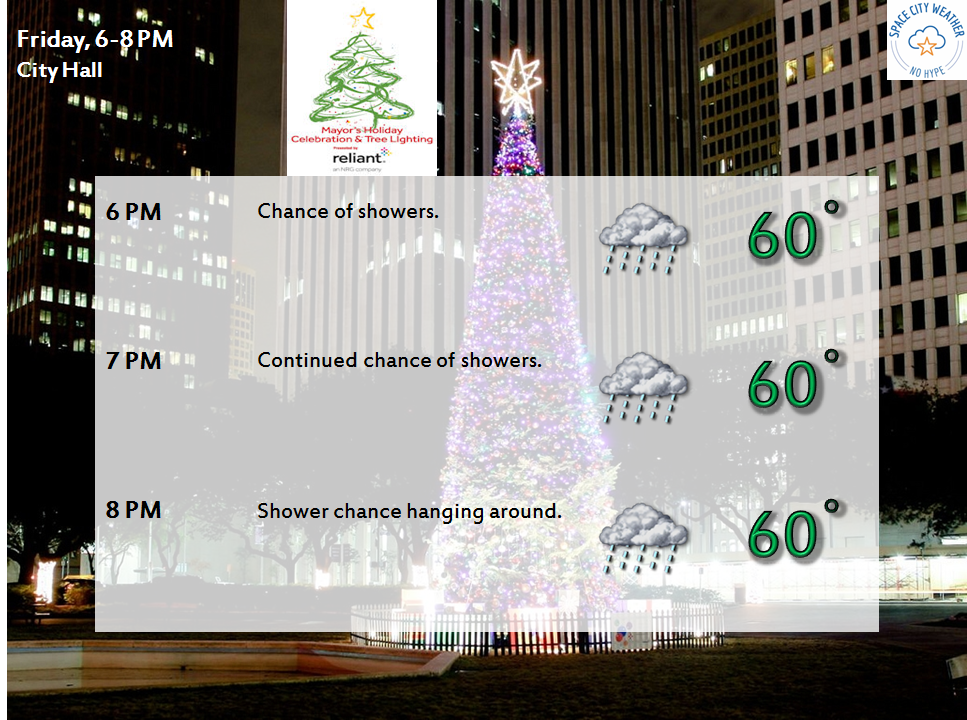
This means that the Christmas tree lighting forecast in Downtown Houston isn’t looking fantastic right now. That said, if the HRRR above is right, we may be able to get it in without too many issues. If you are planning to go, make sure to double check the city’s website or social media feeds.
It may be a bit damp at times for the tree lighting tonight in Downtown Houston
Periods of rain and perhaps thunderstorms will continue throughout the evening and into the overnight hours. We may see heavier rain along and north of I-10 toward morning. That may pivot toward Houston more tomorrow. Basically, the whole area will see rain, heavy at times, and thunderstorms at various points through the day Saturday.
A forecast caution here: Yes, it will be a stormy couple of days, but it probably will not rain in your neighborhood the whole time. This type of rain will come in fits and starts. Trying to time exactly when and where we see the heaviest rain is exceptionally difficult more than 12 hours in advance with storm systems like this.
Good morning! Hopefully you had a splendid Thanksgiving and aren’t still stuffed after yesterday. I may be. But I have an appetite for a forecast, so let’s hop to it.
Today & Weekend
We are in a holding pattern right now between Wednesday’s front and the next system waiting for us next week. That means the weekend will see nice weather for the most part.
Today will be pleasant overall, but a bit gray at times. We may have a couple showers or sprinkles, around the area, but otherwise it will be a mix of clouds and some sun. High temperatures will hit the low 70s.
Forecast radar from HRRR model today shows mostly minor showers scattered about. (Weather Bell)
Today, we’re launching a new series: The Space City Rewind. In this series, relying on various resources and historic weather data, we’re going to discuss historic weather events that have occurred in the greater Houston area. Although there are many fine books and articles in print, there’s limited, definitive information online about Houston’s turbulent weather history. We aim to publish informative, detailed, and insightful pieces on such events. With many new readers and residents in the Houston area, it’s helpful to understand our history and the range of severe weather that can affect those living on the upper Texas coast. We’ll talk about the meteorology, impacts, and share some interesting stories and photos.
We begin with the November 21, 1992 Southeast Texas tornado outbreak.