Good morning. A few areas saw rainfall on Monday—Cypress was one big winner near Houston with nearly 1 inch of rain—but now the atmosphere is pretty much going to lock down for awhile. As high pressure builds to our west, it will prevent rising air, trapping moist, humid, and very hot conditions at the surface. It looks like the heat will peak this weekend, when 100-degree days are possible.
Wednesday, Thursday and Friday
The next three days will see a mix of clouds and sunshine. Because some clouds will linger, they should help to moderate temperatures slightly, keeping highs in the mid-90s. Winds will be out of the south at 10 to 15 mph. Overnight lows will provide little relief, likely falling into the upper 70s for inland areas, and remaining at or above 80 along the coast. There is about a 10 percent chance of a stray shower developing before high pressure really settles in over the weekend.
Saturday and Sunday
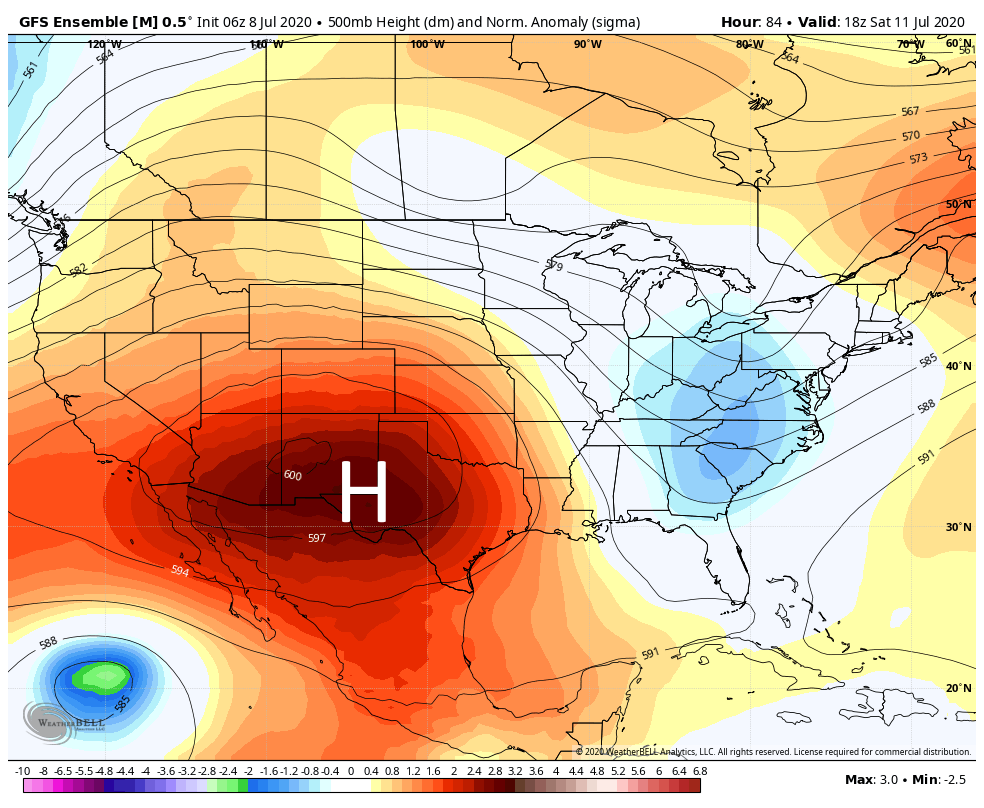
By this weekend high pressure will reach its maximum extent over the southwestern United States. For Houston this means hot and sunny weather, with highs in the upper 90s to 100 degrees. Winds will generally be light. This should be the hottest weather we’ve experienced so far in 2020, so please take care outside with the heat.
Next week
Very hot weather continues to start next week, but temperatures should begin to moderate a bit later in the week. The forecast still looks very dry rain-wise until next Thursday or Friday at the very earliest.

I don’t care for this. I don’t care for this one bit.
Look on the bright side. It could be worse.
Hi, Eric and Matt, thanks for your forecasts. What about Saharan dust? Is it still with us? Thanks!