In brief: In today’s post we talk about the sea breeze, and how it will continue to drive the development of scattered showers this week during the afternoon and evening hours. Rain chances may turn even higher this weekend, particularly on Sunday.
What is the sea breeze, anyway?
We’ve been talking a lot, of late, about the sea breeze. It can be pretty impactful as we saw on Tuesday evening. Where it lines up, there can be the lift needed for moderate to heavy rainfall. Some locations near the Houston Ship Channel, including Galena Park, picked up 2 to 3 inches of rain during a relatively short period on Tuesday. For the rest of us, this produced a pretty spectacular light show on the horizon.
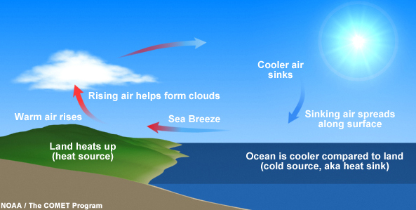
Essentially the sea breeze is what it sounds like. During the daytime the land heats up faster than the water (in this case, the Gulf and Galveston Bay). This produces sinking air offshore and therefore pressure to produce onshore winds. This is also why we often see wind gusts pick up from the southeast during the afternoon and evening hours.
Once onshore this sea breeze runs into hotter inland air, forming one or more boundaries along which there is rising air. If there is enough moisture near this boundary then you get localized, sometimes heavy rainfall with thunder and lightning. These storms are hit or miss, because areas not near a boundary are unlikely to see rain.
Wednesday, Thursday, and Friday
We are going to see a trio of days similar to what we’ve been experiencing so far this week. That is, mostly hot and sunny conditions with high temperatures generally in the mid- to upper-90s away from the coast. As for rainfall, each day will have about 30 percent chance, give or take. Again the pattern will be for showers and thunderstorms to fire up along the sea breeze during the afternoon and evening hours. Winds will peak during the afternoon hours, gusting perhaps to 15 mph. Overnight lows will only drop into the upper 70s, and only briefly.
Saturday and Sunday
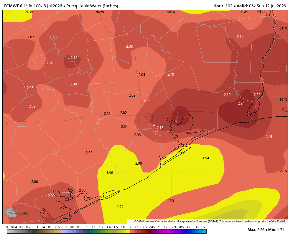
We should see a few more clouds this weekend as atmospheric moisture levels rise further. With the upper-air pattern more or less remaining the same we should see continued sea breeze showers during the afternoon and evening hours, although with the additional moisture overall daily chances should be in the 50 percent range. Sunday could even be a little bit higher. Daily maximum temperatures will likely remain in the range of the mid-90s. As for humidity, well, you know that’s not changing in July.
Next week
There are some indications that higher rain chances will persist during the first half of next week, and that this could help keep a lid on highs (perhaps lower 90s). Through the middle of next week most of the Houston area will probably pick up between 1 and 2 inches of rainfall from this scattered activity, but as we’ve seen the last couple of days, the activity will be hit or miss so overall totals will vary widely.
