In brief: Houston tied a record high temperature on Tuesday, which tells you about all you need to know about how this week’s weather is going. We will see some slightly drier air this weekend, but unfortunately next week looks nearly as hot.
The mid-90s will continue until morale improves
The first few days of September started out with near-normal temperatures. But the second week of September has put up a number of high temperatures in the mid- to upper-90s at a time when our daily highs should be trending down toward about 90 degrees. The last several days have been especially hot—not quite August, but almost. We even tied a record high (98 degrees) on Tuesday.
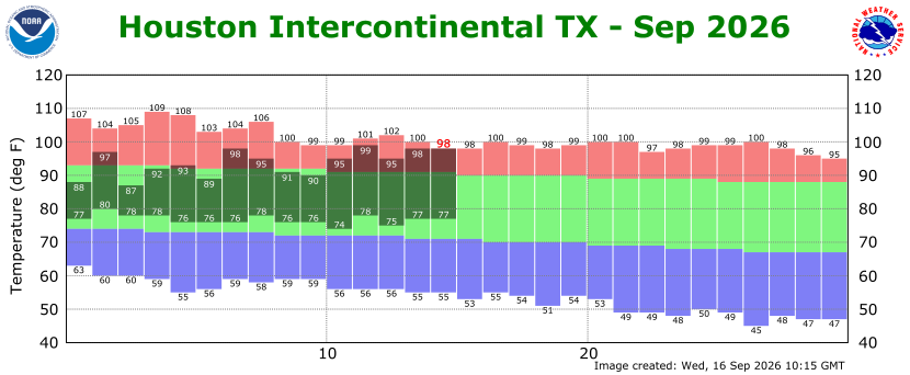
The bad news is that, despite a small amount of drier air on Friday and into the weekend, we are going to see continued hot weather well into next week. I think we can safely expect mid-90s through the middle or end of next week, without much reprieve. The chances of a substantial front making it through before the end of September are now not zero, but they are decreasing day by day.
Wednesday
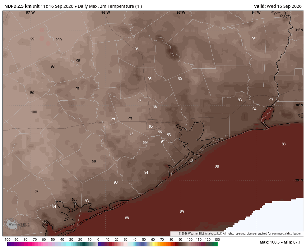
Today will be similar to Tuesday, with temperatures flirting with the record high for today (98 degrees) for inland areas. The point is, it will be very hot for this time of year. We are going to see mostly sunny skies. Some showers did develop over central parts of the region on Tuesday, and we will again have some spotty rain chances locally, but most of us will just see sunshine. The air remains very humid, with lows tonight perhaps only briefly dropping below 80 degrees.
Thursday
With a surge of moisture we will see some slightly better rain chances on Thursday, especially for coastal counties. These areas may have as much as a 50 percent chance of seeing showers and thunderstorms, some of which may be fairly intense. However those chances fall off rapidly the further one moves inland, especially north of I-10. With a few more clouds on Thursday, we may see highs only reach the low- to mid-90s.
Friday, Saturday, and Sunday
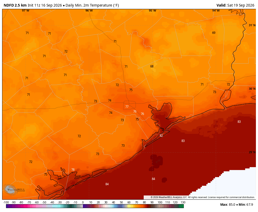
A slug of slightly drier air arrives on Friday, and this will allow for hot days with slightly lower humidity, nights a touch cooler (in the mid- to upper-70s in Houston, with cooler conditions north), and lots of sunshine. Expect highs generally in the mid-90s this weekend with a near zero percent chance of rain. Seriously, if you have outdoor plans you can make them with confidence (and sunscreen).
Next week
We remain in a hot and sunny pattern at least through the middle of next week. Daily rain chances may creep up into the 10 to 30 percent chance range, daily. There is the potential for a slight pattern change during the second half of next week, although I have limited confidence in the forecast at this point.
El Niño is strong, or what?
We’ve received a ton of questions about El Niño, what is means for Houston, and whether we should be truly concerned about a historically strong El Niño. Check back later this morning, at 10 am CT, for some answers in a dedicated post.
