If you like sunshine and pleasant temperatures, enjoy the rest of this morning. If you like sunshine and increasing humidity, enjoy the next several days. If you like rain, I sincerely apologize.
Today
Friday is opening in the upper-50s to low-60s, a fine morning with nothing more than a few passing high clouds. We will warm up quickly this morning and afternoon. Look for us to see highs in the mid-80s this afternoon with mostly sunny skies and mostly light to moderate winds.
Weekend
Both Saturday and Sunday look fairly similar in terms of weather. We could see some morning low clouds, especially on Sunday, giving way to mid to late morning sunshine. If we want to be overly cautious, we will mention that both mornings could see some very light rain or sprinkles underneath any of those low clouds. But the afternoons should be fine.
Winds will pick up a bit this weekend, with daytime winds out of the south around 5 to 15 mph, gusting to 20 mph, especially close to the coast and to the west of Houston.

High temperatures on Saturday will peak in the mid to upper-80s and Sunday in the upper-80s. Some spots north and west of Houston will likely test 90 degrees by Sunday. Morning lows will be generally in the 60s, though Sunday could be around 70 degrees or so.

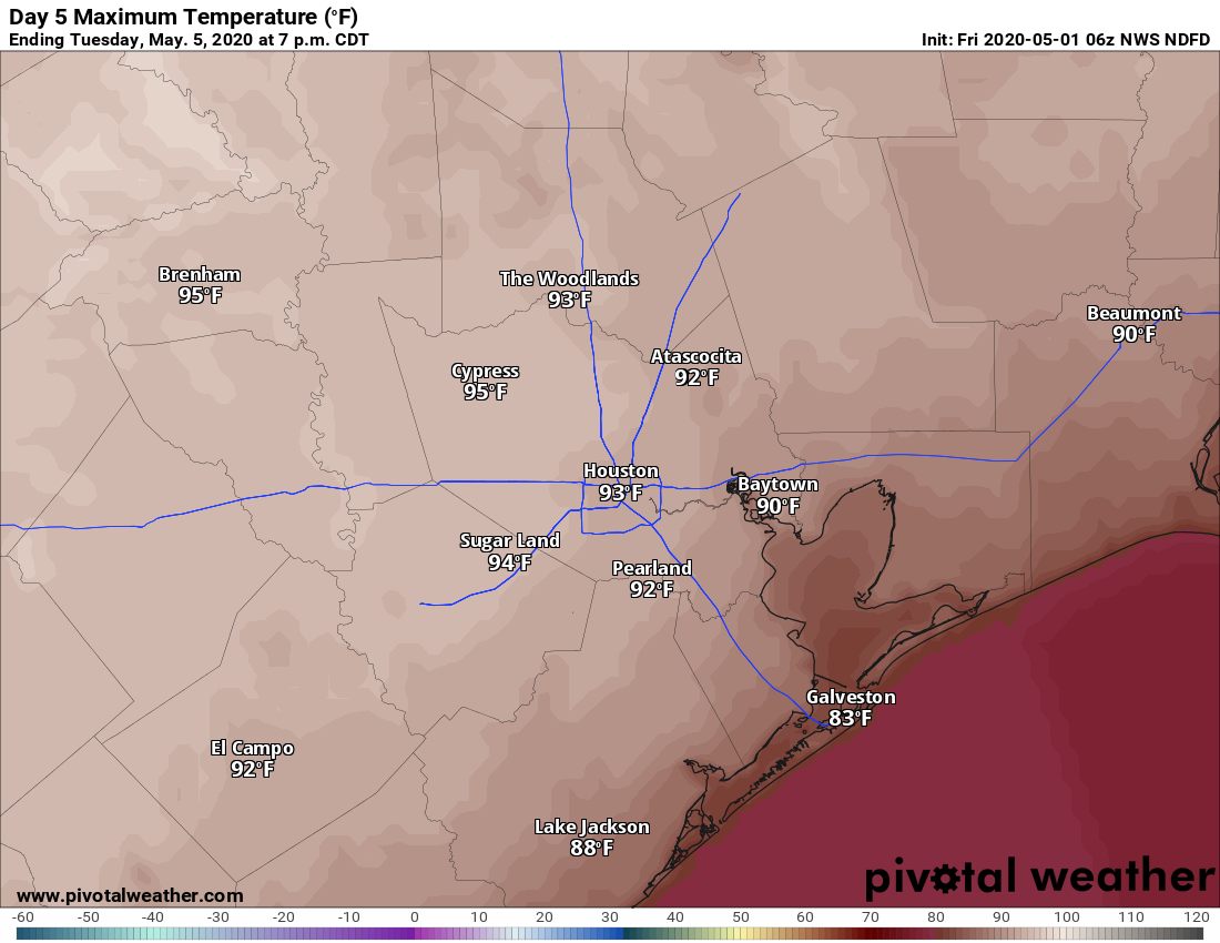
Monday and Tuesday
We should continue to see this pattern of morning clouds and increasing sunshine on both days to start next week. Temperatures will heat up even more, however. Houston should be able to do the low-90s or so on Monday and low to mid-90s Tuesday. Inland locations could be even a bit hotter.
It will be plenty humid as well, with heat index values at or above 100 degrees at times. With all that humidity, low temperatures look to be in the low- to mid-70s on average. Rain chances look close to nil through Tuesday.
Rest of next week
The forecast picture gets muddy by the middle of next week. Will we see a cold front? Will it clear the coast if it gets here? Or will it just be a minor “backdoor” front out of Louisiana? And will it bring rain if it gets here? Yes, those are all open questions. As of right now I would expect slightly less hot weather on Wednesday followed by something closer to normal by Thursday or Friday. That would be days in the low- to mid-80s and nights probably in the 60s. I don’t think an overly refreshing air mass is coming next week, but it should cool off at least a little behind some kind of front.
Despite this week’s rain, we could use more along and south of I-10 in many spots. Next week’s rain chances look rather modest overall. We’ll know more Monday about how things should set up, but as of now I would not be banking on next week to deliver a significant dousing for areas that need one. Showers look possible Wednesday, but I assume we will clear out a good bit quickly by Thursday. We will update you on the latest Monday!