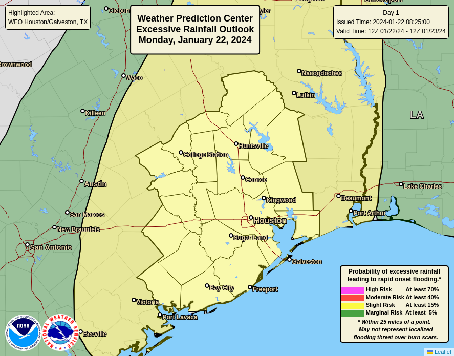
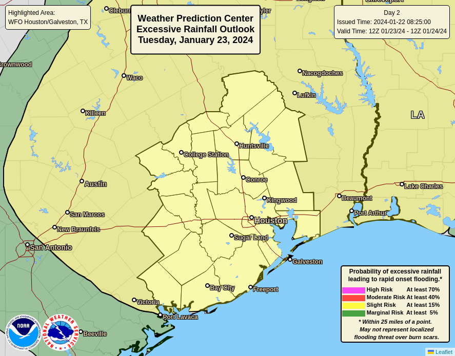
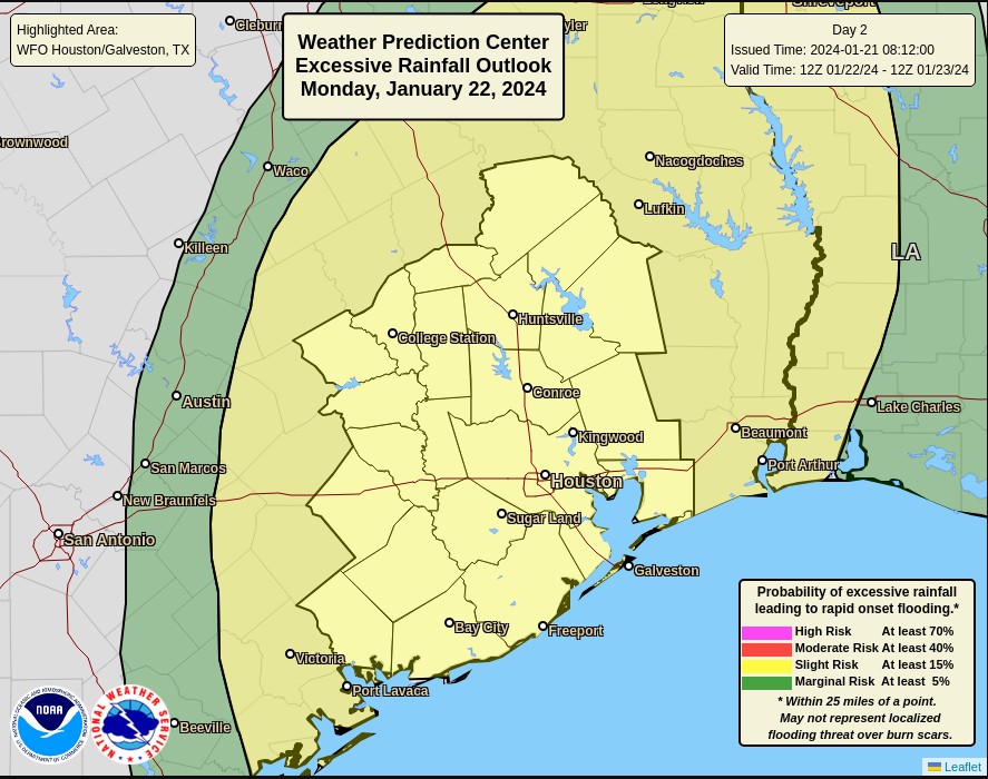
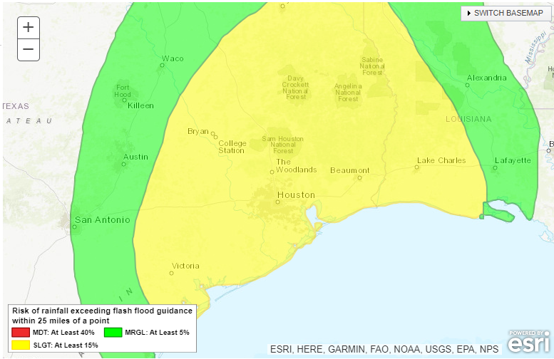
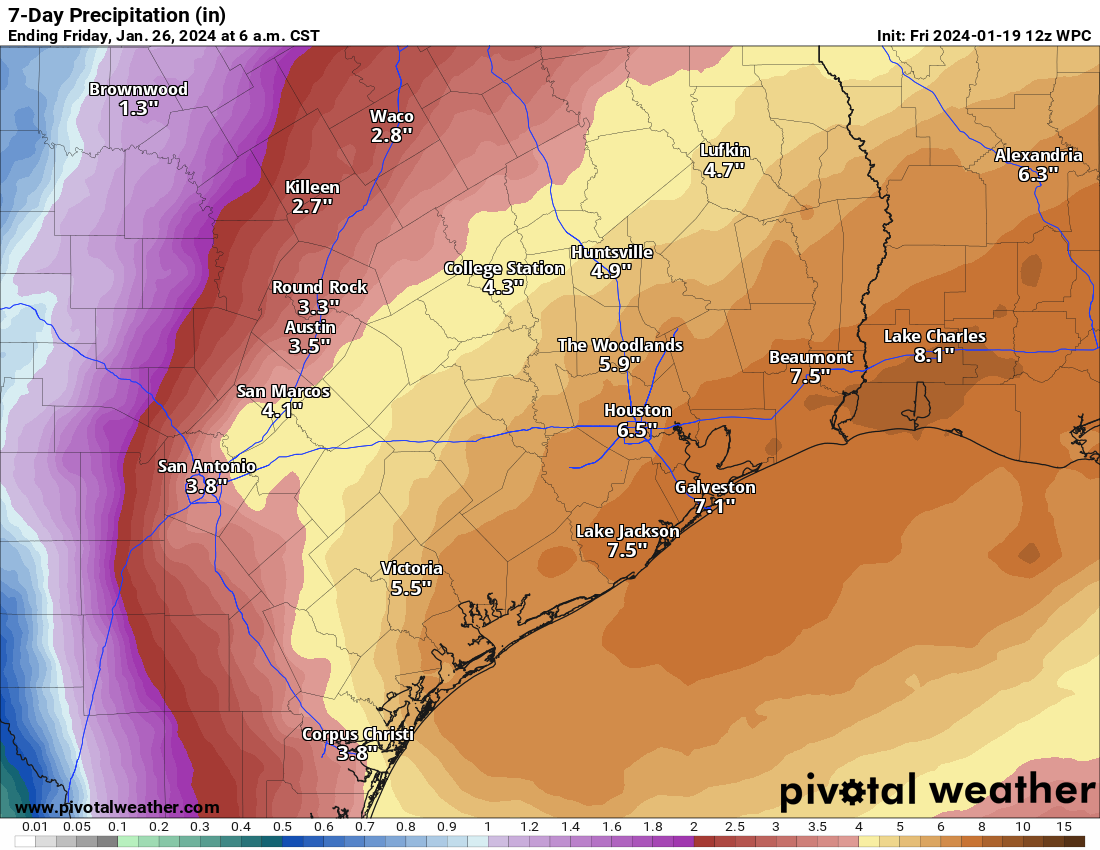
Summary: The Houston area picked up 1 to 4 inches of rainfall on Monday, and we’ll see ongoing bursts of precipitation through Thursday morning. Today the focus shifts north of the metro area, to areas including The Woodlands, Kingwood, and College Station. By Wednesday morning the threat appears to be more centered on coastal areas, including Galveston. We’re maintaining a Stage 1 flood alert for now, but will continue to monitor things closely.
Tuesday
Things are fairly quiet just before sunrise this morning, but showers and thunderstorms are developing to the west of the area in response to disturbance that will move through the region today. This feature will likely bring 1 to 4 inches of rain to areas north of Interstate 10, with the highest totals likely near locations such as College Station and Huntsville. In Houston I expect a somewhat calmer day, with 1 inch of rain or less in the city on down to the coast.
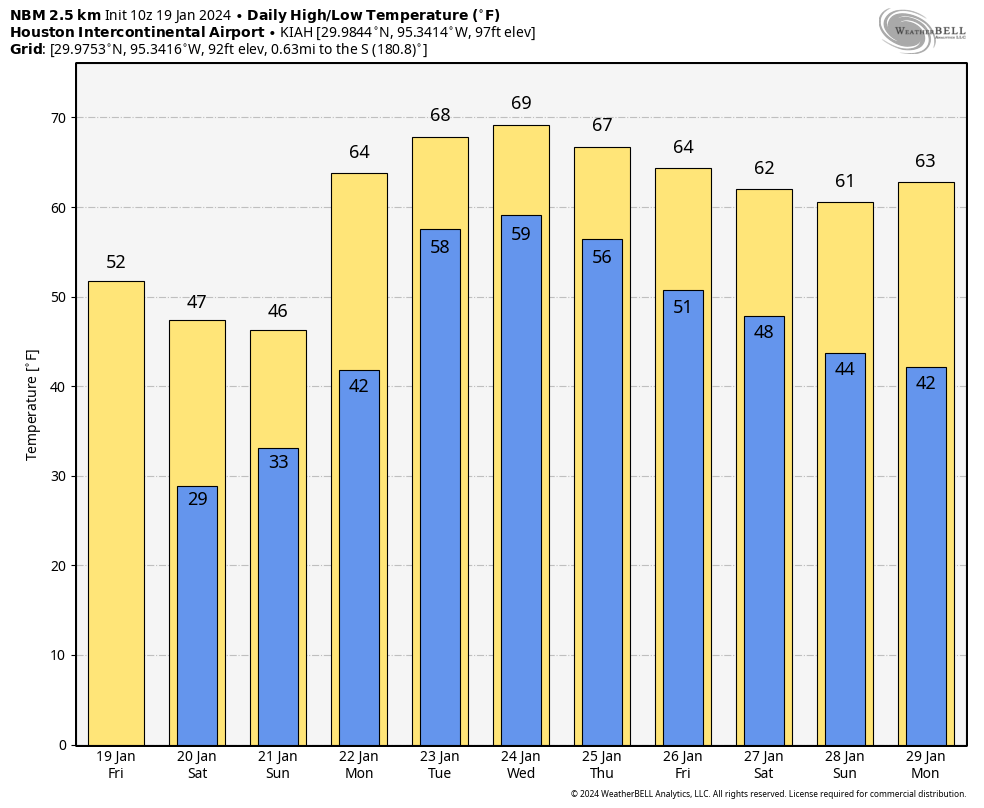
Temperature-wise, today will be fairly warm for January, with highs of about 70 degrees. Skies will be cloudy, with southeasterly winds occasionally gusting to 15 or 20 mph. Low temperatures tonight will only drop into the mid-60s, with continued humid air. Storms will be possible after midnight in the metro area, which I’ll discuss below.
Wednesday
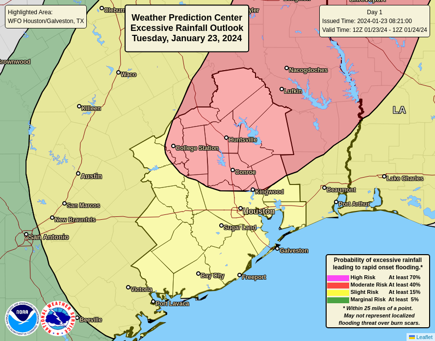
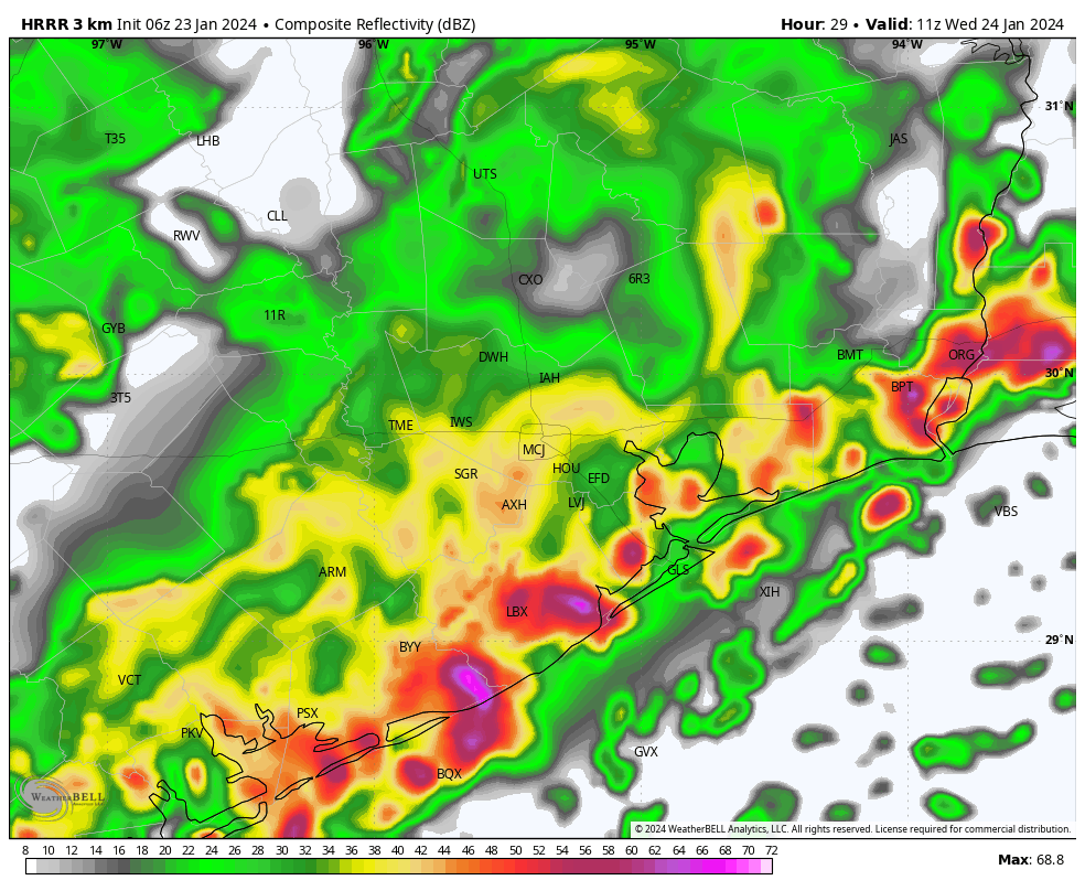
High-resolution models are indicating the development of strong showers and thunderstorms early on Wednesday morning for locations along and south of Interstate 10. While we cannot have great confidence yet, it does look like coastal areas from Port Lavaca to Galveston to Beaumont could see heavy rainfall during the pre-sunrise hours. Some of these storms could well migrate northward into the Houston metro area, setting up the potential for a messy commute on Wednesday morning.
In any case, unlike Tuesday, Wednesday looks rather wet in the Houston urban area, with the potential for street flooding. If there’s more clarity later today we may post an update. I expect additional accumulations of 2 to 4 inches of rain, with higher totals possible near and along the coast. It will be another warm-ish and humid day for most of Houston, with highs of about 70 degrees, but it may be a bit cooler to the northwest of the city.
Thursday
A weak front that will move into the Houston region and stall northwest of the area should finally push through the city early on Thursday morning. I expect this to drive one more round of showers and thunderstorms during the pre-dawn hours before this mess finally exits to the east. Look for partly clearing skies later in the day with highs in the 60s. Lows on Thursday night should drop into the 50s.
Friday
Expect a partly sunny day with highs of around 70 degrees. We’ll see a chance of showers later on Friday and Friday night as a second, stronger front approaches the area. Right now accumulations don’t look too significant, but we’ll see.
Saturday and Sunday
The weekend should see mostly sunny, winter-like weather. Look for highs in the mid-60s on Saturday, with a northerly wind gusting at times to 20 or 25 mph. Lows drop into the 40s overnight, with highs on Sunday reaching the lower 60s. I’m looking forward to taking advantage of the sunnier and mild weather with a long bike ride.
Next week
Look for calm weather to prevail through Wednesday, with highs generally in the 60s and lows in the 40s. A warming trend begins later on Wednesday or Thursday with some slight rain chances returning by Thursday or so. All in all, it should provide a nice run of pleasant weather after this turbulent week.