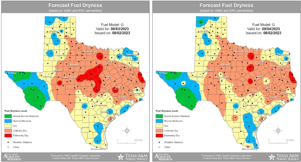
Good morning. One byproduct of the heat and lack of rain this summer has been increasingly dry grasslands, and accordingly we’ve started to see the outbreak of wildfires. For example, on Wednesday, the Texas A&M Forest Service worked hard to contain the 215-acre “Snowhill Fire” in San Jacinto county, to the north of the Houston area. Fire conditions will persist for at least the next several days with the ongoing heat and could be exacerbated by winds a little bit higher than the region has has seen of late.
The model output below from the Forest Service highlights areas where fuel on the ground, particularly grasses, is susceptible to burning.
Thursday
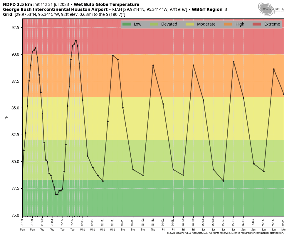
As for the weather forecast, well, do you need to ask? High pressure continues to dominate our weather and we will see highs of around 100 degrees today with perhaps a 10 percent chance of rain. Skies will be mostly sunny, with lows near 80 degrees. Winds will be light, generally from the southeast, at 5 to 10 mph. Basically, this is unchanged from what we’ve been experiencing.
Friday
More of the same.
Saturday and Sunday
As high pressure starts to slowly slide westward, temperatures may come down slightly this weekend. We’re talking highs in the upper 90s to 100 degrees for most of the area, instead of highs around 100 degrees. So, probably not noticeable. Rain chances both days are on the order of 10 percent with mostly sunny skies.
Next week
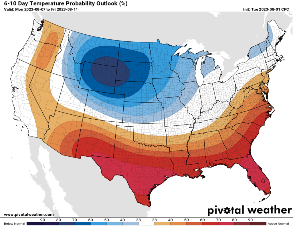
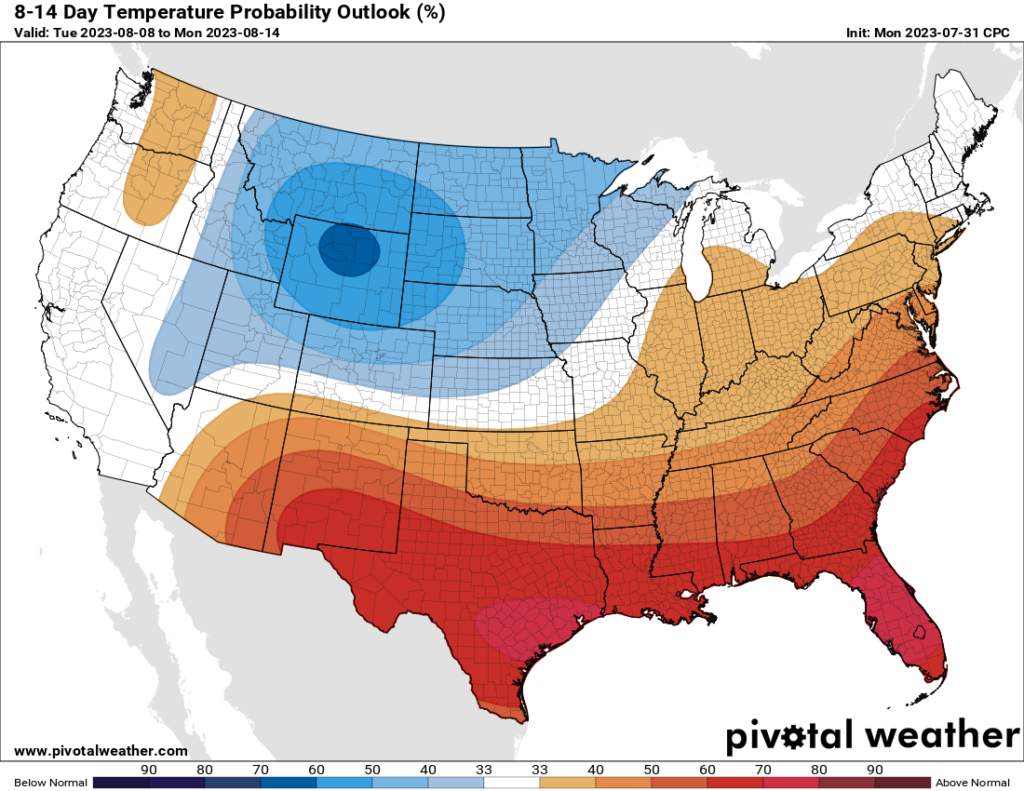
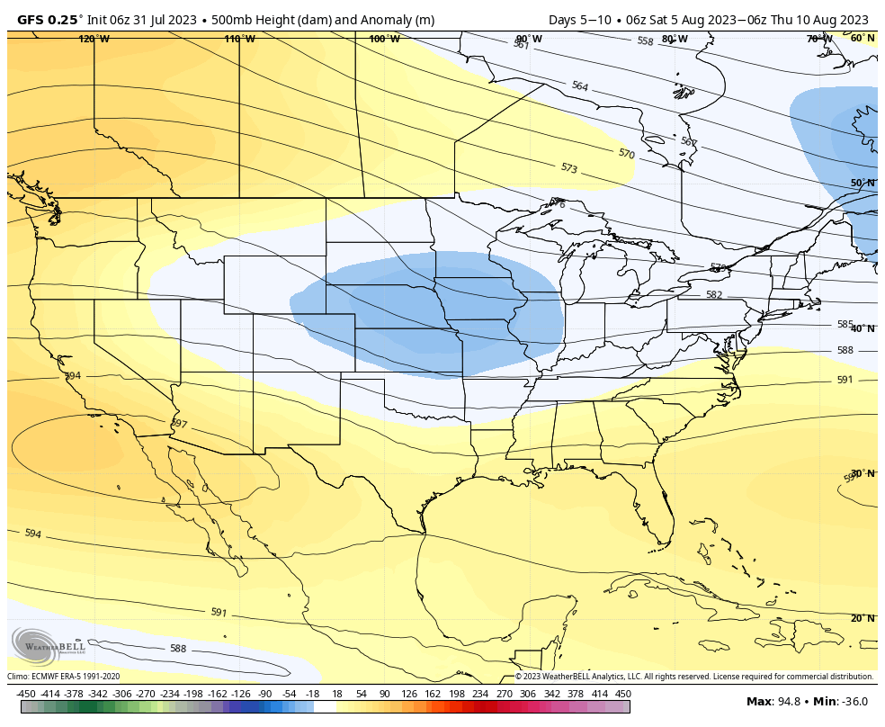
The forecast for next week still calls for hot weather. But there’s still the potential for some slightly better rain chances by Wednesday or so as high pressure weakens a bit. The question is whether it will weaken enough, and I don’t think we can say that yet. Looking further into my crystal ball, I think there may be some hope for this overall pattern to change slightly, and for the better, by mid-August or so. But again, we’ll need at least a few more days before that’s something to feel confident in.