After a couple rounds of some gnarly storms on Thursday and Saturday, the region should be in for a fairly durable break over the next several days. However, the cost will be the strongest heat since last summer. It makes for a fairly simple weather forecast, but there are at least a couple things to note. Since every day looks to be about the same, we’ll discuss things a little differently today.
How hot are we talking?
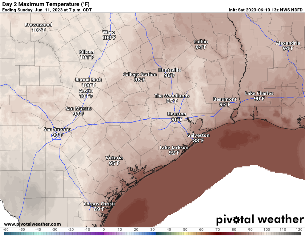
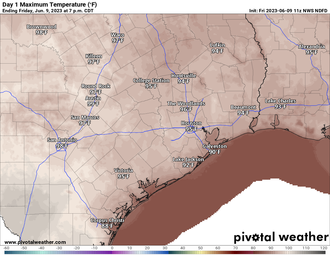
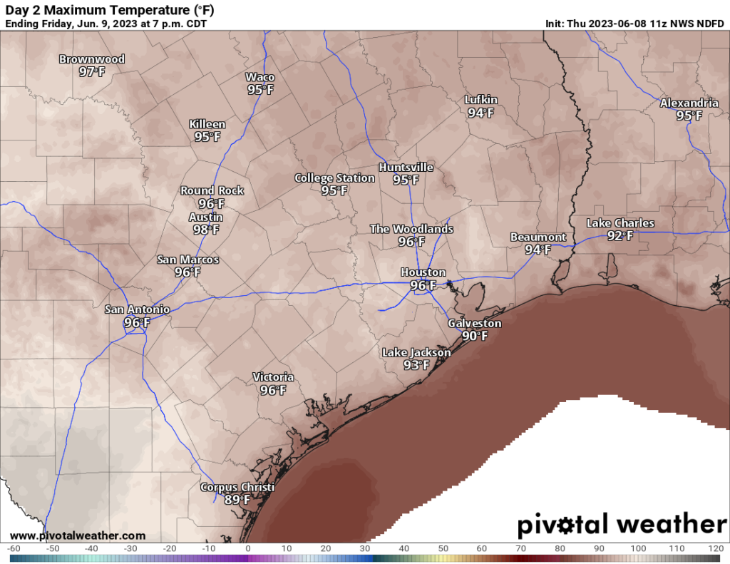
Forecast highs today through the weekend look to be in the upper-90s to low-100s each and every day. There is probably a slightly higher chance of 100+ as we get closer to the weekend as the upper level ridge of high pressure that’s causing this heat flexes a bit more.
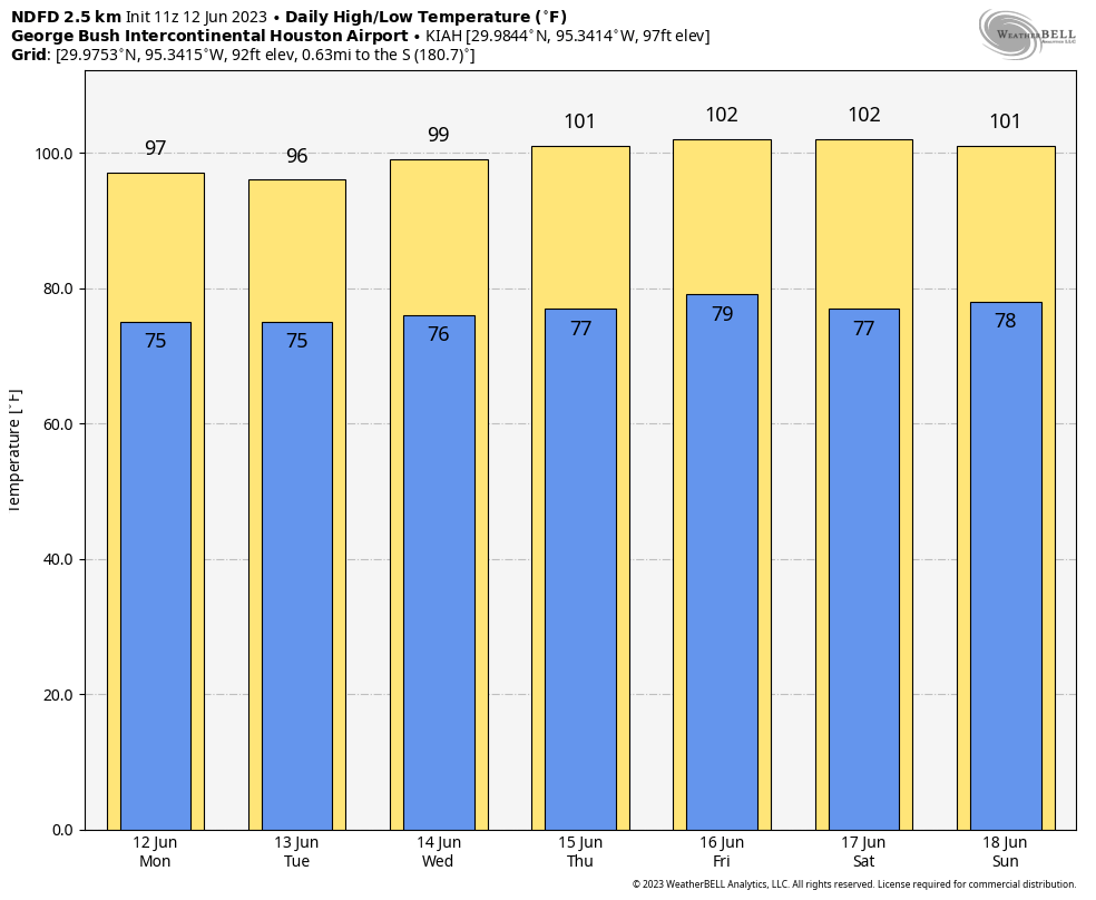
Models indicate about a 70 percent chance of hitting 100° during the peak of the heat (expected Friday through Sunday), with about a 35 percent chance of hitting 103° and a 15 percent chance of 105° in Houston. We get hot in summer here in Houston, but this is sort of the next level of heat. Morning lows will be in the 70s to near 80 each day.
How bad will the humidity be?
The humidity will be about as bad as you typically see in Houston in summer. There’s nothing about this air mass that’s overly impressive in terms of humidity right now. Dewpoints will be running near to maybe just a little above average. So, you’ll feel the humidity for sure, but that’s typical for our area. However, with abnormally hot weather to go with that humidity, it sets us up for escalating heat this week.
As of right now, the National Weather Service does not intend to issue heat advisories for the Houston area today or tomorrow, but that will probably change later this week when we start testing that criteria (heat index, or “feels like” values of 108+ or air temperatures of 103+) a little more. Excessive heat warning criteria features heat index values of 113° or higher or air temperatures of 105° and up.
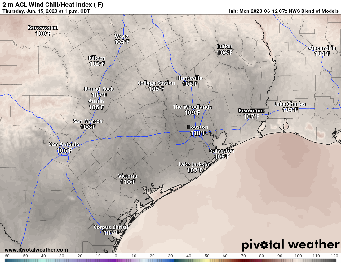
Initially, expect afternoon heat index values of 103 to 107°, worst in and south and east of Houston, escalating to near 110° or hotter by late week. Whatever criteria we do or do not hit, it will be important to take it easier than normal in the afternoon heat. The NWS Houston office has a handy web page with graphics and information on heat safety. Look before you lock, drink water, wear sunscreen, and try to stay cool.
Will anything make this more tolerable?
If you’ve been paying close attention since May, you may have noticed a real lack of wind around these parts. We had some pretty windy months earlier in spring and also last spring. But since at least 2010, no May 1st through June 10th period has had a lower average wind speed in Houston. Relative to recent years, it’s been dead calm. That is finally changing this week.
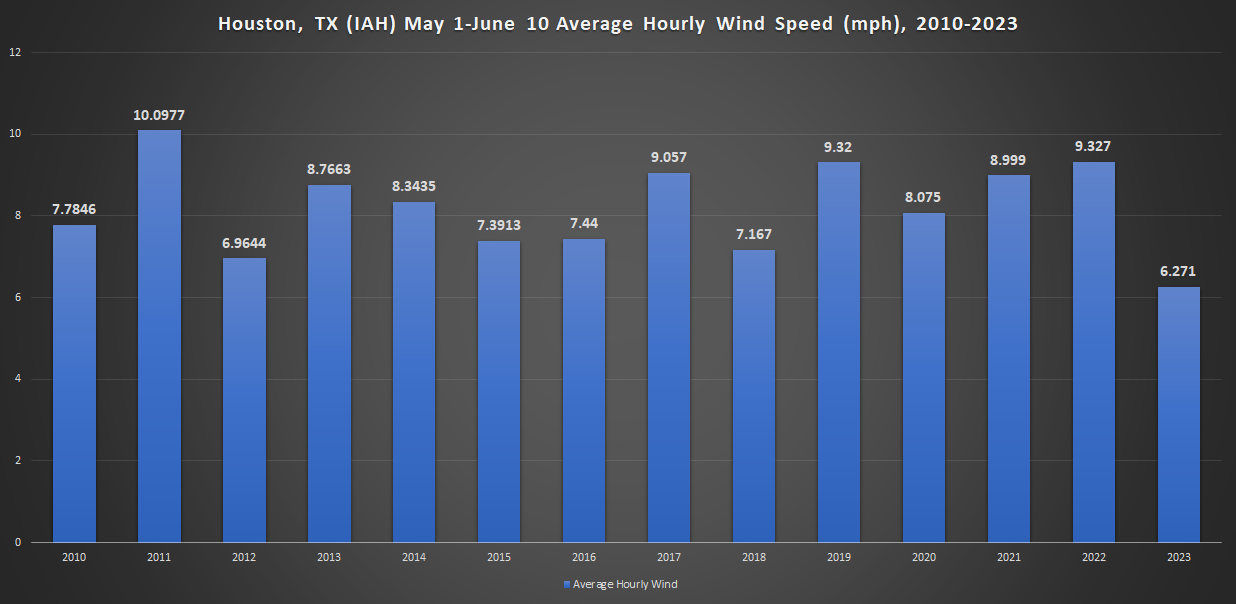
We expect wind this week to average about 10 to 15 mph or so, with occasional daytime gusts of 20 mph. While that won’t make it feel nice with temperatures this hot, it will take a bit of the edge off. It’s a bit counter-intuitive, as this sort of heat is typically associated with what we derisively call a “death ridge,” a hot, dry, calm atmosphere. But we’ll be downstream of it at least initially, so we benefit with some wind.
How about rain chances?
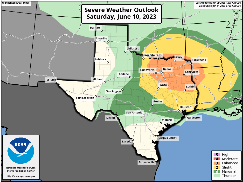
Those will be mostly absent. I would say that if you live north of Houston, up toward, say Huntsville or Madisonville, you have at least a chance at getting grazed by some storms that will pass across North Texas this evening, Tuesday morning, and Wednesday morning. Model guidance from the National Blend of Models (NBM) shows about a daily peak of 10 to 15 percent chances of measurable rain over the next 7 to 10 days for Houston, and maybe 15 to 20 percent up north of Huntsville and Walker County. Chances look absolutely paltry south of I-10 right now. So, no, it does not appear we will see much, if any rain over the next week.
Do we need to worry about power outages?
At this time, ERCOT says that there may be calls for conservation at some point, but they do not anticipate dealing with outages this week. I have seen that thought echoed by others “in the know” on social media that do not work for ERCOT or Texas. It’s always a good idea to conserve where you can this time of year, but the grid should be able to manage the heat for now.
When will this end?
I wish we could answer that with confidence.
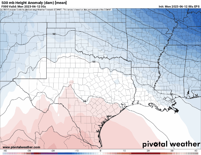
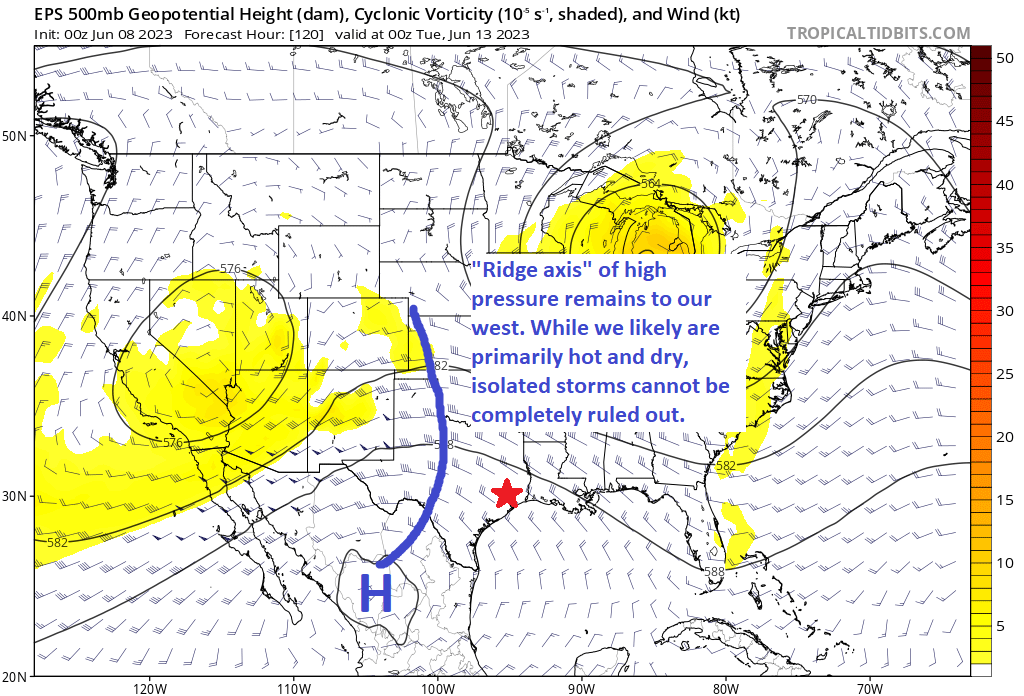
If you look at the weather pattern about 20,000 feet up over the next 10 days (looped above), you can see that the ridge flexes this weekend (indicated by a horseshoe-like curvature to the black lines over Texas) into early next week. We call this a “persistence forecast,” where every day is basically mostly like the previous day. What that means is we’ll likely be dealing with high temperatures of 97 to 103 degrees over the next 10 days. I will caution that there’s always a chance we can’t see a disturbance or something that can throw a wrench into a persistence forecast like this. But right now, I certainly don’t see what that catalyst would be. After midweek next week, it does appear that the ridge may retreat to the west some, which could allow for a bump in rain chances and cooler weather.
Stay cool, and we’ll be back with an update on Tuesday morning!