Yesterday was a chilly, breezy day, and we will probably have some more of that today before our weather changes pretty drastically. This will be our last real shot of winter-type weather for some time, as we see at least a temporary shift into spring next week.
Today
Sunshine should dominate today, with at least a few high clouds floating by through the day. Otherwise, look for a continued 10 to 15 mph breeze with gusts to 25 or 30 at times. Winds over the water will be slightly stronger. After a chilly start this morning, look for us to recover into the low-50s this afternoon.
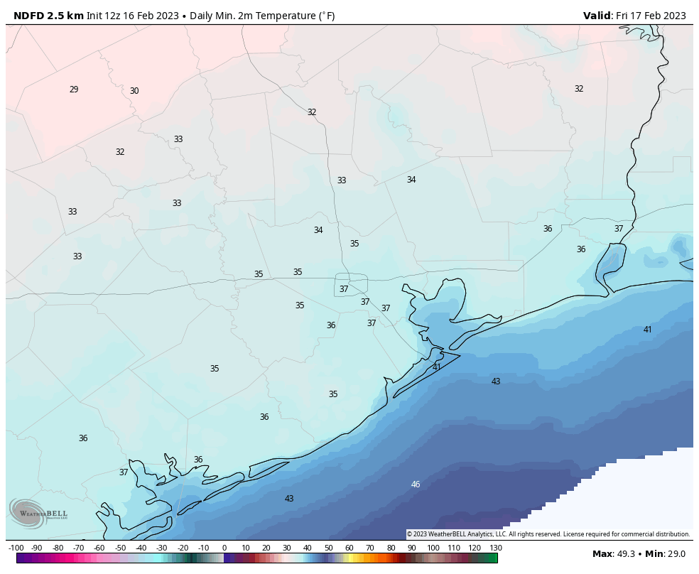
Weekend
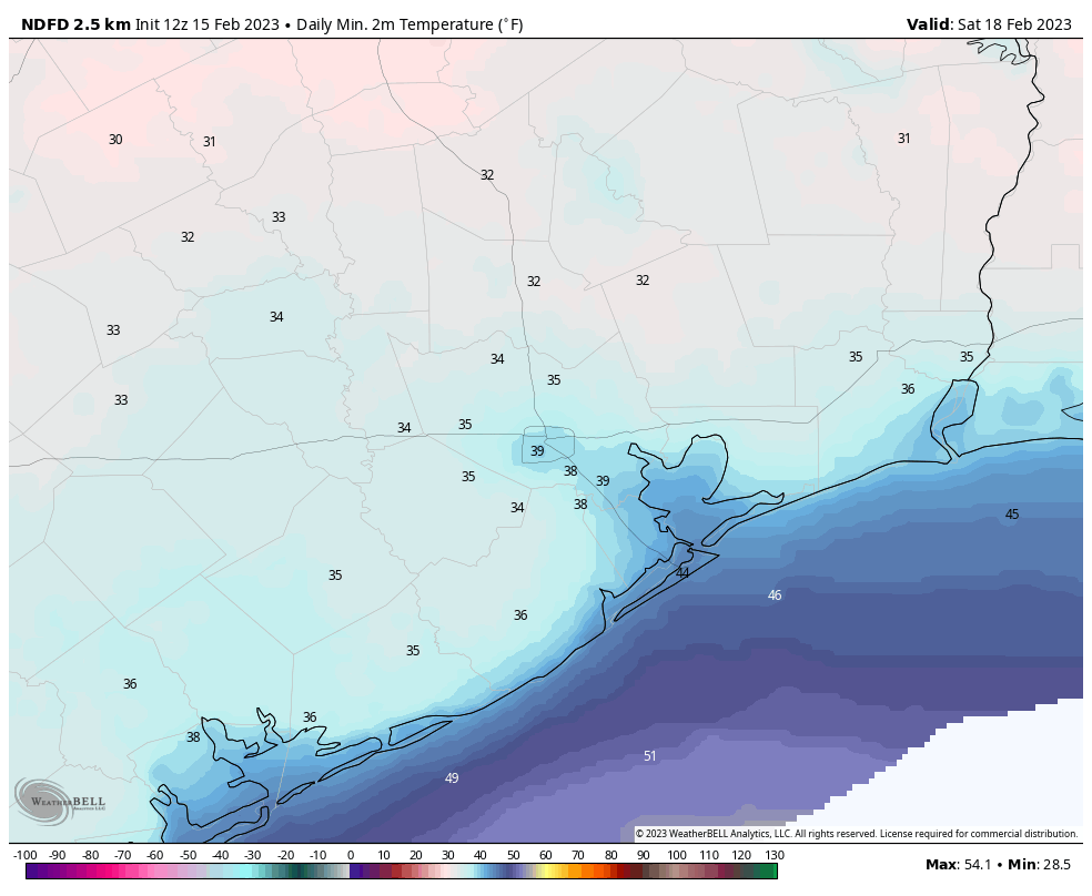
Both weekend days look fine, with a chilly Saturday transitioning to a much milder Sunday. For tomorrow, we will have more sun and high clouds but noticeably less wind than yesterday or today. It will be quite a chilly start to the day, but we’ll gradually creep into the mid-50s or so during the afternoon.
Sunday looks milder with morning lows about 5 to 10 degrees warmer (mostly 40s), and a surge of onshore flow leading to highs near 70 or better. Expect continued sun mixed with occasional high clouds.
Monday and Tuesday
We will really notice the return of humidity on these days as dewpoints shoot up into the 60s on steady onshore winds. High temperatures? Warm. Look for 80 or better both days, with morning lows in the 60s.
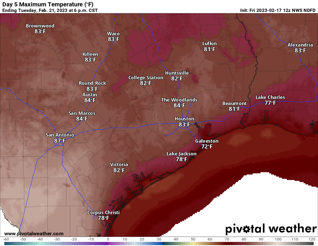
The weather should remain at least partly sunny on both days. There could be a stray shower or some fog on the coast, but winds of 10 to 15 mph or so will help keep the fog from sticking too long I think.
Wednesday through Friday
The forecast remains rather elusive for the back half of next week. The primary problem is that a cold front is likely to stall out and/or dissipate near Houston. If that gets to the coast, we’ll turn notably cooler for a day or so. If that fails to get into the metro area, we’ll continue to see 60s for lows and 70s or 80s for highs. The European model has it slam on the brakes just before getting to Houston’s northwest suburbs. The GFS model pushes it 50 to 100 miles offshore. That’s a *big* difference in potential outcomes.
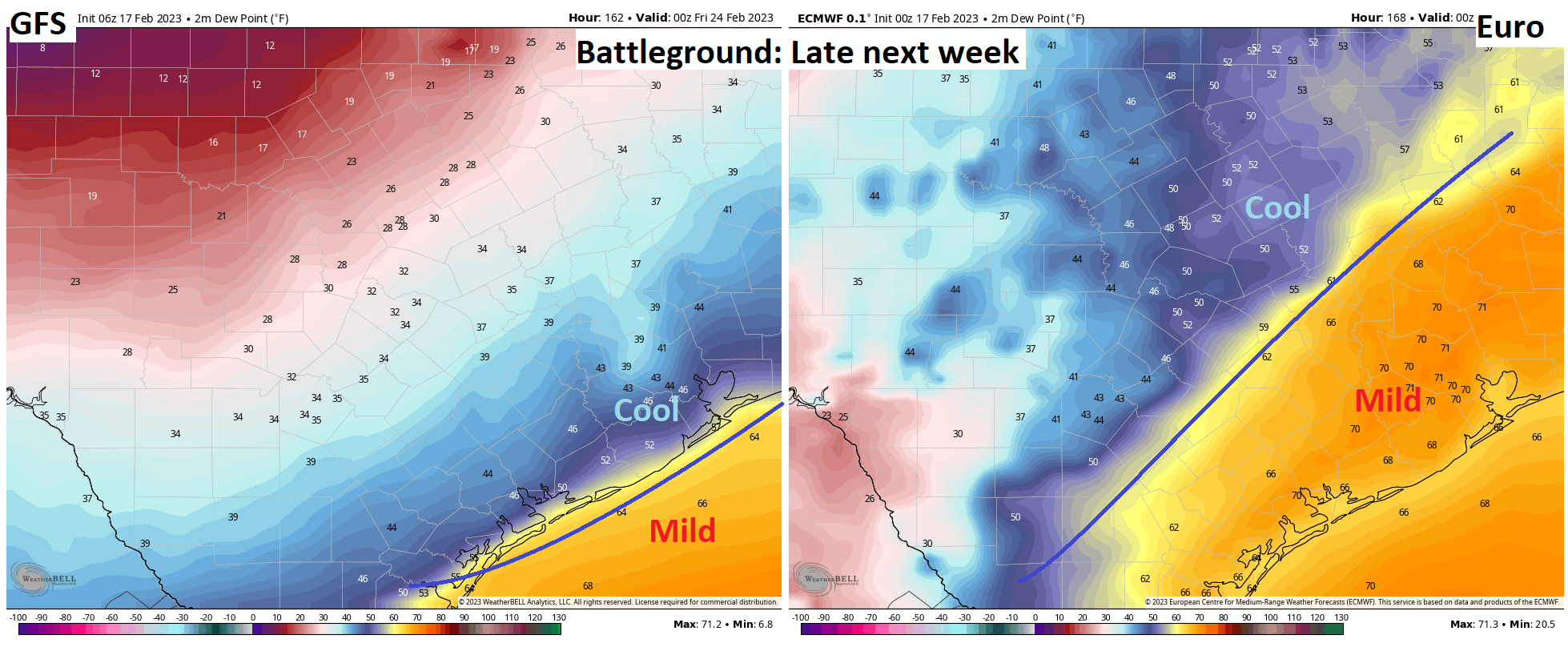
That also will impact the weather we see, with a cooler outcome leading to clouds and shower chances but a warmer outcome likely leading to AM fog and PM sun, with limited rain chances. Take your pick. Right now, I believe the smart money is on a warmer outcome, but we’ll have to wait and see on that.
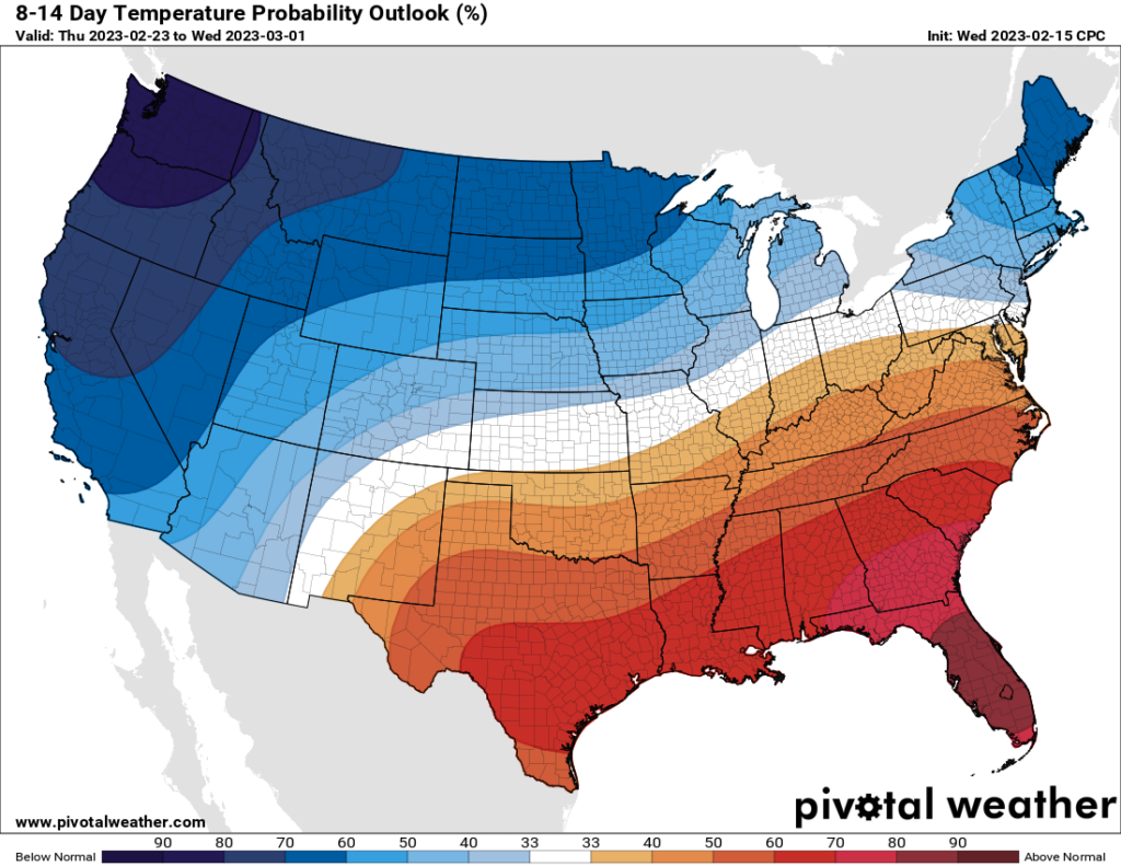
As Eric noted yesterday, the remainder of February will probably finish on a mild note. It will probably also finish somewhat drier than normal. We’re still in a La Niña pattern in the Pacific Ocean, so this shouldn’t come as a huge shock, as that is typical for our late winter and spring weather. For those tracking such things, it would seem that the end is near for La Niña by this summer. While what it means for Houston is very much TBD, in general, that might promote better rain chances this summer, with hopefully fewer hurricanes to watch than is typical. We shall see!