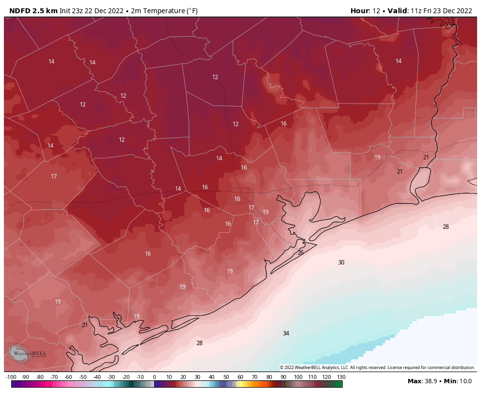
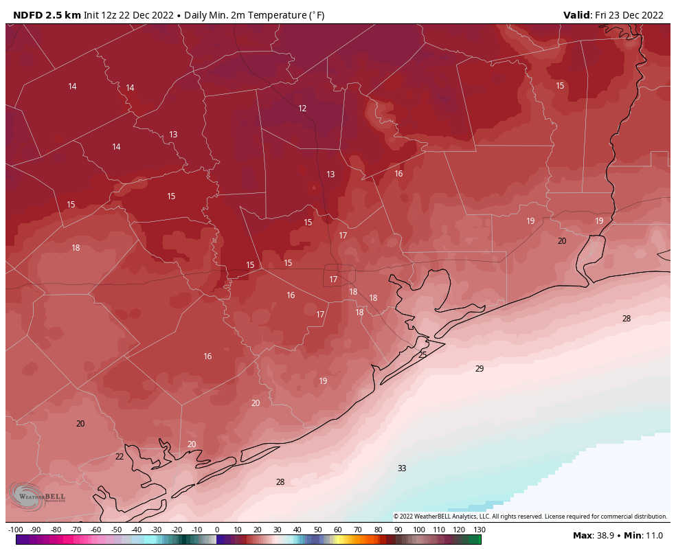
Okay, campers, rise and shine, and don’t forget your booties ’cause it’s cooooold out there today! Unlike 1993’s “Groundhog Day,” this will soon be a distant memory as we warm up heading into next week. But in the meantime, it is our coldest morning since February of 2021. Houston has so far bottomed out at 16°, and the coldest reading I can find as of 6:30 AM is 10° up in New Waverly. I also saw an 11 just outside Tomball. Whatever the case, it’s about 10 to 20 degrees in most places this morning, and it’s cold.
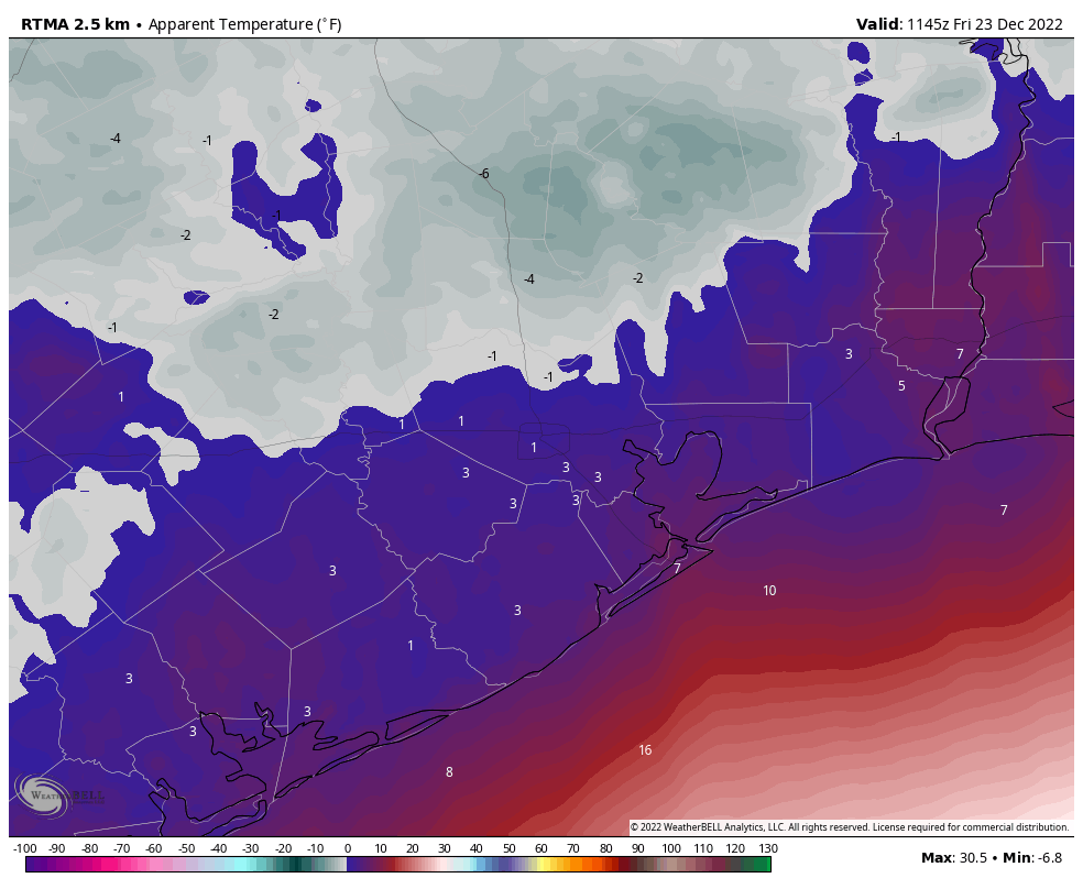
The wind isn’t helping. We continue to see wind gusts up as high as 33 mph in Houston at Hobby Airport and 39 mph in Galveston. The combination of wind and cold makes it feel about as brutal as it can realistically get here in Houston. Wind chills are currently 5° in Galveston, 3° at Bush Airport, 1° at Hobby Airport, and -4° in Conroe.
So before you go out and do that last minute Christmas shopping, please make sure you are adequately dressed. This type of cold can be dangerous, especially for those of us in Texas that are simply not used to temperatures at these levels.
The good news is that roads should be all clear and passable, as we saw no ice or snow with the front yesterday. Travel anywhere across Texas is fine today. If you are flying, please go with a lot of patience. Flights to Chicago are likely to be delayed. Milwaukee’s airport is currently closed. All of these issues will cascade through the system, so flight delays and cancellations are possible anywhere.
Some good news is that ERCOT is in fine shape this morning. As of this writing, Texans are using about 73,000 megawatts (MW) of electricity, and the grid has nearly 85,000 MW available. According to their site, things do get a little tighter looking this evening, as wind falls off versus where it was last night and this morning. As of now, we don’t foresee any serious issues, but given that they failed to forecast the amplitude of the energy demand last night and this morning (they missed by several thousand megawatts), it is worth monitoring later today.
Centerpoint is reporting just shy of 20,000 customers without power this morning. This is due to localized outages from tree branches or power lines being impacted by the strong winds in our area. That number should improve through the day as winds ease up.
Friday
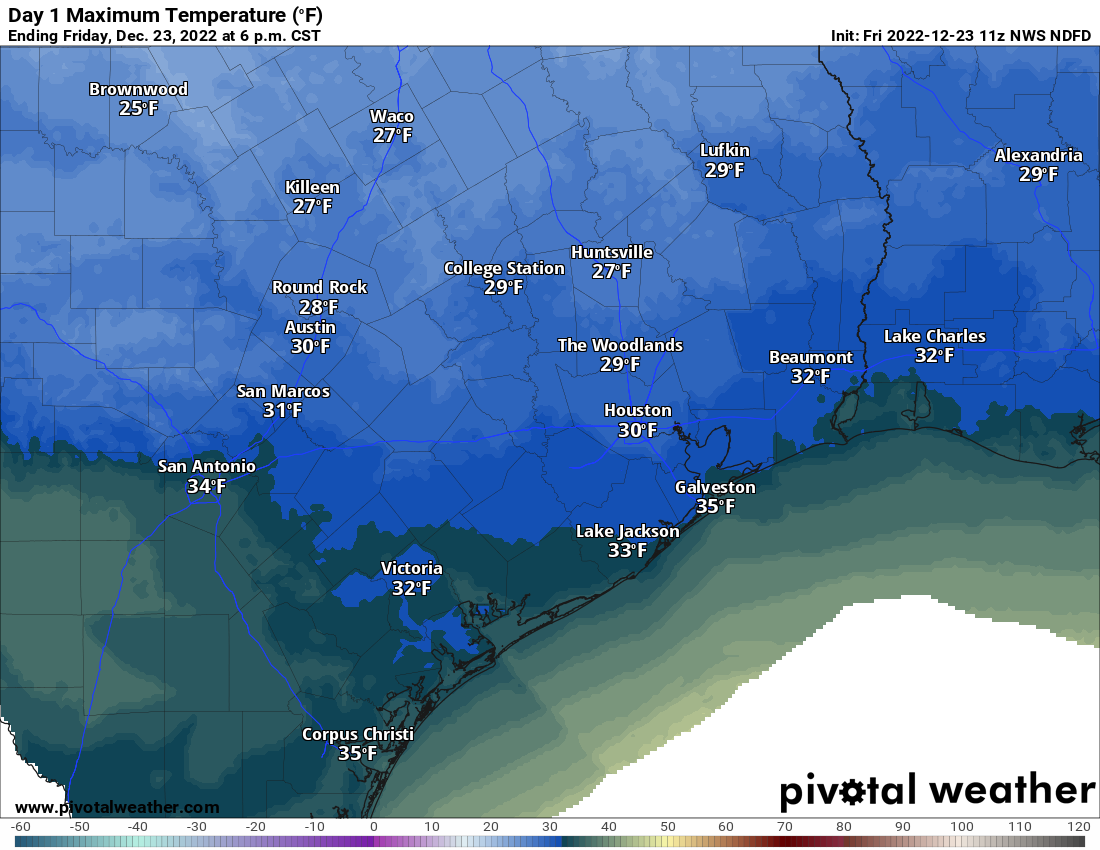
The good news is that the sun will help make it feel just a little less uncomfortable today. Still, expect high temperatures barely scraping 30 degrees in most places. The freeze continues.
Winds will remain blustery today, with gusts of 20 mph inland and 30 mph at the coast. So wind chills will remain a factor all day today as well.
Tonight & Saturday
Most of our attention has been focused on this morning’s temperatures because they were to be the coldest of this event. But tonight will be pretty rough as well. Thankfully, we will see less wind, but we will still likely have a hard freeze almost everywhere, so keep all protective measures for pipes, plants, people, pets, and livestock in place. Some passing cloud cover may prevent temperatures from dropping as far as they did last night and this morning, but it will still be plenty cold.

Saturday should end up being a slightly nicer day. Expect only a light breeze, more sunshine, and temperatures warming above freezing and deep into the 30s.
Sunday & Monday
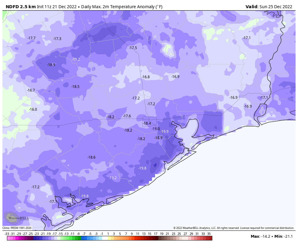
Christmas Day will be another chilly one, but we’ll be gradually eating away at the cold. Only outlying areas really have a risk for a significant hard freeze Sunday morning, while most of Houston proper, coastal areas, and some of the denser suburbs will probably “only” get to the mid-20s overnight. We’ll turn things up into the 40s on Christmas afternoon.
We may get a weak reinforcing front on Monday. Still, we’ll likely get above 50 degrees Monday afternoon. We’ll have another chilly night Monday night into Tuesday with 30s in most spots and perhaps a few high 20s in outlying areas.
Rest of next week
Tuesday will see highs in the 50s or low-60s, Wednesday in the 60s or low-70s, and Thursday into the 70s. In fact, we’ll probably see highs in the 60s and 70s and lows in the 50s or 60s straight through New Years weekend. The weather may turn more unsettled late next week as well, but details on that are minimal this far out. We’ll tackle that next week.