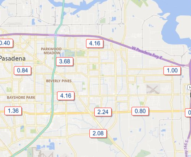
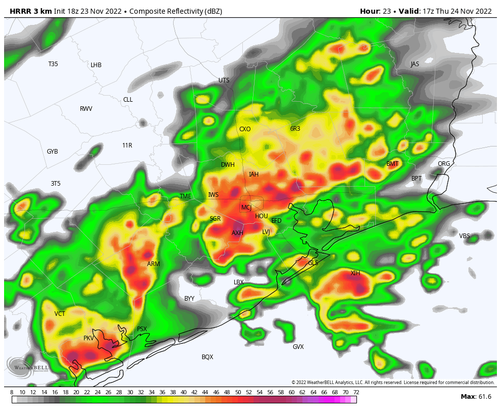
Thanksgiving’s rains were very impressive. In fact, for Hobby Airport it was a new Thanksgiving record, with 1.53″ of rain, breaking last year’s 0.59″ (set on Nov 25 last year) for wettest Thanksgiving since records began in 1930. But it was areas just east of Hobby Airport that really took home the stuffing.
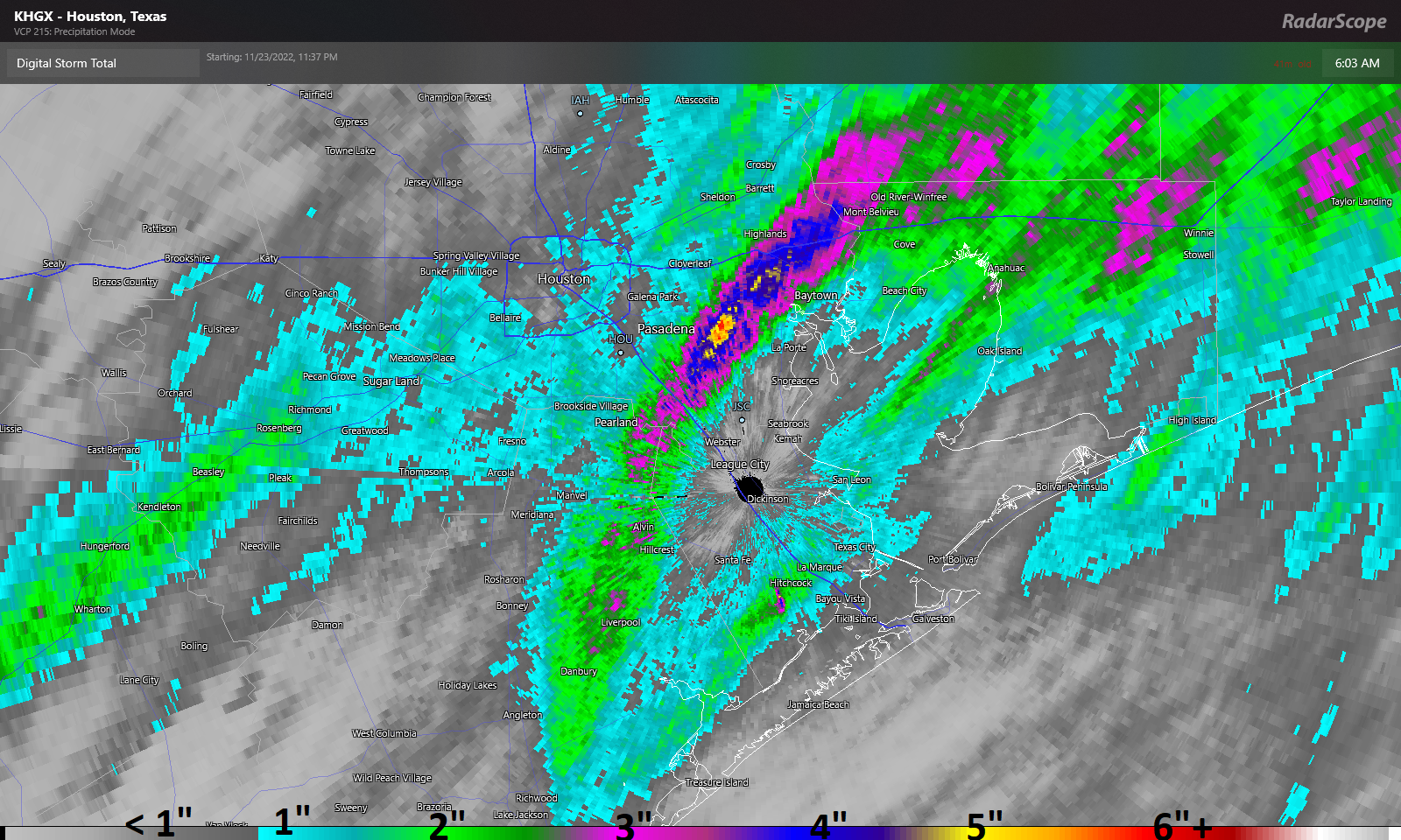
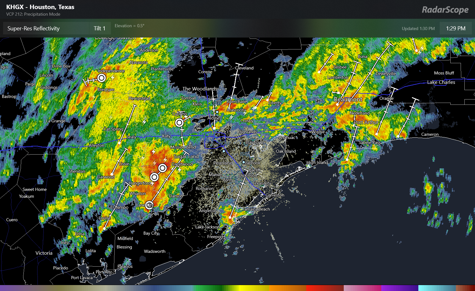
A narrow band between about Friendswood through just west of Mont Belvieu saw anywhere from 3 to 7 inches of rainfall, with the bullseye right over Deer Park. In addition, you may have heard about the tornado warning in Brazoria County. Thus far no confirmed tornado reports have been noted, but things definitely got dicey for a few minutes yesterday afternoon. The severe threat is not zero today, but it’s relatively low and confined to areas well south of Houston.
Housekeeping/Fundraiser
I just want to open today with a little housekeeping. First, with active weather back in the area for the first time in awhile, we encourage you to download our app for your iPhone or Android device. Likewise, if you or someone you know prefers weather updates in Spanish, Maria Sotolongo does exactly that for you at our companion site Tiempo Ciudad Espacial! Maria truly does outstanding work, so please check it out and share it with any of your friends or family like weather updates written in Spanish. Maria also curates our Facebook, Instagram, and Twitter feeds for TCE, so you can follow those as well.
Related to that, our annual fundraiser is down to the wire now! There are just a few days left for you to truly help make a difference for our site. Your contributions directly help fund our work, app improvements, and tricks up our sleeve for the future. You can click here to buy items to rep the site. And if you don’t wish to purchase merchandise and just want make a contribution, click here and check the box that says “I’d like to make a donation only.” We are grateful for any and all support. Thank you!
Today
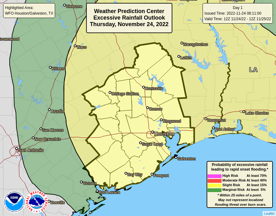
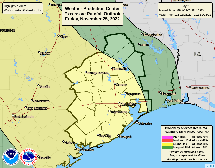
Onto the weather. A little housekeeping here too: A Flood Watch remains in effect until tomorrow morning, and Eric and I will maintain our Stage 1 Flood Alert until then as well. We continue to expect primarily street flooding to be the issue with further rains, but we also do want to monitor the area around Armand Bayou through the Clear Creek watershed given yesterday’s exceptional rains there.
The frustrating reality today is that we do not expect a washout, but there will be a chance of rain and scattered showers or downpours around virtually all day. The morning looks mostly fine, but rain showers will become more frequent this afternoon and evening. The bottom line today: Have an umbrella and a backup plan in case you’re chased indoors for a time. Temperatures look relatively stable, in the 50s and 60s, gradually warming through the day.
Later today through Saturday morning
It’s encouraging that we have a little bit of a break today because we are likely to get smacked with another round of heavy rain and storms this evening into Saturday morning. Expect periods of showers and storms to become more numerous from late afternoon and evening, culminating in what should be a pretty solid line of storms toward sunrise on Saturday. Some strong storms with gusty winds are possible in addition to heavy rainfall.

We expect roughly 1 to 3 inches of additional rainfall between now and tomorrow morning, most of which will fall in roughly a 6 hour window overnight or early Saturday. Isolated higher amounts are absolutely possible. The heaviest rain seems likely to fall near where the heaviest rain fell on Thanksgiving Day, which is to say in Houston and points south and east. Street flooding will again be possible tonight and early Saturday.
Temperatures will remain stable, in the 60s.
Rest of Saturday
If you have outdoor plans Saturday, you have a mixed bag. The morning will be dicey due to lingering showers and storms, but the afternoon looks great. Rain should end from west to east between about 7 and 10 AM on Saturday. Skies should begin to clear and temperatures will bounce around a bit within the 60s with lower humidity. We should cool a bit toward the 50s by late afternoon.
Sunday and beyond
Sunday will live up to its name with sunshine. Morning lows will start in the 40s to near 50 and warm by afternoon well into the 60s. We will essentially repeat this on Monday.
For Tuesday, clouds and temperatures will increase. We have an outside shot at 80 degrees Tuesday afternoon with enough sunshine. Our last 80 degree day was on November 11th. A few showers will be possible. Humidity will also surge higher. Our next front should arrive Wednesday into Thursday knocking us back into the 40s for lows. Another fairly quick warm up seems likely for next weekend, but additional shots of cool to cold air may not be far behind. A little something for everyone.
Eric will have an update later this afternoon to set us up for tonight’s storminess.