A beautiful Tuesday will give way to a beautiful Wednesday, as we continue to space our fronts apart just enough to enjoy some fair weather in between. There will be another front to come on Friday, followed up by a stronger, more impressive front early next week, which will give us additional opportunities for some needed rainfall in the area.
Today
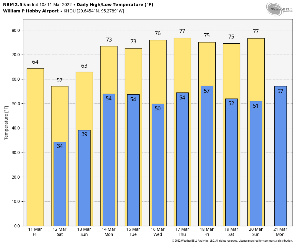
Not much to say about today’s weather. It will be sunny, pleasant, and calm. Look for light winds, low humidity, and highs well into the 70s and at least a slight chance for 80 in a few spots.

Khalid is Wednesday evening’s performer at the Houston Livestock Show & Rodeo, and the weather should be lovely. Look for mid-70s on arrival and mid-60s or a bit cooler when you depart. No issues are expected, so enjoy!
Thursday & Friday
Onshore flow will begin developing this evening into tomorrow morning ahead of our next front. Look for a mostly fine Thursday with sun, clouds, a southerly breeze, and a slight chance for some isolated showers or sprinkles by mid-afternoon. The highest odds of windshield wiper type rain may be south and west of Houston on Thursday. Look for highs well into the 70s to near 80 again tomorrow afternoon.
With southerly winds and increasing humidity, we’ll stay mild Thursday night, and lows should not drop much below the mid-60s through midnight. The front approaches overnight and should kick through before sunrise on Friday. It will bring scattered showers and a chance of thunderstorms.
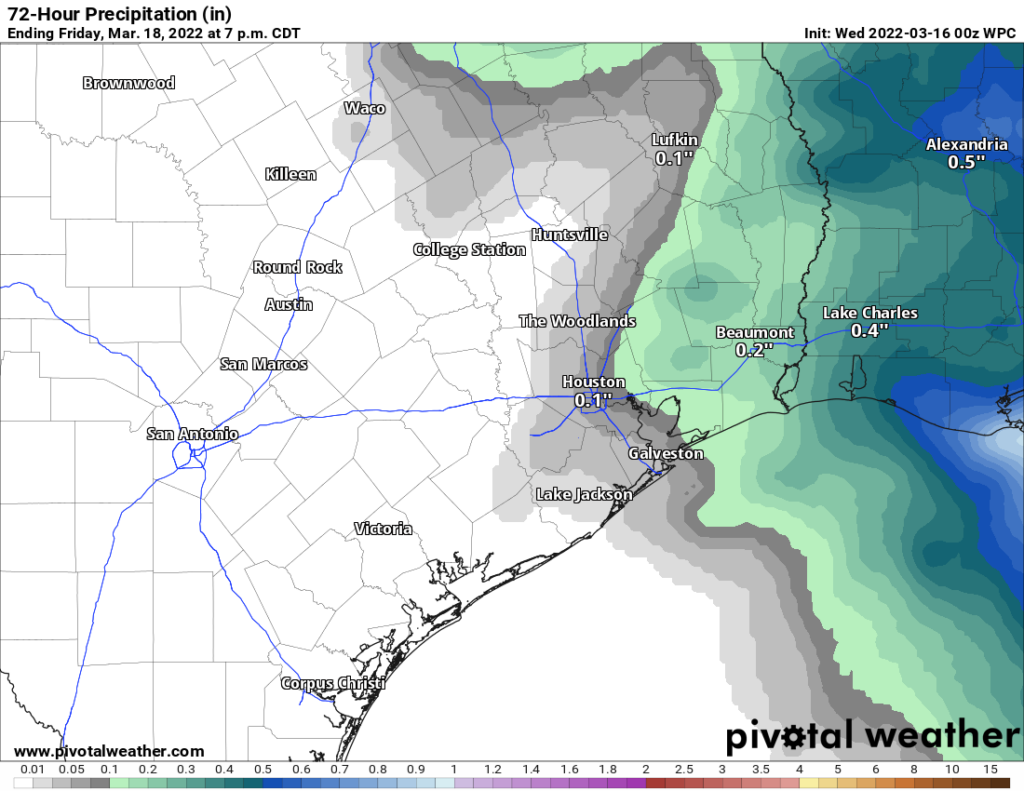
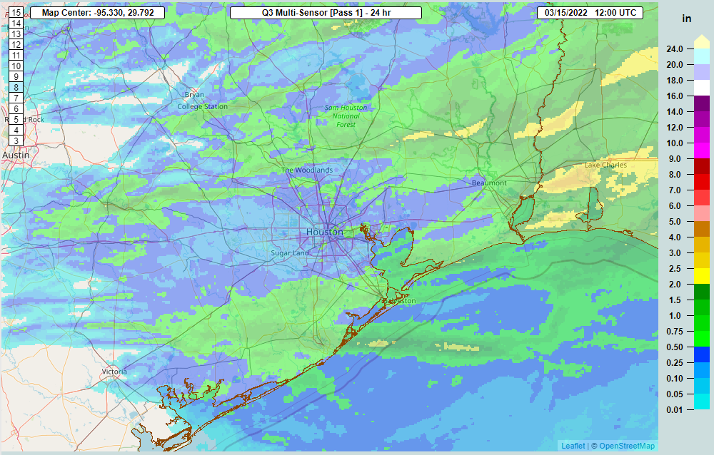
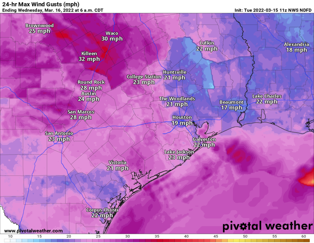
The front really is not expected to get its act together until it has passed east of our area, meaning rainfall (as you can see above) should be generally a tenth to a quarter-inch or less. A few spots could see higher amounts though. The timing of the front should allow for rapid clearing on Friday morning leading to a breezy but pleasant Friday afternoon. Look for highs around 70 with a fresh north or northwest breeze, gusting much like yesterday to 20 or 25 mph in most cases.
Weekend
The weekend continues to look great, with mainly sunshine, highs in the 70s and lows in the 40s to around 50 degrees. Any weekend plans to close out a spring break week should be just fine.
Next week
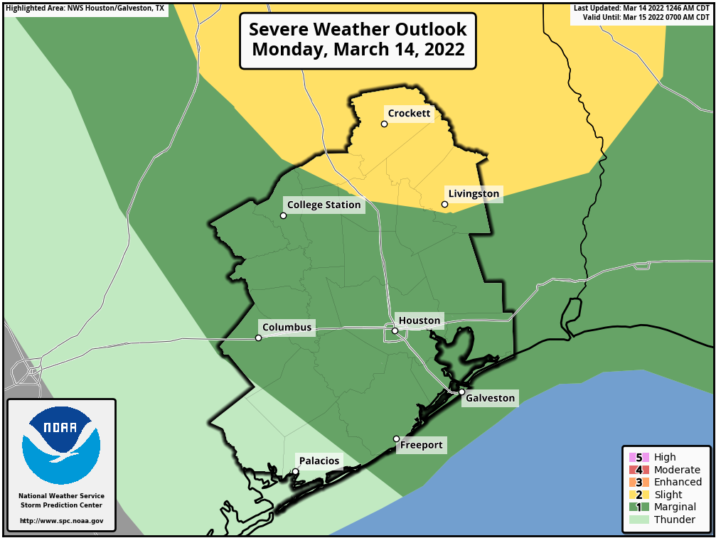
We will repeat the front scenario early next week, except this one looks like it’s going to pack some punch. It’s much too early to get into specifics, but we are already outlooked for the potential of severe weather on Monday, something that usually doesn’t happen around here.
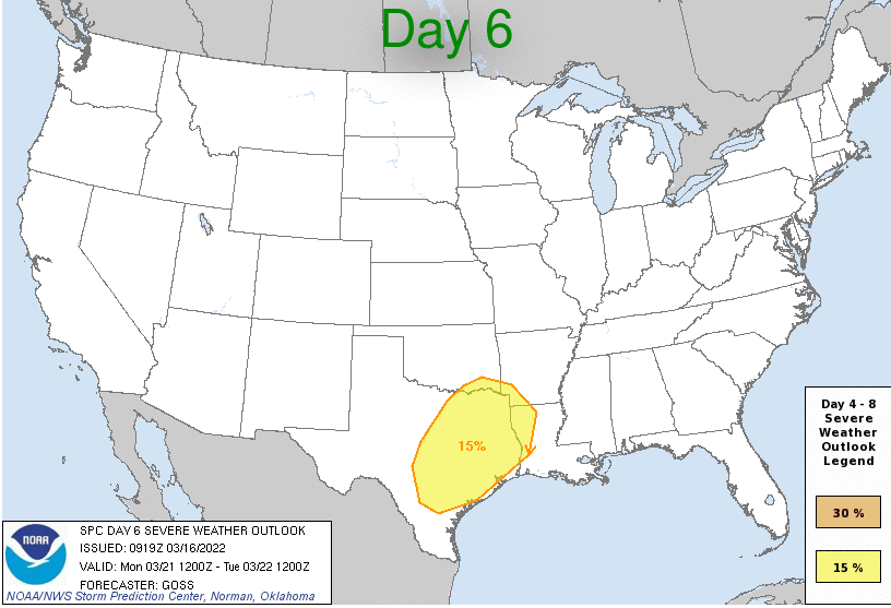
As is often the case in spring in southeast Texas, we will probably have to deal with some degree of “capping” in the atmosphere, which may initially limit how much storm coverage we see on Monday. In fact, if you want to really read between the lines, you’ll notice that the SPC map above has the risk area drawn away from the coast. But it’s too soon to say with any certainty if that will be the case. Generally, the higher odds of severe storms on Monday would be as you progress farther north. We’ll almost certainly see storms with the cold front itself on Tuesday, however, and it’s possible those could be strong to severe as well. Either way, it appears we’re in for something, but Monday will be the day to watch more closely initially. We’ll keep you posted as we get closer.
Once the front is through, look for very nice weather to follow once again for Wednesday, Thursday, and even possibly Friday.