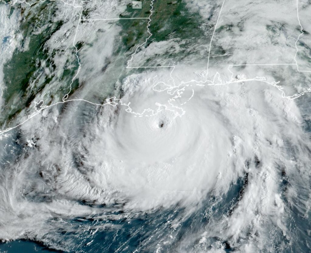
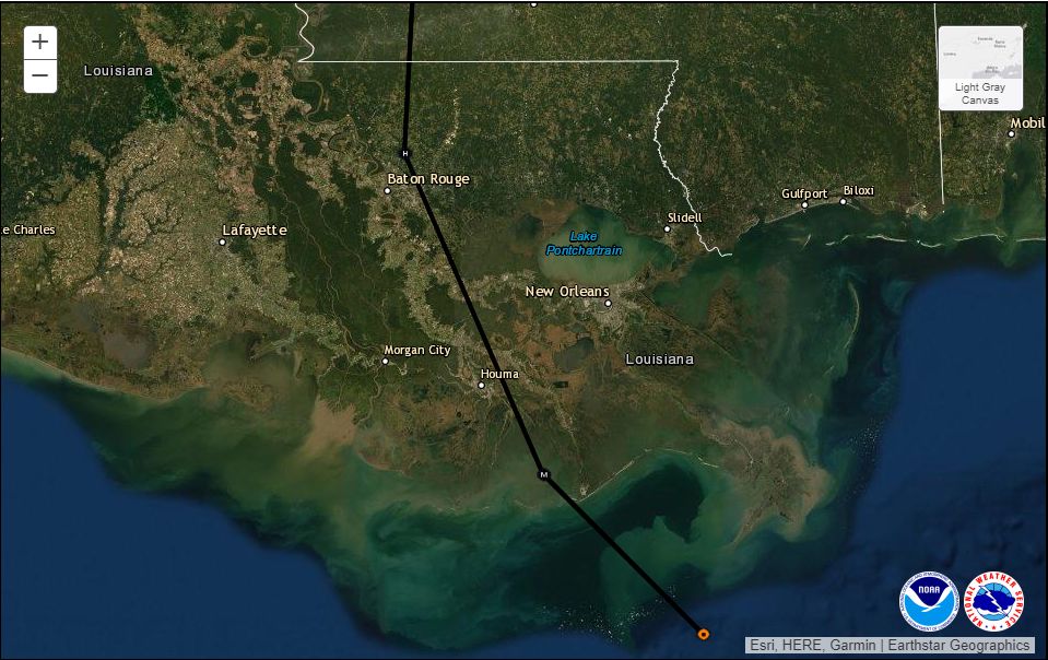
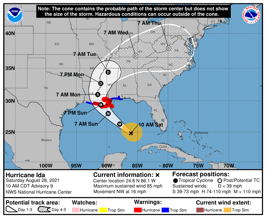
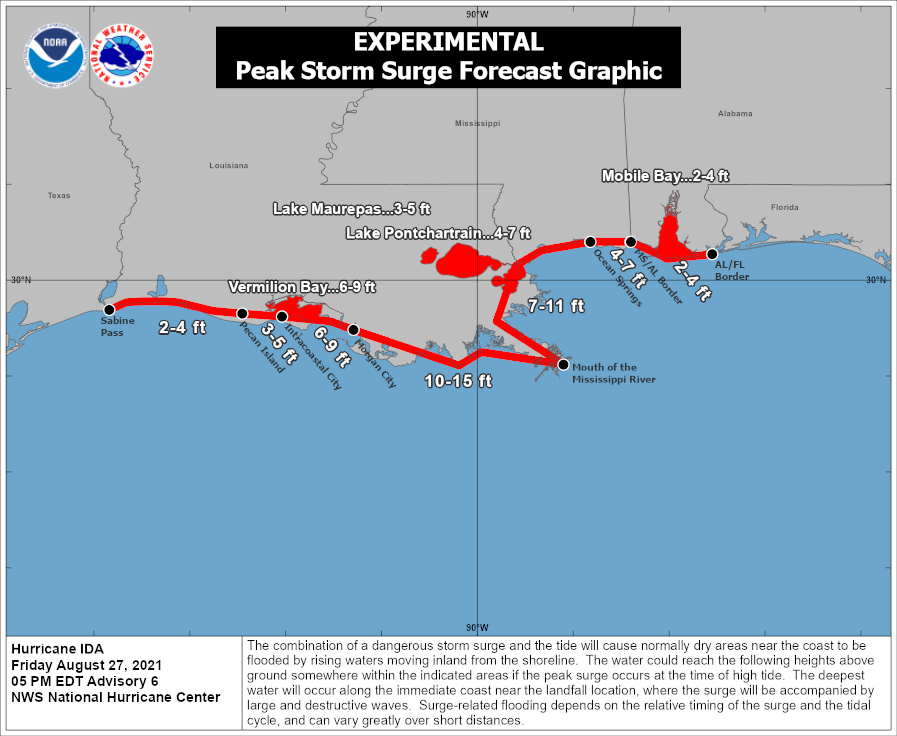
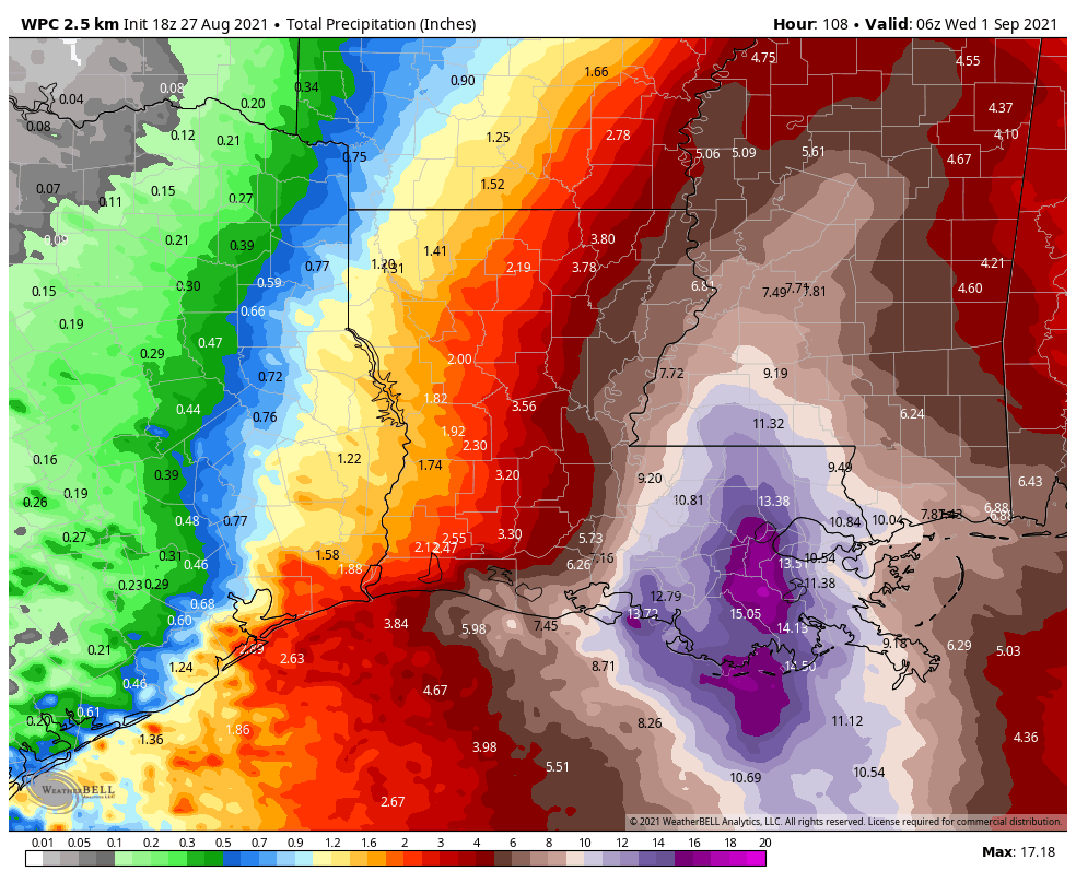
Good morning. Ida has finally weakened into a tropical storm this morning, and is now slowly, at a rate of about 8 mph, moving away from Southern Louisiana. Much of the region is submerged under storm surge and very heavy rainfall. More than 1 million customers in the state, affecting about half of the state’s population, are without power today. Some will be without power for many weeks. Ida, in short, has left a sobering trail of destruction and misery in its wake. We must help our neighbors, and here are some ways to do that right now.
Monday
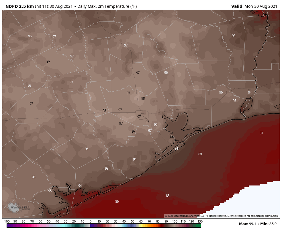
Today will be hot and sunny, with only a slight chance of showers and thunderstorms. Highs will likely reach the upper 90s. As Ida pulls away from Louisiana, winds will be out of the north and northwest locally, at about 5 to 10 mph, and the overall flow will draw warm air into the region. Rain chances will be down to around 10 percent. Overnight lows will be around 80 degrees.
Tuesday
This will be a similar day to Monday, albeit with slightly higher chances of rain showers, perhaps on the order of 20 percent.
Wednesday and Thursday
Low pressure aloft will bring a modest increase to rain chances by the middle of the week, perhaps about 40 percent for areas south of Interstate 10, and less to the north, and this should also cool temperatures down into the mid-90s. Skies should otherwise be mostly sunny with warm and partly cloudy nights.
Friday, Saturday, and Sunday
While the weekend forecast is not yet locked in, the greatest likelihood is that we see hot and sunny weather, with highs in the mid-90s. As some slightly drier air mixes in, overnight lows may drop into the mid-70s. While not “nice” this definitely would be more pleasant than sultry nights around 80 degrees. Overall rain chances look low this weekend, probably below 20 percent each day.
Tropics
With Ida inland, and an inconsequential tropical depression in the open Atlantic Ocean, what else is there for us to worry ourselves about? The primary area to watch is the southern Caribbean Sea where conditions are somewhat favorable for a tropical depression to develop later this week. The National Hurricane Center gives this area a 20 percent chance of development.
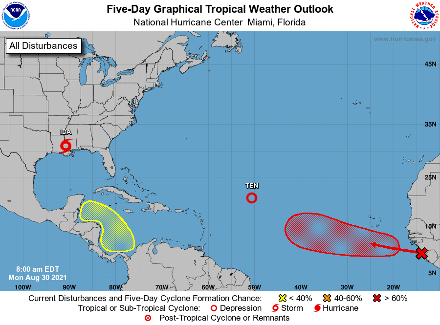
This system is likely to approach Central America or the Yucatan Peninsula later this week, and if it survives interactions with land—which is far from certain—something may eventually move into the Gulf of Mexico. However there is no strong signal in the global models that this will happen, and if it does, there’s little indication it will eventually track toward the upper Texas coast. So while this is something we’re watching, it’s not something we’re particularly concerned about. As for the disturbance moving off of Africa (red X in the map above), it has a high chance of developing but is likely a fish storm that will not bother and landmasses.