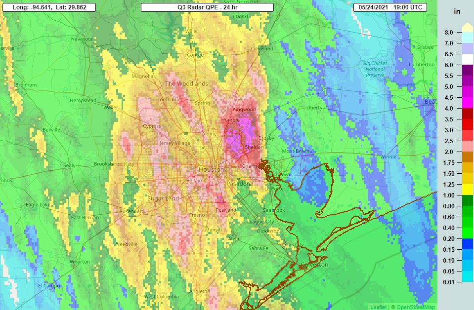
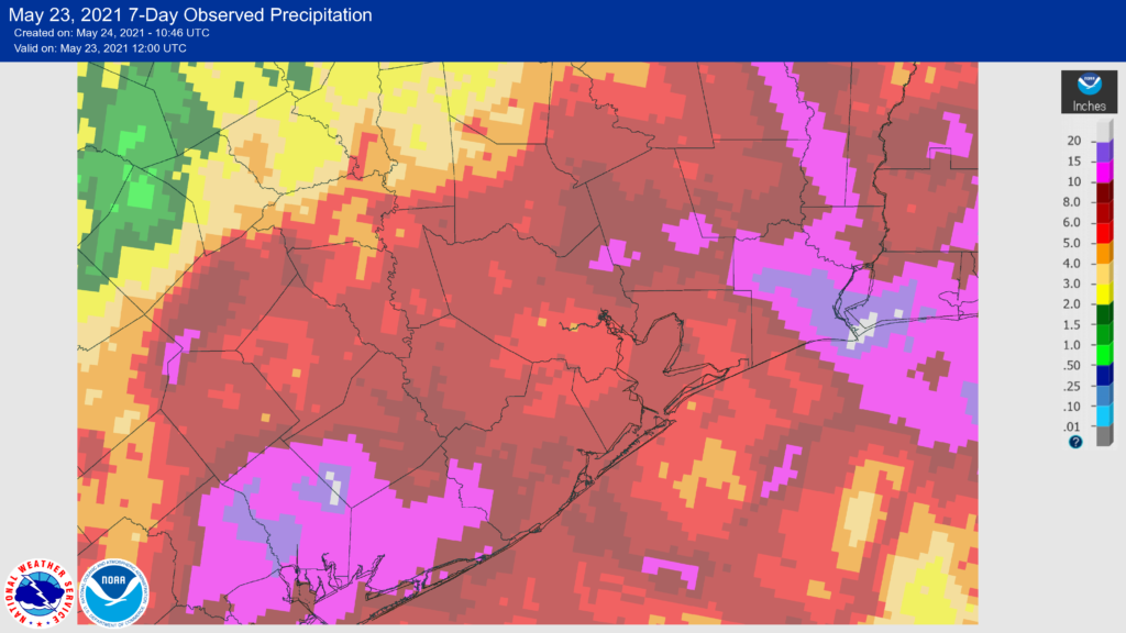
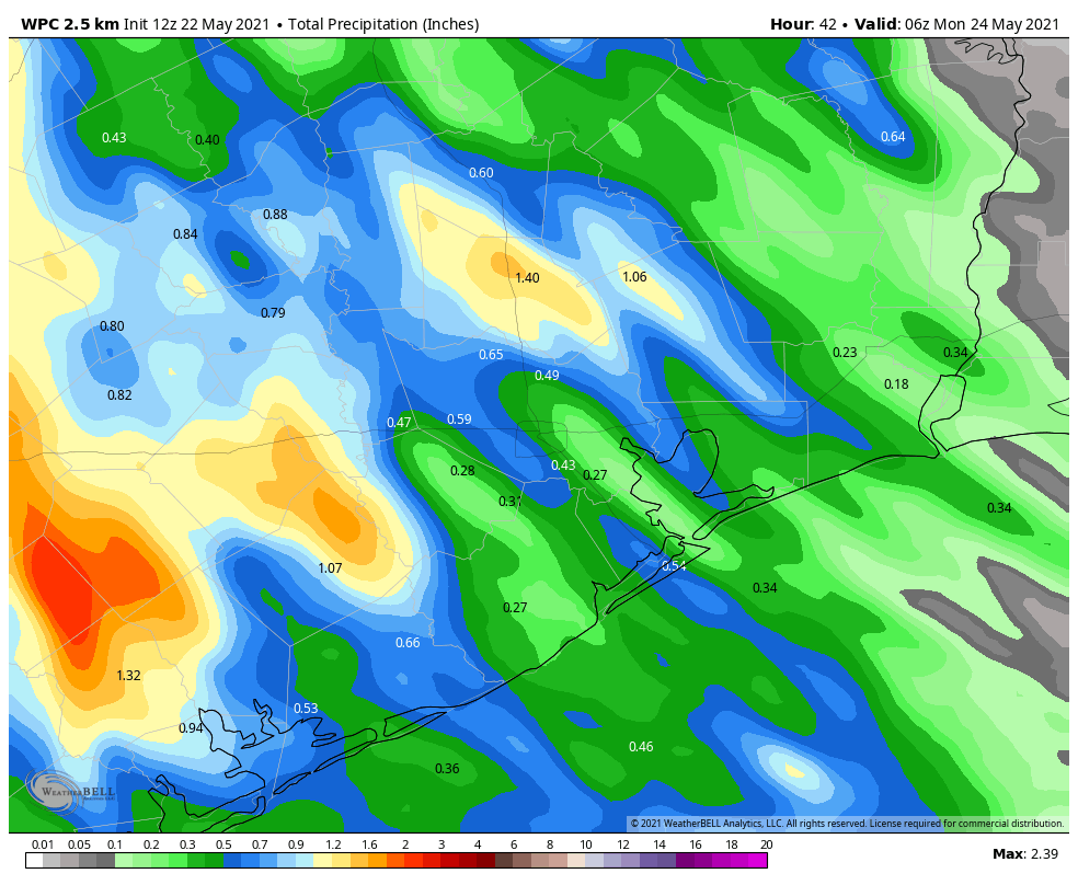
Good morning. Not going to lie, the intensity of storms on Monday surprised me. First, some areas northwest of Houston saw as much as 6 inches of rainfall. Then, early on Monday evening parts of Austin County—only about 60 miles west of Houston—saw about 10 inches in a short period of time. So it’s with more than a little trepidation that I approach the forecast today.
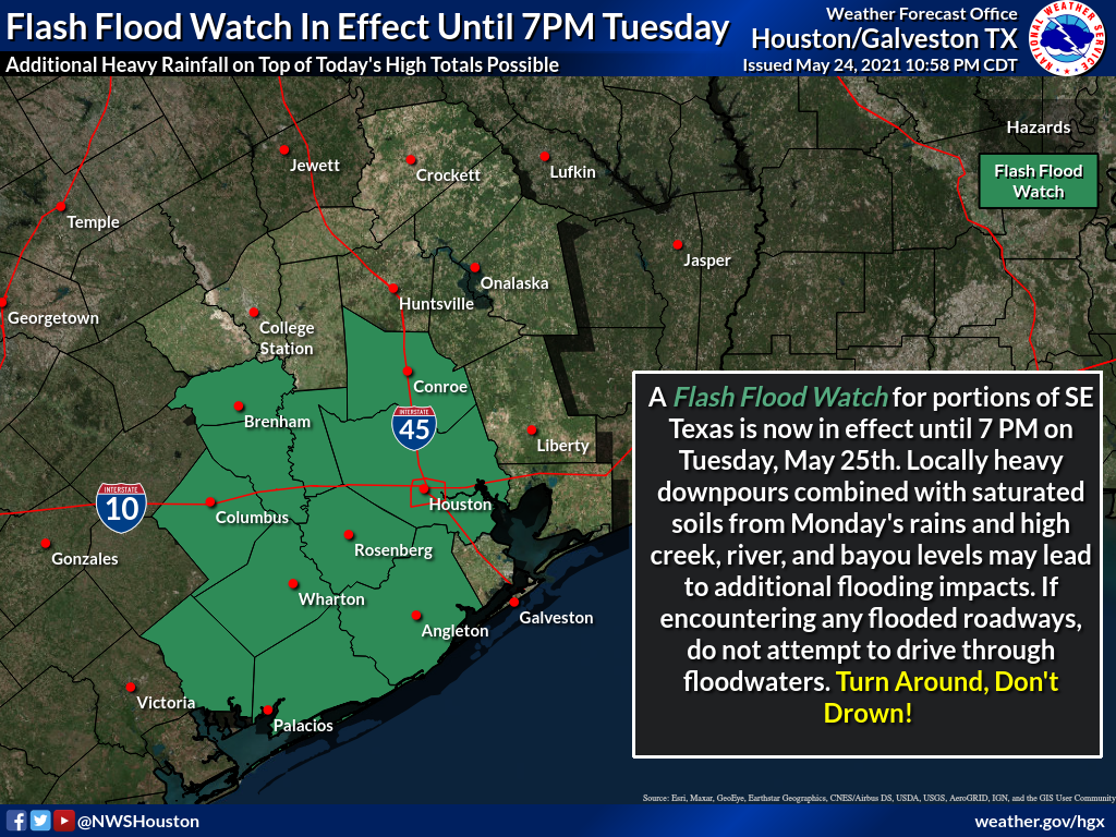
Generally, we should see fairly calm conditions this morning, with storm coverage increasing this afternoon as temperatures warm. A flash flood watch is in effect for central and western parts of our region due to the potential for additional heavy rainfall today.
Tuesday
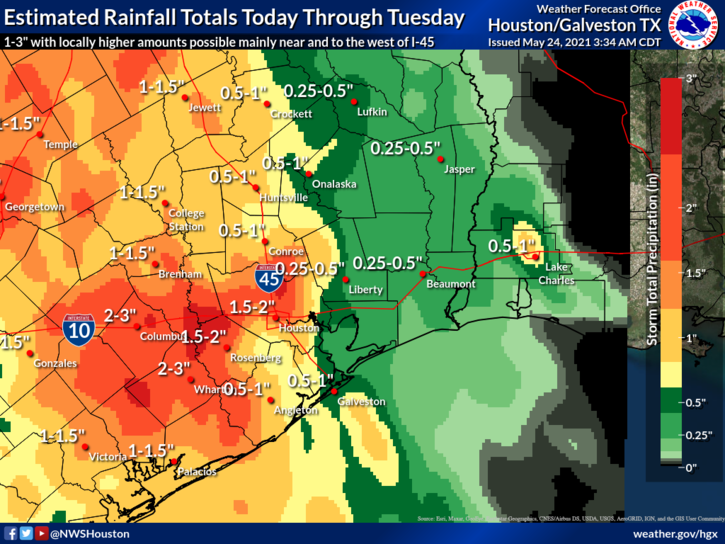
The atmosphere remains plenty moist to support heavy rainfall today, particularly north and west of the Highway 59/Interstate 69 corridor. This includes the particularly hard hit areas of Austin County. In this general area we are likely to see widespread accumulations of 1 to 3 inches today, with higher isolated totals approaching 5 inches. Given the sodden soils well west of Houston, this could cause some problems both on roadways and along swollen creeks. These storms are likely to develop after noon, and wane during the evening as the sun begins to set. Highs will otherwise be about 80 degrees.
Wednesday
Atmospheric moisture levels should begin to fall on Wednesday, and accordingly we expect much less coverage of showers, and less intensity where rain does fall. Overall, perhaps 30 percent of the area will see rain on Wednesday, with highs reaching perhaps the mid-80s. Skies remain partly to mostly cloudy.
Thursday and Friday
As high pressure continues to build over the area, we expect these to be mostly sunny days, with highs in the mid- to upper-80s. This should allow for the region to begin to dry out.
Saturday, Sunday and Memorial Day
Let’s start with the fact that we have questions about the weekend forecast. It will be complicated by an approaching, weak front that appears likely to stall out just north of Houston. Skies will probably start out at least partly cloudy on Saturday, and depending on the movement of the front, areas north of Interstate 10 could see some scattered showers during the afternoon and evening hours. These may even spread across the entire region. Not helpful, I know.
Sunday’s weather will also depend on the front’s position, but there is a better chance for more sunshine on Sunday. Both days should produce highs in the upper 80s. Memorial Day will probably fall on the partly to mostly sunny side of things, but overall confidence is low. Sorry, I know everyone has weekend plans, and would like some certainty.