In brief: Good morning. This is an update for winter-enjoyers. Although temperatures will moderate some this week, we are looking at a sharp incursion of colder air by Saturday, likely the coldest of the season. We also cannot rule out some freezing rain or sleet, although it’s too early to have confidence in such a forecast.
A mild winter … so far
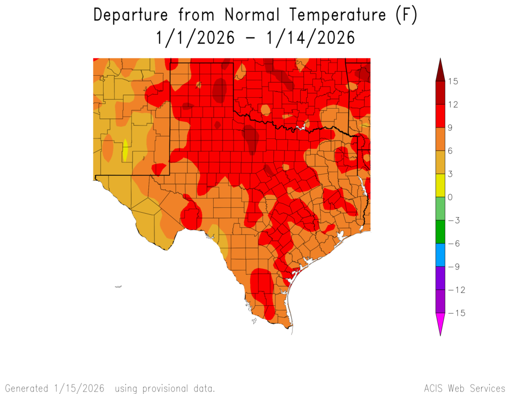
Houston has recorded a handful of freezing temperatures this winter, including a mark of 32 degrees on Sunday morning. But the coldest our air has gotten just been barely below freezing, back on December 15 when the mercury reached 31 degrees at Bush Intercontinental Airport. I say all of that to note that we expect our coldest airmass of the season to push into the region next weekend, and it is possible that widespread parts of Houston will dip into the 20s. We also cannot rule out freezing rain or a wintry mix. All of that to say, after a mild winter to date, things could turn a bit gnarly next weekend. More on what we know, and don’t, below.
Monday
Temperatures are generally in the mid-30s this morning, so it’s chilly once again. However unlike Sunday most of our region is above freezing. We are going to warm up nicely today with mostly sunny skies, allowing highs to reach the mid-60s. Winds will be light, from the southeast this afternoon. Temperatures will only fall into the mid-40s overnight, with increasing cloud cover.
Tuesday
This will be a mild, partly sunny day with highs in the low- to mid-60s. Winds may be a bit gusty, from the east. A weak front will pass into the area, and stall out near the coast. This will set the stage for scattered showers from Tuesday night into Wednesday night. Lows on Tuesday night will drop into the mid-50s.
Wednesday
This will be a gray day, with high temperatures likely peaking in the mid-60s. It will bring our region’s best chance of rain in awhile, with the overall likelihood of precipitation a little higher near the coast where there will be more moisture available. I expect most of the region will probably pick up on the order of 0.25 to 0.75 inch of rain, with some higher isolated totals. All in all this won’t be too impactful, and let’s face it, our coastal areas (raises hand) are pretty desperate for some precipitation. Lows on Wednesday night will drop into the upper 50s.
Thursday and Friday
These look to be warmer and mostly cloudy days, with highs in the vicinity of 70 degrees and lows in the 50s. It won’t feel particularly humid, with dewpoints in the 50s, but the air won’t exactly be dry either. Depending on the timing of the Arctic front mentioned above, temperatures could drop Friday night, or it could be another mild night. Some light showers will be possible ahead of the front on Friday afternoon and evening.
Saturday and Sunday
If the front does not arrive on Friday night, it should do so by Saturday morning. Here’s what we know right now:
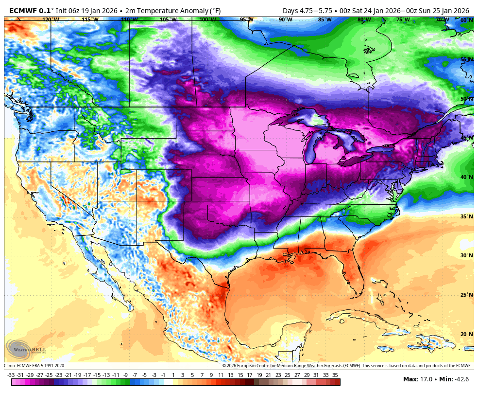
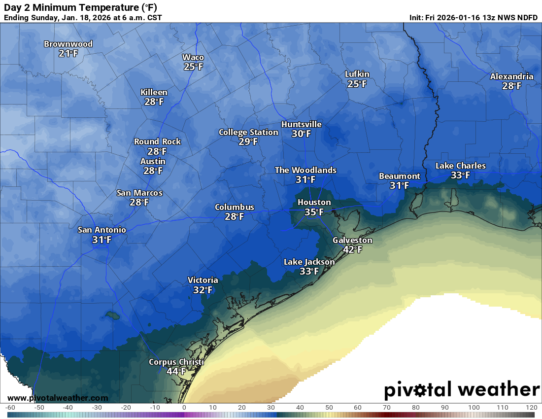
A massive amount of Arctic air is going to spill down into the Midwest and Central United States from Canada, bringing temperatures 30 degrees below normal. Some areas in Wisconsin and Illinois could see temperatures in the -10 degree range, or thereabouts. This air mass will modify as it moves south. and the real question for Texas is whether we see a direct shot of this Arctic air, or a less impactful ‘lobe’ that breaks off from the main body. For now I’m just not sure beyond saying it’s going to get quite cold.
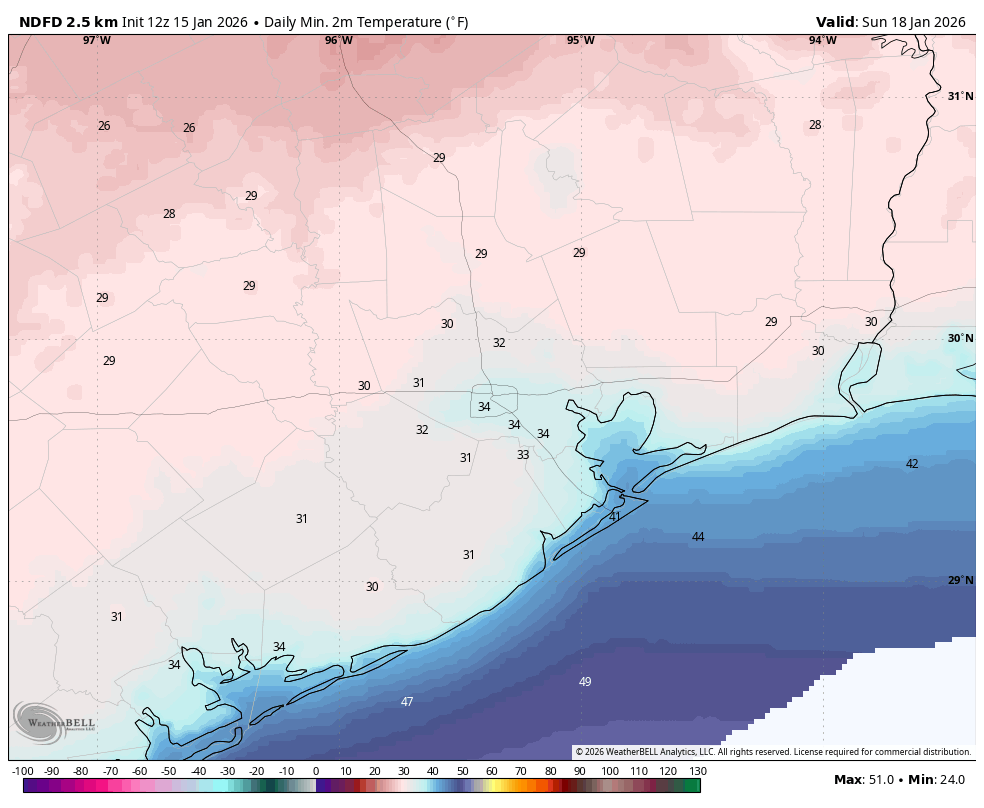
How cold? I expect highs on Saturday in the 50s, dropping to the 40s by Sunday. In terms of lows, I expect a widespread freeze in much of Houston for Saturday and Sunday nights. But still to be determined is whether this a freeze of the variety we have seen to date (i.e. 30 to 32 degrees) or more impactful (mid-20s for much of the metro area). I’m just not sure at this point, but obviously we will be watching things closely all week.
Beyond this we cannot rule out the possible of freezing precipitation this weekend. A chance of showers will linger after the front (we expect mostly cloudy skies this weekend), and some of this precipitation could take the form of sleet of freezing rain depending on air temperatures. Snow seems unlikely, but we’re not ruling anything out at this point. Anyway, sleet, and especially freezing rain, would cause mobility impacts this weekend, and possibly into Monday morning. We don’t have any details yet, and we cannot predict with any confidence whether there will be a winter storm. But it’s not out of the question.
Next week
Temperatures will moderate some next week, but we are still probably looking at highs in the 50s and lows in the 30s or so. Hello winter!