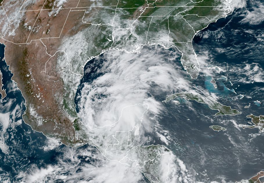
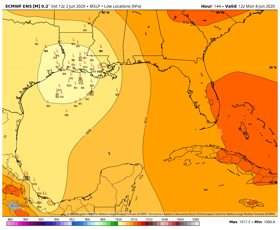
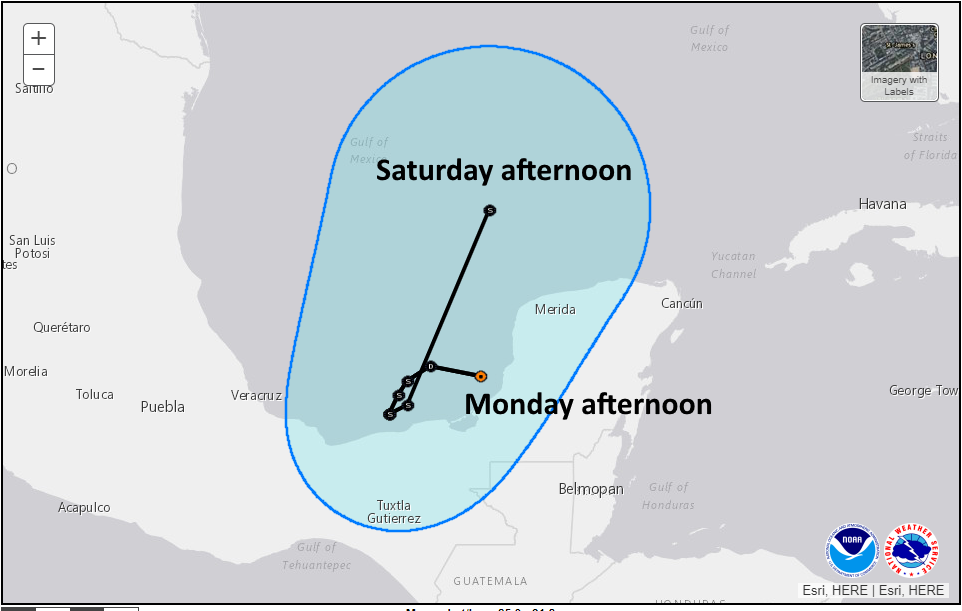
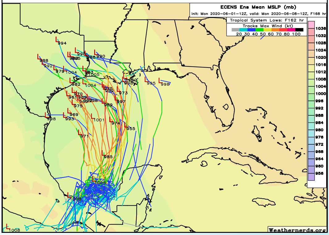
Good morning. Houston is seeing warm and humid conditions this week, as one would expect in June. However, we still have a ways to go in terms of summertime heat, and the region should reach the mid-90s by Saturday. The question remains about what happens after that, and it almost entirely depends on what happens with Tropical Storm Cristobal. At the moment, it still appears as though the storm and the bulk of its effects will probably stay east of Houston, but we’re far from being able to make a definitive call on that.
Wednesday
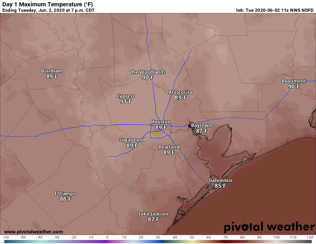
Today should produce the region’s best chance of showers and thunderstorms until at least Sunday. A combination of daytime heating, ample moisture in the atmosphere, and only moderate high pressure should allow for some storms to fire up this afternoon before fading this evening. High resolution models offer a mixed bag of solutions, bit given our recent pattern I’m fairly bullish on at least some moderately strong storms firing up closer to the coast and pushing inland later today. Areal coverage of these storms will probably be in the 30 to 50 percent range, so not everyone is going to get wet. Otherwise, expect partly sunny skies with highs of about 90 degrees.
Thursday, Friday, and Saturday
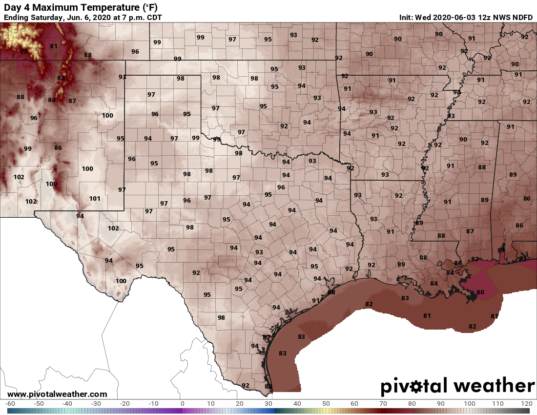
As high pressure settles into the area we should see a warming trend, with partly to mostly sunny skies through Saturday, and highs rising into the mid-90s. Under such a pattern we normally would expect only slight afternoon rain chances along the sea breeze.