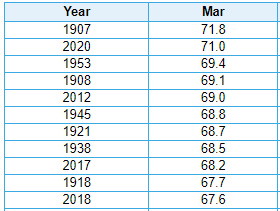
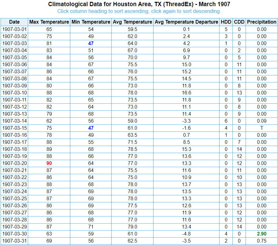
Well Houston, you were promised two days of beautiful, spring-like weather. Now that you’ve had them we’re heading back to a more moist, warm period through this weekend and most of next week. Let’s put it this way—we’re unlikely to see the 50s in Houston again until at least the weekend of April 11th. The bigger news, for now, is the likelihood of a wet weekend.
Thursday
Temperatures are starting out in the 60s this morning, and should warm into the mid- to upper-70s. Highs will depend in part on cloud cover, and if you see a few slivers of sunshine this afternoon it will make things a little bit warmer. Scattered light to moderate rain showers will be possible this afternoon and evening, especially north of Interstate 10, but we don’t expect anything too impactful. Winds will be mostly light, out of the southeast at 10 mph or less. Low temperatures tonight will probably fall down only to around 70 for most.
Friday
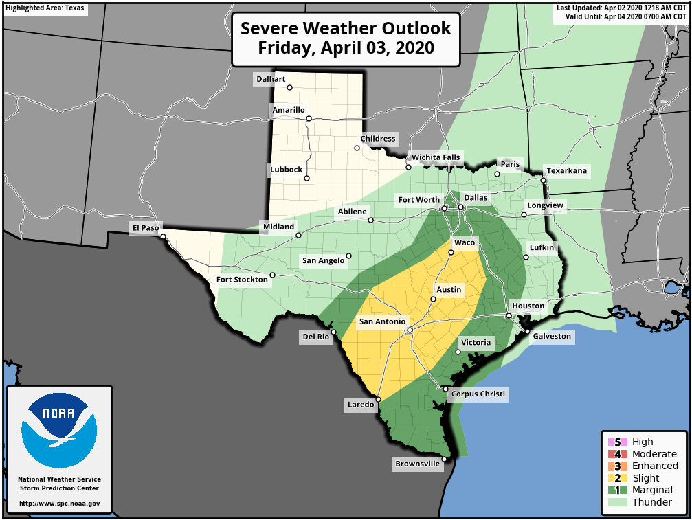
This will be another day like Thursday, albeit with a little bit better rain chances, and temperatures perhaps rising a little closer to 80 degrees during the day time. Friday night will be warm again, with a modest chance of thunderstorms, again with the best chances north and west of downtown Houston. The strongest thunderstorms should remain to the west of Harris County, near a slow-moving cold front as shown in NOAA’s severe weather outlook above.