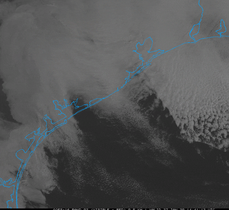
On Monday the state climatologist, John Nielsen-Gammon, called my attention to the visible satellite image page for the upper Texas coast. I’ve attached a snippet below, showing the period roughly from 8am to 1pm on Monday. If you look just northwest of Galveston Bay you can see the cooling stack plumes show up from some of the largest refineries in the Ship Channel. These facilities are leaving bow wakes in the low-stratus cloud layer.
So what is causing this? The cause is weather-related, John speculates it is likely a combination of the following factors:
- A well-defined temperature inversion at the top of the low cloud deck.
- Weak stability and strong wind shear above the inversion that would enable waves to be trapped horizontally on the inversion rather than propagating upward and away.
- A sufficiently shallow stratus layer that a bit of downward motion would be enough to temporarily clear out the clouds.
- A sufficiently large volume of heated air rising from the plants to produce strong enough wakes to be seen.
In any case, the weather on the Texas coast is rarely dull! Now, on to the forecast.
Tuesday
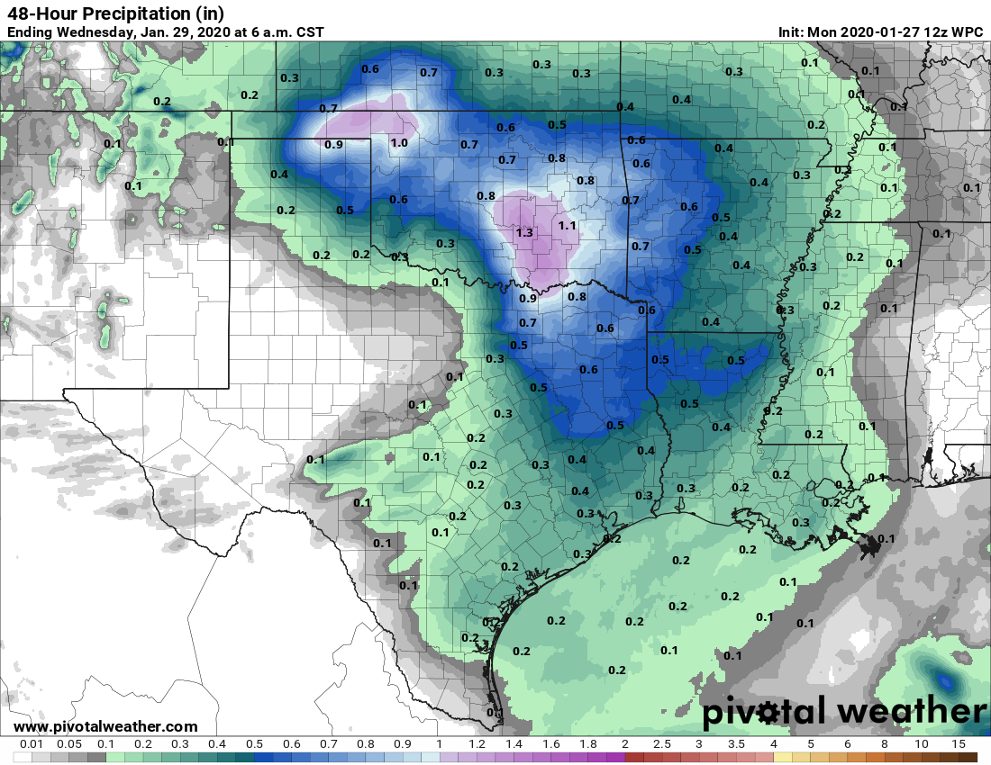
A diffuse mass of mostly light to moderate rain showers will move slowly from west to east across the Houston area today. The showers, with possibly a few embedded, stronger thunderstorms, will probably persist through most of the daytime hours. Most parts of the region should see between 0.25 and 0.5 inches of rain throughout the day. The combination of clouds and rain will likely limit daytime highs to the upper 60s for most of the region. After sunset, a cold front will sweep through Houston to help dry the region out. Conditions tonight will be breezy and colder, dropping into the 40s.