A low-pressure center has moved from Mexico into the southern Gulf of Mexico, and the National Hurricane Center has determined that Tropical Depression Three has formed. It likely will become Tropical Storm Cristobal within the next 12 to 24 hours. This doesn’t really change much from earlier, as we expected development when the center got over the warm Bay of Campeche. And the most important message I want to leave you with today is that we are a long way from knowing where this system is going, and what it’s going to do.
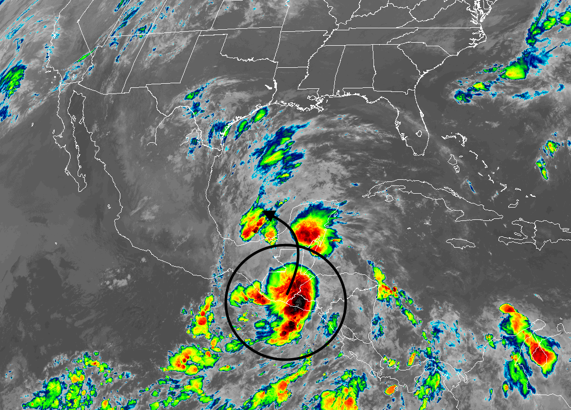
This image should help explain why:
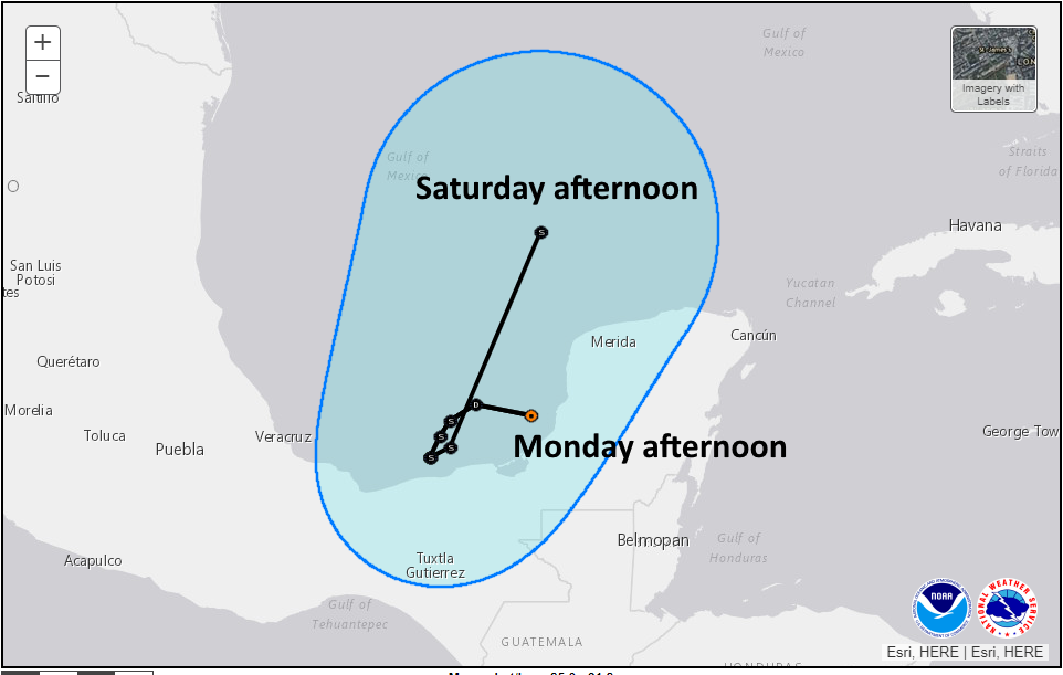
In this graphic I have zoomed in on the National Hurricane Center’s 4pm CT Monday five-day track forecast for the depression. Note that it is expected to spend the next four days wobbling around the Southern Gulf of Mexico. It may even go inland and die out, allowing another center to re-form to the north. One thing is sure, regions of Southern Mexico around the Bay of Campeche are going to get drenched.
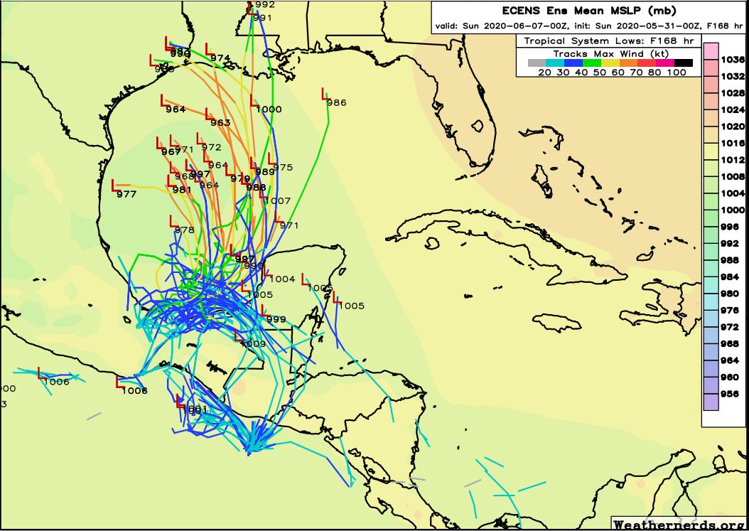
The forecast models are really struggling with what happens this week as the storm swirls around the Bay of Campeche. Because of this, it is hard to have much confidence in what happens after the next four days. However, the most likely outcome is that some kind of tropical system will eventually move northward toward the Central Gulf of Mexico by Friday or Saturday. Unfortunately, it’s difficult to know how strong it will be, and where it will go thereafter.
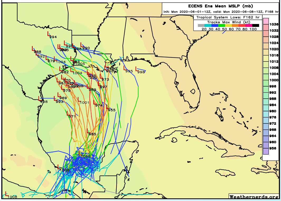
Based upon the ensemble modeling shown above, Texas and Louisiana remain the most likely destinations. Something may come ashore Sunday-ish, but we just can’t say whether it will take the form of diffuse showers, an organized tropical storm (most likely), or possibly even a hurricane. Looking ahead to the weekend we are so far into the thickets of uncertainty with this depression, given its wobbly nature over the next few days, that it’s not really possible to say more than that. Is heavy rain possible this weekend? Yes. Should we be overly concerned about it yet? Certainly not yet. Could a hurricane hit somewhere along Texas this weekend? Yes. Are the overall chances high, as in 50 percent or higher? As of now, at least, the answer is definitely no. Chances are significantly lower than that.
We’ll have more tomorrow, just don’t expect much more clarity on the situation for a day or two at least. We’re still definitely in wait-and-see mode with this storm.