Temperatures have only fallen down to around 60 degrees for most of Houston this morning, and we’ll have one more warmer day today before cooler weather returns with a front tonight, and lasts for the rest of this week.
Tuesday
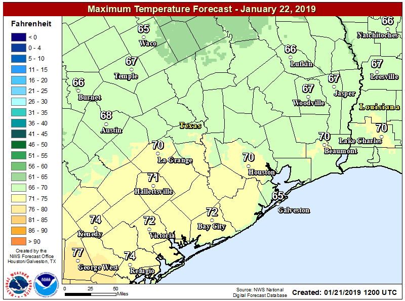
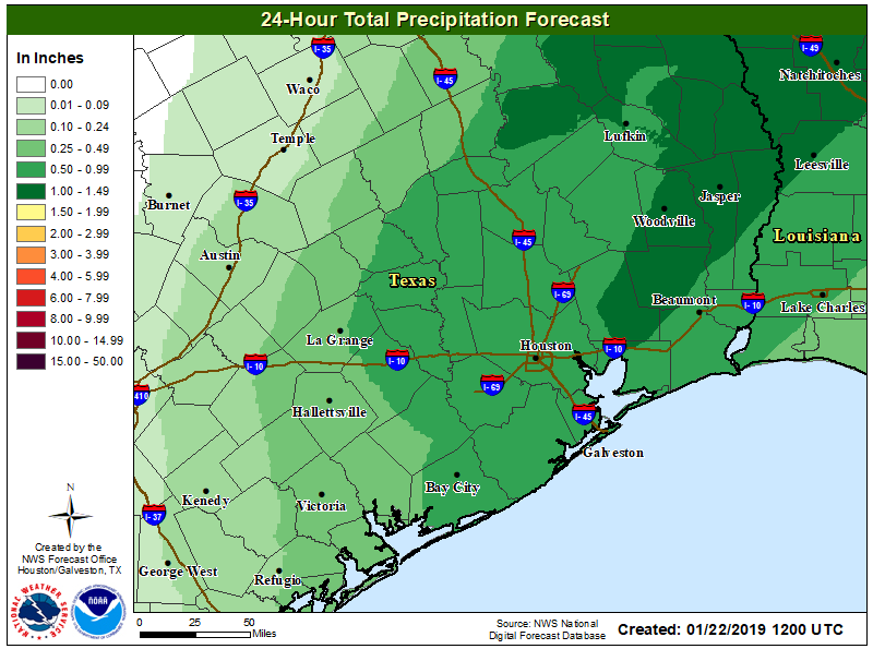
Highs today should generally get up to around 70 degrees, with mostly cloudy skies keeping them from getting much higher. Winds will be blowing out of the south today, increasing moisture levels ahead of a cold front tonight. Although scattered showers will be possible during the daytime, by far the best chance of rain will come tonight with a line of precipitation along the front. The front should reach areas northwest of Houston between 9pm and midnight, roll through Houston sometime between 11am and 2am, and should be off the coast by or before sunrise Wednesday. At this time, accumulations of 0.5 to 1.0 inch of rainfall are likely.
It should be noted that some models have been hinting at the possibility of snow or sleet for areas northwest of Houston, such as the Brazos Valley, with this system. However it seems most probable that the colder air needed for wintry precipitation will lag far enough behind the precipitation to preclude this. Can’t rule it out, but it seems doubtful. The chance of seeing anything like this in Houston itself is pretty near zero.