Editors note: This is one of our very occasional sponsored posts from Reliant, which brings Space City Weather to you free of charge, with no intrusive advertising. Thank you for reading.
Over the last month, I’ve been testing a Google Home Hub from Reliant—this is one of those “smart” devices that you’ve probably seen a commercial for on television. A Google Home Hub is essentially a voice-activated smart tablet that allows you to control other “smart” devices in your home. We put ours in the kitchen, next to the refrigerator. (This is, after all the hub of our home). A little bit bigger than a post card, the device is small enough to be inconspicuous, but large enough to be useful.
Reliant has partnered with Google to allow customers easy access to their electricity usage. Finding out your daily electricity consumption is as easy as saying, “Ok Google, ask Reliant how much electricity am I using.” From there you can find billing information, pay your bill, track usage, and look up other details about your account. This is something I’m looking forward to using this summer when electricity usage rises along with temperatures. There are more features, too. You can use the Google Home Hub to adjust a Nest thermostat, or see who is ringing the front door bell.
For our family, at least, the real killer application is having a tablet in the kitchen when cooking. Need to convert tablespoons into cups? Easy. Need to find a substitute for an ingredient? That’s pretty easy too. It’s been fun to find new recipes on the device. How-to videos are also useful for learning new tricks in the kitchen—I never knew the difference between slicing, mincing, and Julienne cuts. (I kind of do now.)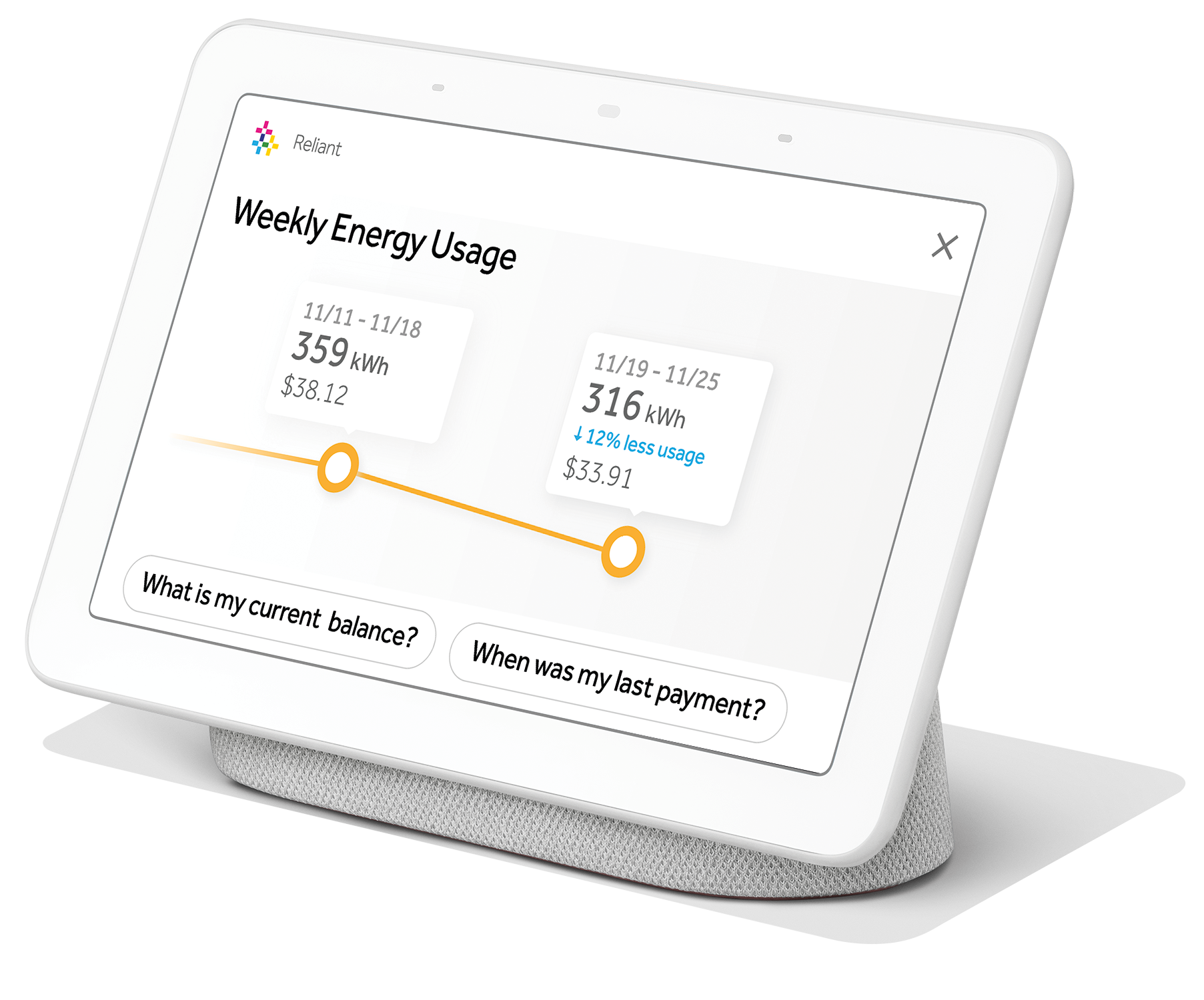
As a parent, I’m increasingly concerned about the number of screens in our home. But so far, this one doesn’t seem to have taken time away from interacting with our kids. I’d have to say it’s increased our time together because we use the device as an excuse to cook more. Don’t know if that will last, but it’s been fun so far. And if you’re worried about privacy, it’s easy to turn the mic off manually, so the device isn’t listening all the time.
Regardless, we’ve found the Google Home Hub to be a convenient smart home device with a ton of possibilities—everything from checking what your commute looks like or asking when the new season of Game of Thrones begins—all powered by just your voice. And it’s pretty awesome that our hometown electricity provider has a partnership with Google to provide more insight and access to our electricity usage, making it easier for us to take control of our bills. Reliant tells me they’re the first energy company in the country to create visual displays that provide personalized energy information—pretty impressive if you ask me. If you’d like a Google Home Hub, Reliant is offering one right now as part of a bundle with their Truly Free Weekends plan. You can learn more about that here.