Good evening all. We wanted to give you an evening update on the incoming rain event for Wednesday. Truthfully, not much has changed from Eric’s synopsis and outlook this morning. But we want to freshen up some thoughts around timing, amounts, severe weather, and so forth.
Quick Summary
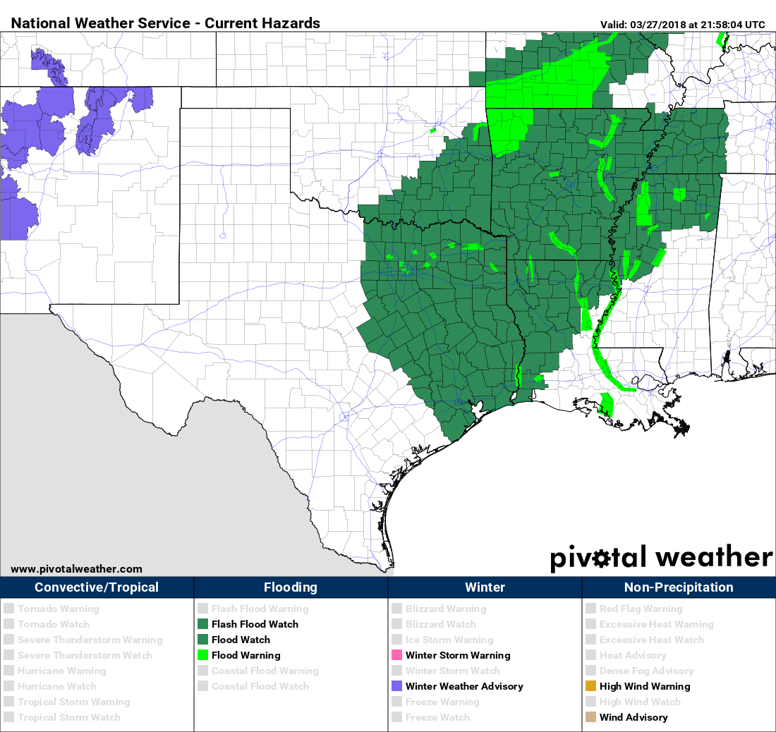
- Flash Flood Watch begins at 1 AM Wednesday north & west of Houston and 7 AM in Houston and points south & east.
- Heavier rains stay north & west of Houston later tonight and Wednesday morning. Isolated strong to severe storms are possible tomorrow afternoon, especially along and southeast of US-59/I-69. Widespread heavy rain and storms moves through with the front later Wednesday evening.
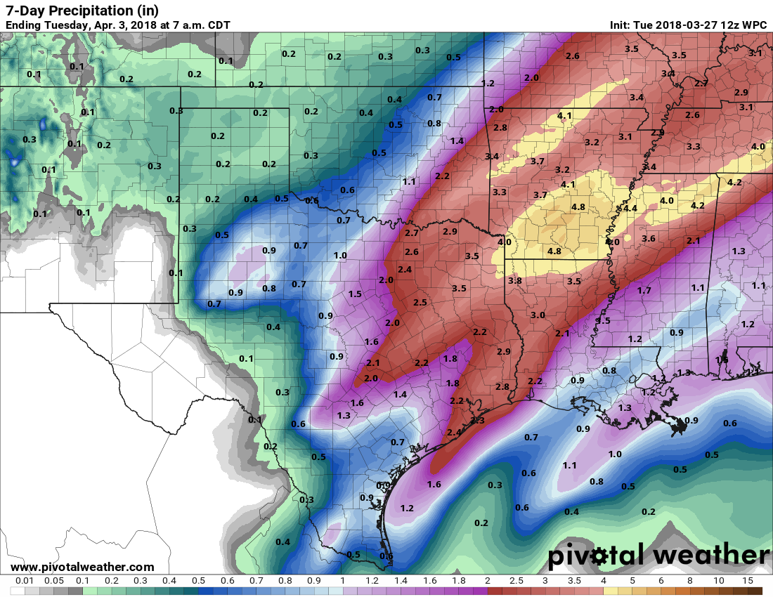
- We still believe 1-3″ of rain on average will fall with a few pockets of 3-5″ or a little more not out of the question.
- Street flooding is the primary form of flooding we are concerning ourselves with. Though bayous and creeks could rise, they should be able to handle tomorrow’s rains.
Flash Flood Watch
The National Weather Service has posted a Flash Flood Watch for almost the entire region (Edit to add: As of 8 PM, only Jackson & Matagorda Counties are excluded from the watch). The watch begins at 1 AM for areas north and west of Houston and at 7 AM for Houston and points south and east.
Timing
This is the one that I think might throw some folks for a loop. Much of Wednesday in Houston will actually be a lot like today. We do expect heavier rains in the morning northwest of the Houston metro area (up toward College Station, perhaps drifting as far south and east as Sealy through The Woodlands, which is why the flash flood watch begins at 1 AM there and not in Houston). But isolated showers and maybe a downpour with heavier rain well northwest should be the M.O. through early afternoon Wednesday.
We then have two parts to the stormy weather show. Part one is from early afternoon through early evening, when we’ll watch for scattered strong to severe thunderstorms. Not everyone will see rain, but if you do, it could be heavy. More on the severe weather threat below. Part two will be the main event tomorrow night. The cold front will be ushered slowly southeast from about 10 PM through 3-4 AM Thursday by a vigorous upper level disturbance. Look for the majority of tomorrow’s rain to fall from early evening into the early overnight.