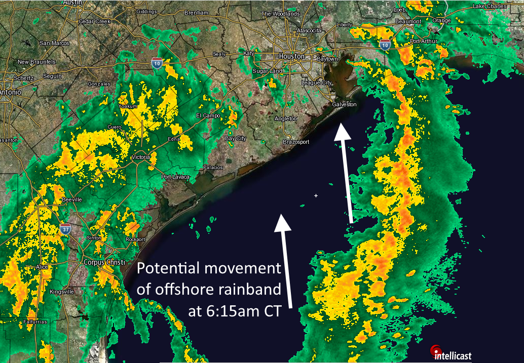
We have been talking about a potential flooding threat for Houston for quite awhile, and those of us along the upper Texas coast can finally begin to contemplate putting this event in the rear view mirror. Overall, these rains turned out to be pretty much as expected for the Houston area—with most of the region getting 2 to 5 inches of rainfall over the last several days.
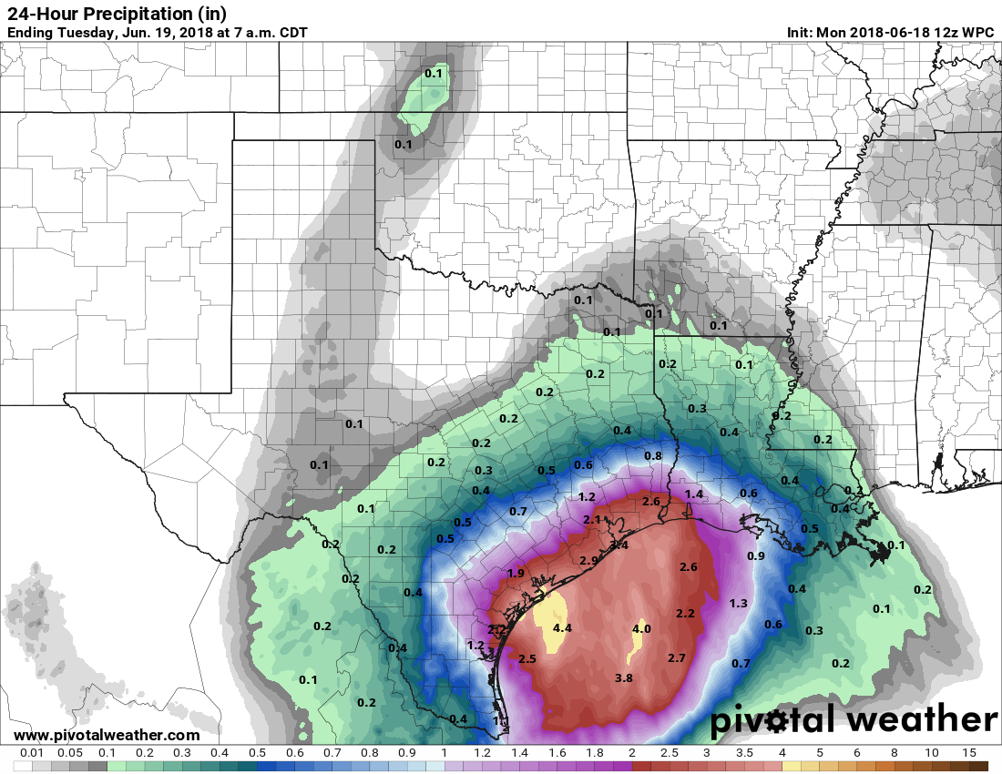
However, Houston and Galveston represented a relative calm in the storm. Multiple parts of the Texas coast, such as the Rio Grande Valley, Corpus Christi and Port Arthur, received 12 inches or more of rainfall from a tropical disturbance that moved into Texas this week. The following map of estimated rain totals over the last three days (which you can click to enlarge) shows this. Truthfully, we anticipated the greater rainfall totals in Corpus Christi, but the Beaumont and Port Arthur-area rainfall surprised us. That bullseye could just as easily been Houston.

Wednesday
The atmosphere remains very moist over the region, but the axis of heaviest rainfall has moved off to the southwest, from Brownsville, to Corpus Christi to Victoria. The National Weather Service has retained a Flash Flood Watch for Jackson, Wharton, Matagorda, and Colorado counties, but removed the rest of the Houston metro area from these watches.