We’ll dive into the forecast for the Fourth of July in a moment. Houston has been plagued by July and August-like heat often since May. Now that we’re in July, the good news is that, at least for a short time, we will reverse course a bit. It will still be hot, but it will actually feel more like May or June than July.
Today
Off the bat, I think today will be mostly trouble-free. Again, if your plans take you east of Houston toward Louisiana, you’ll likely run into showers and storms a good bit of the way beyond Beaumont. Here in Houston, it will be partly to mostly sunny through early afternoon, though clouds should increase later in the day. High temperatures will surge back to the mid-90s once more. I wouldn’t rule out scattered showers or storms later this afternoon or evening for places primarily east of I-45.
Tonight
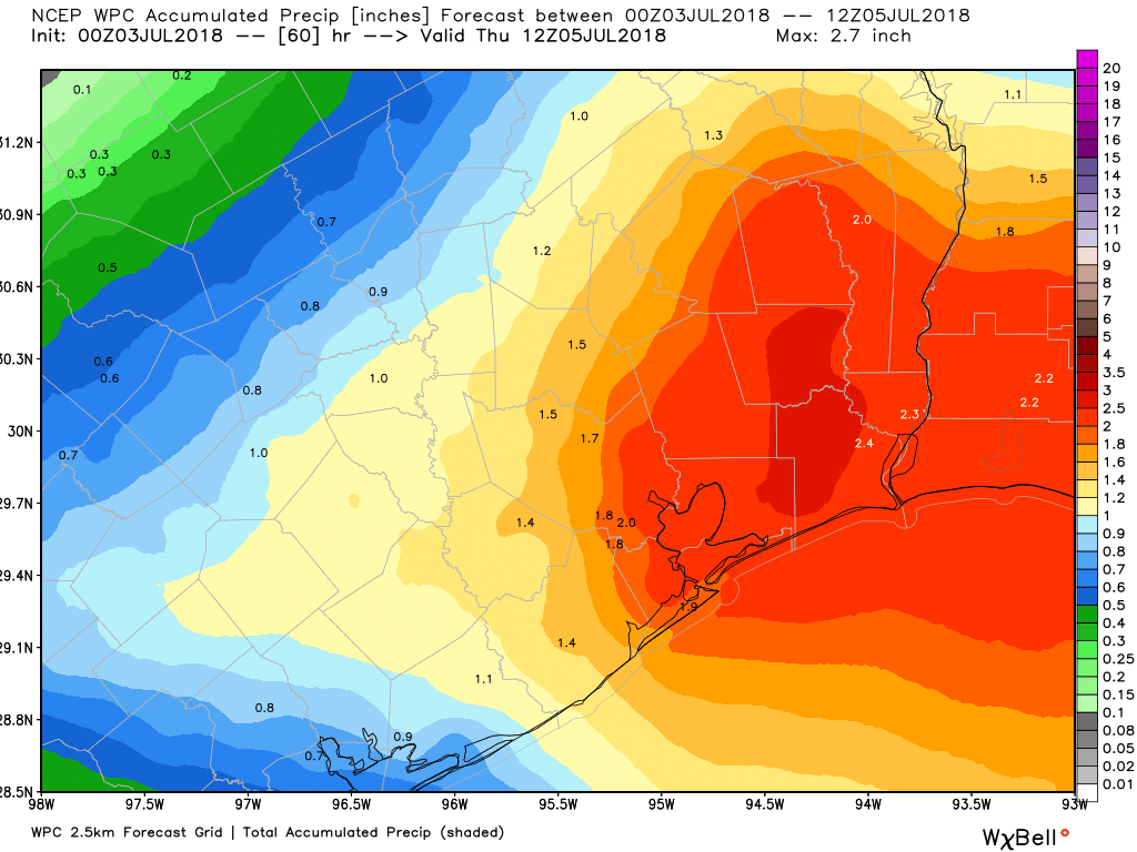
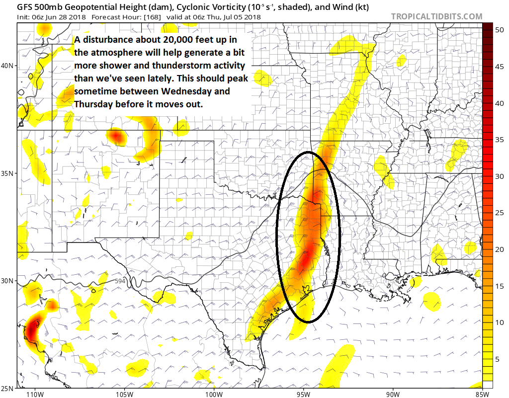
Our upper disturbance will approach the area later tonight. Ongoing showers and storms in Louisiana may try to hold together as they move into Texas late. Our weather models are somewhat divided on solutions overnight tonight. Possibilities across the Houston area range from “mostly nothing” to “you’re probably going to be roused from slumber at 5 AM because of thunder.” Weather models generally handle these scenarios with mixed results, so there’s a healthy degree of uncertainty here. The radar isn’t exactly lit up in Louisiana this morning, so perhaps this suggests we will need the sun to come up before we get much activity.
But when I look at the “big picture,” meteorologically, I see a strong disturbance approaching overnight. To me, this argues that showers and storms will become more and more likely as the night goes on.
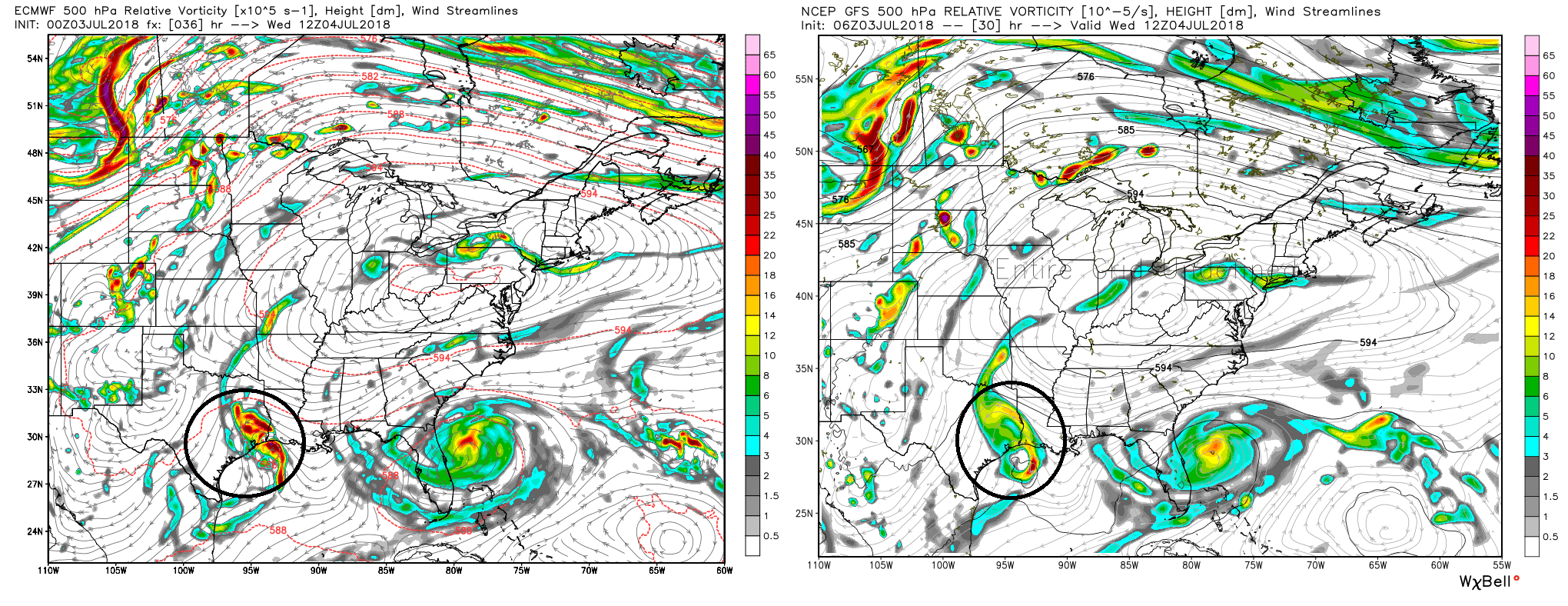
I would not at all be shocked to see the “roused from slumber” solution win out for some of us. If storms do keep going overnight, it’s not a lock that the entire area would be impacted by them.
So I’ll go with this bottom line tonight: Scattered showers and storms become increasingly likely as the night goes on, with highest odds east of I-45. Expect low temperatures to bottom out in the mid- to upper-70s where it doesn’t rain, and mid-70s where it does.