Good morning. We hope everyone has a safe and enjoyable New Year’s Eve today and tonight. There have been a lot of questions about how cold it’s going to get, whether it’s going to snow or ice and what to expect over the next few days. So, we’ll set out to answer those questions for you this morning!
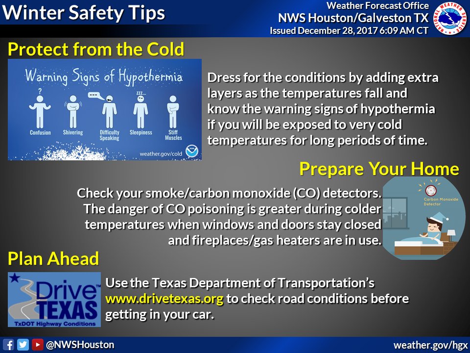
Right off the top, we do expect hard freeze type conditions in most of the area at multiple points over the next several days. If you need tips or advice on how to prepare for cold weather, here’s some info from the city of Houston. I grew up in the Northeast, where we’d laugh about getting worked up about low temperatures in the low or mid-20s. Turns out, cold of that level can indeed be quite damaging here. If you’re new to the area, I can tell you from experience, it’s smart to go through the checklist and do what you can.
Today
It’s a gray, drizzly morning, and that probably won’t change a ton as the day goes on. We may see a bit less drizzle later this afternoon or evening. Temperatures today aren’t going to be any warmer than they are right now. We’ll stay steady in the mid or upper-40s, slowly dropping back toward evening. Upper-30s arrive in the Brazos Valley by late afternoon. Winds will gradually increase through the day today too. Expect gusts of 20-25 mph today.
But bottom line here: No travel issues are expected during the day in Houston. If you’re headed north, there are icy spots reported west of I-35 and north of I-20, mainly in the Panhandle and up toward the Red River. If you are traveling out of Houston today, I’d strongly suggest you check DriveTexas.org for the latest.
Tonight
Winds will continue to howl and temperatures will continue to drop. By Midnight, temperatures in the city of Houston will likely be down to about 34-36° north of I-10 and 36-38° south. Up toward College Station, it’ll be at or below freezing by Midnight in all likelihood. Same goes for areas around Conroe or Huntsville. Some wet roads may have patchy black ice on them, so if you will be out returning from holiday festivities or commuting late, use extra caution along and north of Hwy-105. In and around the city of Houston, we do not expect any travel issues even after midnight.
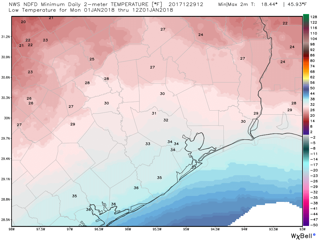
Overnight, it gets colder. Expect low temperatures on Monday morning around 30° in the city of Houston proper and near freezing in Galveston. North of Houston, it gets more into hard freeze territory, and indeed Hard Freeze Warnings are posted for Liberty, Montgomery, Walker, Grimes, and San Jacinto Counties tonight. We should see lows in the upper-20s in The Woodlands and mid-20s in Conroe. Further north, we could do low-20s in spots in the Brazos Valley or up toward Huntsville. Same goes for East Texas north of Beaumont.
In addition, we’ll still have some wind, so expect wind chills down to around 15° in Houston and colder in spots north of Houston. Take extra steps to secure any coverings for sensitive plants as well to ensure you can lock in as much ground warmth as possible. If you’re heading out tomorrow morning, bundle up.
(Space City Weather is brought to you this month by the Law Office of Murray Newman)