Rinse, repeat cycle in Southeast Texas

We are firmly in what I like to call a rinse and repeat cycle here in Houston. Showers and storms have been resilient much of this week, and with that in mind, I’d expect we see another round of storms today.

While not unprecedented, our current “cool” streak continues to lengthen. Yesterday marked five straight days below 90°, which hasn’t happened within August since 2001. If we manage to avoid 90° again today, it will be the first time in 20 years that we’ve accomplished six in a row in August.

Today

Radar is quiet this morning, with just a couple showers at the coast, perhaps even fewer than yesterday. Similar to Thursday though, with the sea breeze spreading inland from late morning into early afternoon, showers and storms should fire up over a good chunk of the area. We may see locally heavy rain as this happens. Also like yesterday, we could see locally high water on some area streets, especially those typically prone to flooding. It shouldn’t take a lot of rain to accomplish this. Storms will keep moving though and it shouldn’t rain in any one place for too terribly long. All in all, similar to Thursday, but perhaps a bit less coverage/intensity than we saw yesterday.

Forecast radar from the HRRR today shows scattered afternoon showers  & storms, though perhaps a bit less coverage than we saw Thursday. (Weather Bell)
Forecast radar from the HRRR today shows scattered afternoon showers & storms, though perhaps a bit less coverage than we saw Thursday. (Weather Bell)

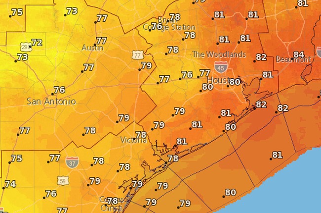
Temperatures today will be contingent on how quickly the rain arrives. We still managed 88° yesterday despite a good deal of cloud cover in the morning, but with rain arriving  just after Noon, temperatures were cut down. So upper 80s to around 90° is reasonable for today. If rain arrives a little later, we could break our 90-free streak today.

See full post

Rain risk not quite done for Houston

With rain and storms daily, Houston has held up pretty well, particularly considering the terrible situation in Louisiana. Yes, there have been minor bouts of flooding in parts of the area, but the rain has moved quickly enough and sporadically enough for us to escape major problems to this point. And for the first morning this week, we don’t have any Flash Flood Watches in the area to tell you about.

7 day rainfall totals show a widespread 3-5", areas of 5-8", and a max near Cypress of over 1 foot! (Harris County Flood Control)
7 day rainfall totals show a widespread 3-5″, areas of 5-8″, and maxes near Crosby of over 10″ and near Cypress of over 1 foot! (Harris County Flood Control)

We’re beginning to see this pattern finally erode a bit.

Today & Friday

The transition from this widespread daily thunderstorm pattern to something we’re more familiar with in summer in summer is underway: Morning coastal showers spreading inland with the sea breeze off the Gulf in the afternoon. You can see a radar forecast for today below:

HRRR model forecast radar for today shows storms spreading inland during the afternoon. (Weather Bell)

Basically, I would expect gradually fewer showers today and tomorrow compared to how the earlier part of this week has gone. That said, we’re still probably looking at a slightly stormier than usual pattern for August, just not as busy as it has been for much of the week.

See full post

After the big sizzle, Houston enjoys some cooler weather for a few days

Through the first 12 days of this month Houston had an average high temperature of 99 degrees, including five consecutive days with highs of 100 degrees or above. Overnight lows were sticky, too. We all felt the sizzle. But as high pressure moved out, and clouds and rain moved in, daytime temperatures have plummeted. During the last three days Houston has enjoyed high temperatures averaging 85.5 degrees, and morning lows of 75 degrees.

Of course the counterpart to these delightfully “cool” temperatures for August has been the potential for flooding, and it’s not going away quite yet I’m afraid. Houston remains under a flash flood watch through at least 7pm Wednesday evening.

As rains moved in, temperatures went down. (National Weather Service)

See full post

Still a chance of flooding today in Houston, but slightly drier heading into the weekend

Houston experienced another wet day Monday, but with nearly all of the metro area receiving 2 inches of rain or less the water levels were manageable, and flooding limited as bayous were able to fall back down to near-normal levels.

As a bonus, highs generally only climbed in the mid- to upper 80s, and lows fell into the mid-70s this morning across much of the region. It feels—almost—nice outside. Especially for August.

Today

The greater Houston region remains under a flash flood watch through this evening, and it’s not hard to understand why. Although bayous are generally low, area soils are now wet, and any rain that falls will flow directly into bayous. With atmospheric moisture levels still quite high, it will be possible for some isolated areas to pick up an additional 3 to 5 inches today, the National Weather Service warns.

With that said, most of Houston will likely see a day similar to Monday—mostly cloudy skies punctuated by some relatively short-lived but potentially intense thunderstorms. I’m hopeful we will not see widespread flooding, but given the moisture in the atmosphere we can’t rule it out. Be sure and enjoy those highs in the 80s.

Wednesday and Thursday

Atmospheric moisture levels will slowly fall, and along with it we should see slightly fewer daily showers, and those that form should have a bit less intensity. We’re still likely to see rainfall, but the threat of significant flooding should decrease as we get further into the work week. Highs will remain seasonally cool, in the mid- to upper-80s.

Most of the greater Houston region could pick up an additional 2 to 3 inches of rain this week. (Weather Bell)

See full post