If only the Houston Marathon were run this morning. Yes, it’s cold on the morning a week from the marathon, but temperatures are now above freezing, winds are light, and skies are clear. Unfortunately, as we look ahead to next weekend, the forecast is anything but clear.
Here’s what we know as of Sunday morning about the week ahead: Temperatures this week will be warm. Highs from Tuesday through Saturday will be warm, likely between 70 and 80 degrees for nearly all the metro area. We also know that at some point toward the end of the week a cold front will move into Houston—but the timing is uncertain, and therefore so is the forecast. In addition to concerns about temperatures we’ve also got to worry about precipitation along with the front, especially if the cold front passage occurs between midnight Saturday and noon on Sunday, which seems entirely plausible at this point.
In terms of uncertainty, here’s what I mean. About 28 of the 50 ensemble members of the European model bring the cold front though Houston by 6 am CT on Sunday. But only half of those models bring the front through substantially before the start of the marathon, such that any associated precipitation is likely to have cleared out.
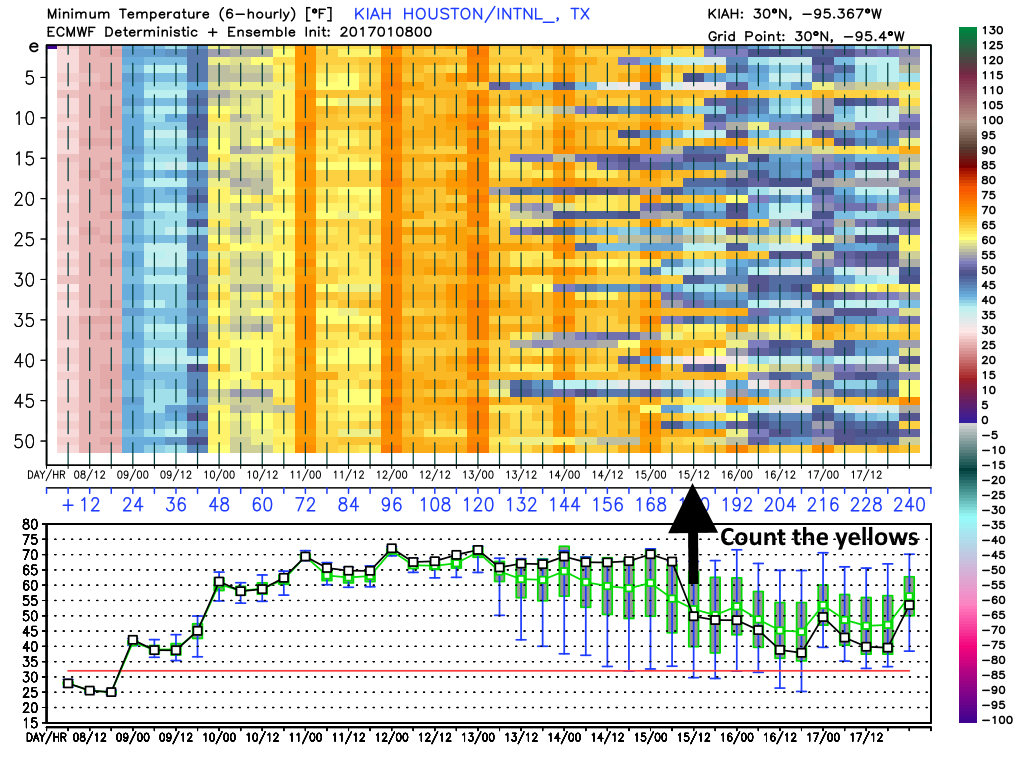
And so it is very difficult to make a forecast for the marathon. There is perhaps a one-third chance that the front moves through on Saturday, making for a clearing and colder race morning. There is perhaps a one-third chance the front arrive just before, or during the race, which makes for a wet race morning, with perhaps 1 inch of rain or so (potentially a wet and windy mess). And there is perhaps a one-third chance the front doesn’t make it through until after the race, making for a warm, humid run.
I hope we will find some clarity in the forecast in a day or two, but as of right now the forecast is a mess because the timing of the front is so close to race day.
(Space City Weather is sponsored by Westbury Christian School for this month)