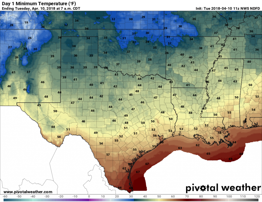
When the clock struck 2:10pm on Monday, Houston’s temperature rose from 59 to 61 degrees at Bush Intercontinental Airport. Thus ended a streak of 51 hours of temperatures below 60 degrees, which Matt notes is the region’s longest streak of sub-60 degree weather in April since Houston went 61 straight hours from April 6-9, 2007. But fear not, lovers of cool weather, as the temperature remained in the low 60s for only about 12 hours, before falling back into the 50s this morning as another weak cool front moved into the region.

Tuesday and Wednesday
Prepare yourself for a couple of days of exceptional weather. With modest northerly winds, and clearing skies, highs Tuesday should climb into the mid-70s, and on Wednesday into the upper-70s. Lows Tuesday night will generally be in the 50s, and several degrees warmer on Wednesday night as the onshore flow resumes. Enjoy!
Thursday
A bit warmer, with mostly sunny skies and highs in the low 80s. Winds out of the south will be noticeable as the the onshore flow really kicks in, piling up moisture across the region. Still, a pretty darn nice day.
Friday through Saturday morning
Friday will warm into the low 80s, but temperatures will be moderated somewhat by mostly cloudy skies. The timing is still uncertain, but due to a approaching low-pressure system we’re likely to see storms headed into the weekend. Our best guess right now is that areas north and west of Houston (i.e. Brazos Valley) see some thunderstorms Friday afternoon, but for most of Houston any heavier rainfall and thunderstorms will probably hold off until Friday evening or the overnight hours. These storms should be fairly fast-moving, so we’re not too concerned about rainfall accumulations, but at this point we can’t rule out some severe weather and potentially lots of lighting. (Most modeling suggests the stronger storms will develop east of Houston, over Louisiana). Regardless, this is something to think about as you make any plans for Friday night and Saturday morning, and we hope to have better details as we get closer to the weekend.
Saturday afternoon and Sunday
Skies should clear out sometime on Saturday, and we should be left with a pretty nice day—with highs in the 70s. The front bringing Friday night’s storms is a fairly strong one, so we expect Saturday night to be pretty chilly, with much of the area probably falling into the upper 40s. This is a good cold blast for mid-April. Sunday should be spectacular, with highs in the low- to mid-70s and lots of sunshine.
We’ll probably jump back up to the low 80s for most of next week.

“Lovers of cool weather,” that’s me. Thanks for this forecast… I can wear my sweaters awhile longer.
So thankful for you guys and your accurate forecasting, even if it doesn’t stay cold!
Yes, we’re enjoying the cooler weather while it lasts, too!
Any thoughts on the wind for Saturday and Sunday? Would like to do some fishing on the bay.
Choppy winds Saturday, probably 15-20 mph. Dying down somewhat on Sunday I’d think.
Thanks, Eric!
In with cool, out with hot! That’s my campaign slogan. Anyhow, looks like it could be interesting Saturday morning for the Bellaire Trolley Run.
As always, the threat of severe weather exist at night and into the overnight hours……so annoying.
Eric, is it merely a coincidence or is there something about our climate and atmosphere that makes the threat of severe weather occur so often during the overnight hours?
Why can’t we get one of these hail storms for lunch for once? Haha!
This pattern of continued cold (not cool) fronts pushing through Houston in April reminds me of 2012. I remember that spring we were lucky to have cold fronts coming our way through early May! Any similarities that you see?
Thanks for the updates. Wondering what yall are thinking as far as hurricanes this year? I have a beach home rental in Galveston and really worried about the next big storm. Thanks
My kids’ school is having field day on Friday. I’m hoping this storm does hold off until the evening like you say it may. We are up in Spring near the Woodlands.