Good morning. Before the forecast, let me just say a few words about Tuesday’s storms. Most of the tornadoes associated with this powerful system remained well to the west (Austin), north (Crockett), and east of the Houston metro area. Notably, a powerful tornado struck the New Orleans area on Tuesday night, killing at least one person, and damaging many homes. Such large tornadoes are relatively rare in cities near the Gulf coast, a category which includes Houston. Why? Because the supercells that produce them typically form and pass further inland. This is due to the sharp temperature gradients needed between warmer and cooler air to produce tornadic rotation, which are often not present so close to the Gulf of Mexico. Usually, but not always, the tornadoes we see in Houston are EF-0 to EF-1, with winds of about 60 to 100 mph. An assessment will be performed today to determine the strength of the New Orleans twister.
Wednesday
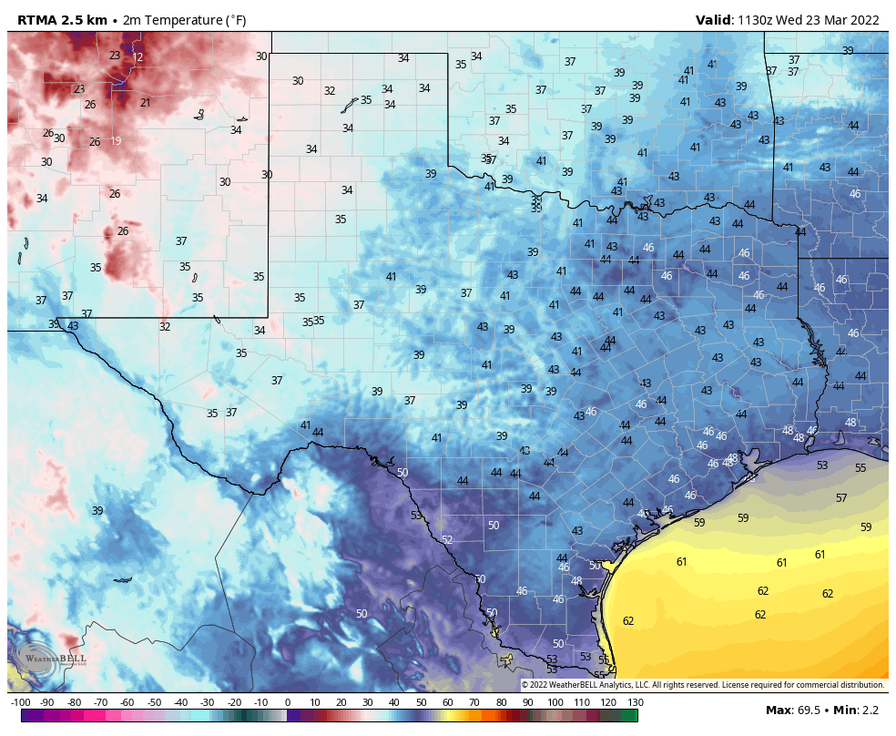
Temperatures have generally fallen into the upper 40s across the metro area and winds have died down this morning. With high pressure holding sway we’ll see some gorgeous spring weather this week. I call this “almost painful” weather because living in Houston we know the kind of heat and humidity that is coming this summer, and it’s almost painful to think about how pleasant things are now in contrast. But that’s my opinion of course, I know some of my readers absolutely love summers in Houston. To that I say, bless your hearts. High temperatures will reach near 70 degrees today, with winds out of the north at 10 to 15 mph. Low temperatures tonight will be similar, in the upper 40s for most.
Thursday and Friday
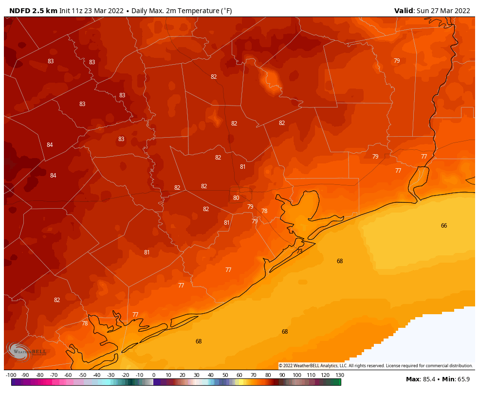
We’ll warm up heading toward the end of the work week, with highs in the low 70s on Thursday, and near 80 degrees by Friday. Lows should still drop into the 50s.
Saturday and Sunday
The onshore flow resumes this weekend, but we still should see fairly dry air and mostly sunny skies. In short, it should be another great weekend for whatever springtime activities you have in mind. Both days should see high temperatures of around 80 degrees, give or take. There are no rainfall concerns.
Next week
Clouds return to the forecast for the first half of next week, but for now I’m not anticipating much in the way of rainfall. Dewpoints will continue to rise, however, so we’ll become friendly with humidity by Monday or Tuesday. The next front should arrive later on Wednesday or next Thursday, but we’ve now reached the point of the forecast where it should be written in pencil, so we’ll just have to see what this way comes.
DUDE!!!! Do you know what “Bless your heart” in Texas lingo means???? I cannot believe that you would say that to native Houstonians that love our summer heat and humidity!!! It’s definitely better than the snow and ice from winters across the nation!!!
You will get over it!
Lol, I think he knows. As a native Houstonian that loves the summer heat and humidity, I got a chuckle out of the “Bless your heart” comment this morning. Our summers aren’t for everybody.
SMDH! That’s not the point!
You take the good with the bad living in Texas. We all know that. And the bad is the summer oppressive heat that goes on forever!!! Native Houstonian here and I hate our long hot hot hot summers!! But I wouldn’t live anywhere else!!
Bless your heart LOL. Thanks for the chuckle this morning. And thanks for your work!
Berger. Wait until you get old and your circulation slows. You’ll love summer too.