In brief: A tropical depression is heading toward the upper Texas coast, and will bring heavy rainfall into the region on Tuesday and potentially Tuesday night. We have put a Stage 2 flood alert into place for areas along and east of Interstate 45, and Stage 1 to the west.
Tropical Depression forms
In its 1 pm CT update on Monday, the National Hurricane Center upgraded a tropical system in the northern Gulf to a Tropical Depression, which means it has maximum sustained winds of 35 mph. A depression is a designation just below that of a Tropical Storm. Tropical Depression Five is moving to the west-northwest at 5 mph. The official forecast calls for this depression to become Tropical Storm Edouard some time later today or tonight before landfall on Tuesday. It is presently forecast to have maximum winds of 45 mph, but rapid intensification is possible. Regardless of further intensification, this will be a rainmaker.
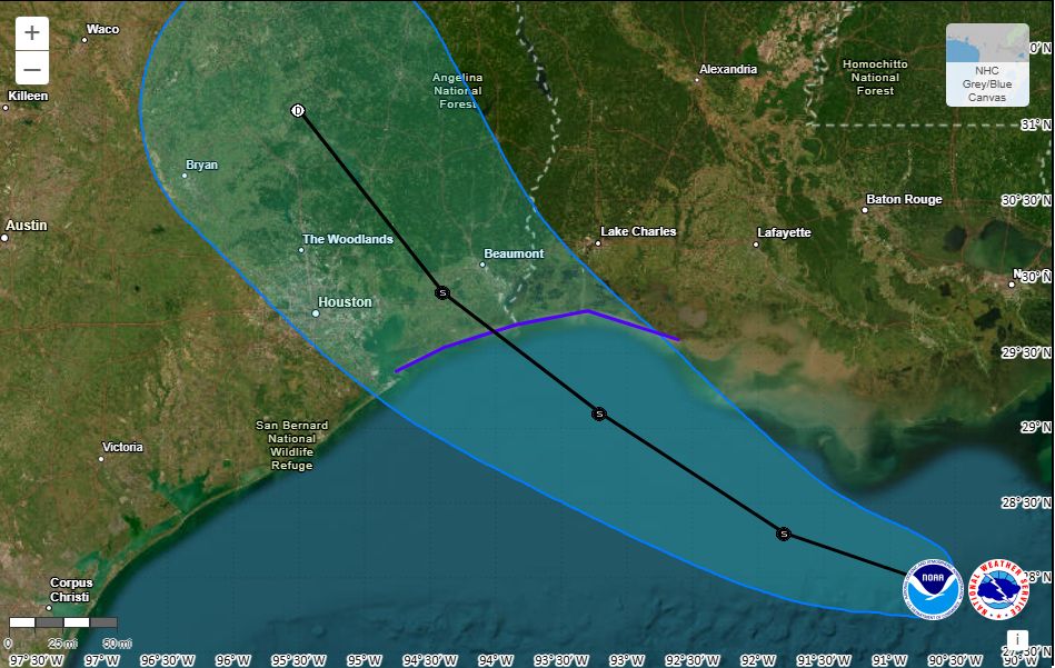
Where is TD Five headed?
Confidence is high in the track forecast that brings the tropical system to coast by Tuesday afternoon, or so, with a landfall between High Island, Texas, and Cameron, Louisiana. Along such a track, the likelihood of tropical-storm force sustained winds in the Houston region is low, but we could see some gusts of 30 to 40 mph along the coast and Galveston Bay on Tuesday afternoon. After landfall this system should continue to move northwest, away from Houston, before dissipating.
What about rain?
This is the big question. We don’t have any concerns about flooding today or tonight, with only scattered showers expected. That changes on Tuesday, beginning around sunrise.
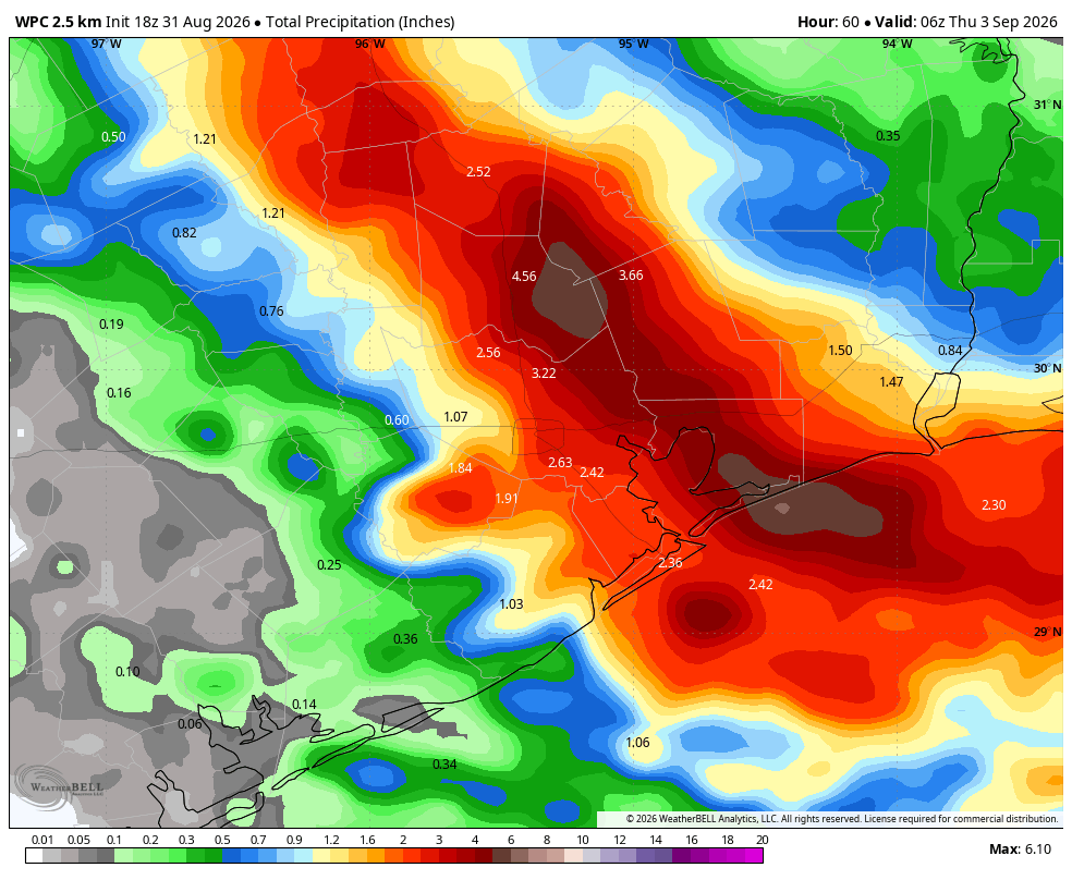
As the tropical system nears the upper Texas coast rains associated with it will begin to move onshore. The big risk with tropical moisture, especially at this time of year, is very high rainfall rates. Tropical storms can produce rainfall rates of 3 or 4 inches per hour (or in rare cases, even higher) which will quickly back up streets and highways. This is the case even with our soils in a very dry state after August. In terms of total amounts, we feel pretty confident that a swath of land between Houston and Beaumont will receive rains of 4 to 6 inches, with some higher bullseyes. Most areas should receive considerably less.
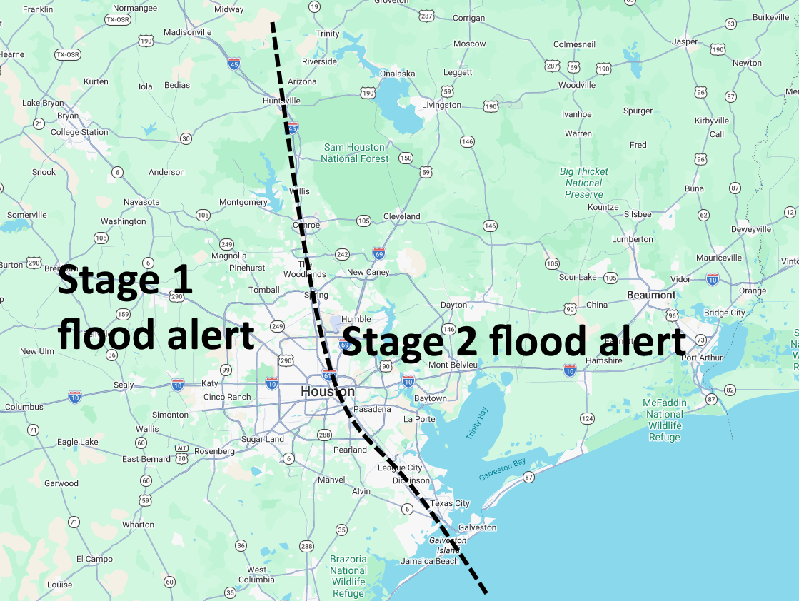
Based upon the latest modeling data I feel like this band of heaviest rainfall could line up as far west as the I-45 corridor through Houston, or further east, over Mont Belvieu or Winnie. Compared to this morning, our concerns about heavy rains falling over, or near Houston, are increasing a little bit. For this reason we have decided to issue a Stage 2 flood alert for areas along and east of Interstate 45 on our flood scale; and a Stage 1 flood alert for areas west of Interstate 45.
In terms of timing, we think rain chances will start to increase on Tuesday morning, peak during the afternoon hours, and persist into Tuesday evening and remain high perhaps until midnight or early Wednesday.
We will have another update by or before 10 pm CT on Monday.
