In brief: Just a short update to note the formation of the Atlantic season’s first named storm, Arthur, and what it means for Houston today. In short: rains ending, but the next several hours will be windy near the coast.
Hello, Arthur
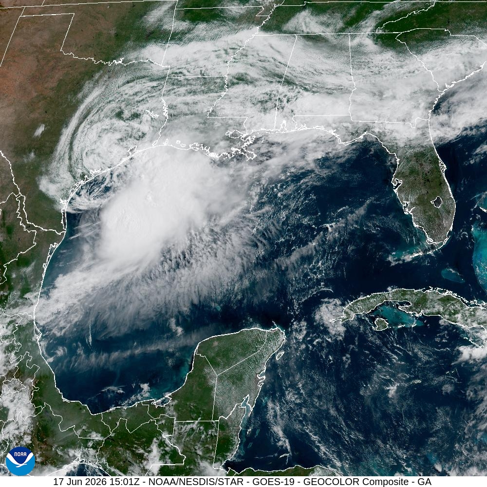
The Atlantic season’s first named storm, Arthur, has formed less than 100 miles from downtown Houston. Although that may sound concerning, we’re here to tell you it’s really not.
Our biggest concern from this system has been the potential for heavy rainfall, but that risk is now rapidly diminishing. The bulk of the precipitation from Arthur is falling well to the northeast of its center, and most of this is offshore. The scattered showers we are seeing across Houston as of 10 am CT on Wednesday will continue to diminish. We are likely to be rain free from the middle of today through Friday evening. For this reason we are ending our Stage 2 flood alert.
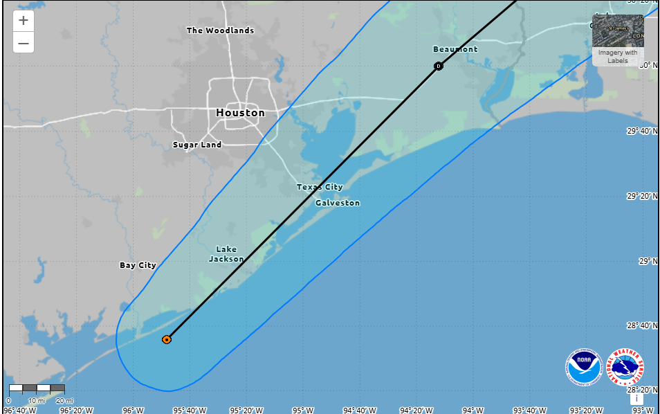
The biggest impact from Arthur is being felt right along the coast. Its sustained winds have been measured at 35 mph, or higher, along Galveston Island, with some gusts up to 50 mph. This has, frankly, exceeded our expectations. Even areas as far inland as Hobby Airport have recorded gusts up to about 30 mph. These winds should start to ease by this afternoon as the center of Arthur nears Galveston and starts to move away. After that we expect calm and sunny, albeit hot, conditions on Thursday and Friday.
We’ll have a full forecast for you, per usual, on Thursday morning.
