It’s another foggy morning and a dense fog advisory is in effect until 9 a.m.
TODAY-FRIDAY
Goodbye winter, hello early fall. Houston will see two days of near record heat with highs around 80 degrees, with sultry lows in the upper 60s. These overnight temperatures are nearly 25 degrees warmer than normal for mid-December. Skies will be partly to mostly sunny.
SATURDAY
Saturday will start out warm and muggy, with humidities near 100 percent. Heaven help you if you’re running a half marathon that morning because it’s going to be absolutely miserable for long-distance runs.
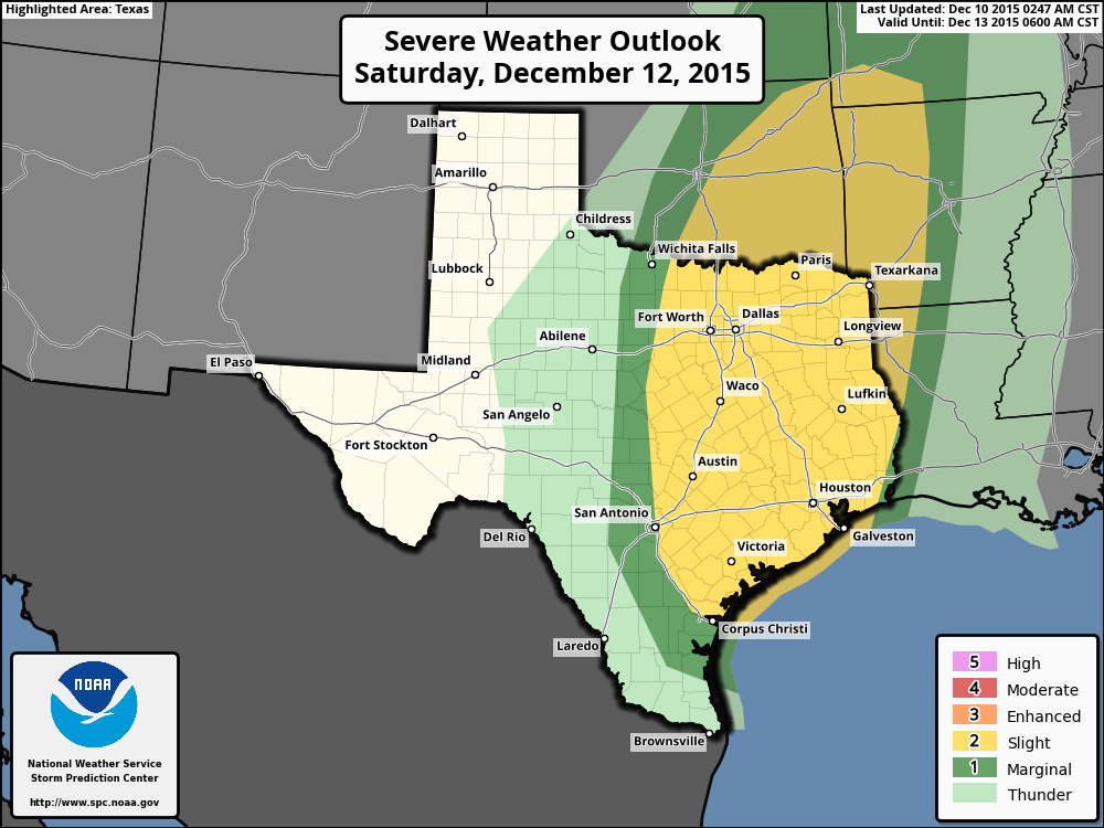
Rain chances will be relatively low during the day, but increase a bit during the afternoon before spiking after sunset as a storm system approaches and clashes with the Gulf of Mexico moisture. The entire region is under a “slight” chance of severe weather, according to NOAA’s Storm Prediction Center, with damaging winds the primary threat.
These storms should be capable of bringing 1 to 2 inches of rain for most of Houston, with a bit more possible to the north of the city. The heaviest rain and any storminess should come between sunset Saturday and sunrise on Sunday.
SUNDAY
Expect light to moderate rain during the morning hours after sunrise. It still appears as though the cold front will pass through Houston sometime between around 6 a.m. and Noon on Sunday, although the timing remains a bit iffy. After the front moves through rain should end quickly, and dewpoints will fall. I expect a dry afternoon and evening.
NEXT WEEK
Monday will be cooler but Tuesday will see us warm up quickly. After that, however, for the most part I’d expect cooler, but not extremely cold weather for the second half of next week.
I can’t tell you how much I appreciate these posts. The hype-free, “just the facts, ma’am” approach is delightful, and the guidance is useful.
Eric/Matt –
Any long range forecasts for air travel Christmas week? Any blizzards or ice storms likely up north? Or another Christmas with temps well above normal?
Thanks!
Blackhawks, that far out and that far away, you’re not going to get anything useful in the way of a forecast. It’s not much better than guesswork. If you want to see how at least the GFS model is trending, you can go here:
http://wxmaps.org/pix/meteograms.html
That will give you model forecasts out 16 days for a lot of cities, but don’t count on them to give you anything but a false sense of knowledge at this point 😉
Cool charts! – – now I need to learn how to read them.
Forecast is for snow on the 18th, but that’s before I leave.
Cool charts! – – now I need to learn how to read them.
Forecast is for snow on the 18th, but that’s before I leave.
The Big Chill hits Christmas Day.
So, Lights in the Heights is going to be a bust?
There may be a break in the weather this evening around the time of the festival. Perhaps not a total bust.
I was going to do 9 miles on Saturday morning… Doh!
Horrible time to try and run. I am going to wait until about noon on Sunday.
No half marathon Saturday but I am running the 25K Sunday in Sugar Land at 6:30 AM Sunday. Do you think the worst will be over by then?
Oops, I meant 30K.
Tricky to say for sure. My guess is the front comes through sometime during the run. So rainy to start, and very humid, but drier and cooler to finish?
Taking the blanket off the bed today. Might well be running the a/c tonight; that’s not right.
Man, pity the poor guy who’s running a half-marathon this weekend, Eric. Good luck!