Rain possible tonight, stunning weather for the rest of the week

It’s in the low- to mid-50s across most of Houston this morning, but with relative humidity near 100 percent and southeast winds the chill won’t last for long.

TODAY

Temperatures will warm into the upper 70s today, with mostly sunny skies turning mostly cloudy by the end of the day. As a cold front approaches and passes through the region tonight rain is possible, most likely between sunset today and sunrise on Wednesday. While some areas may see as much as 1 inch of rain, I’d expect most of the region to see only a tenth of an inch, or two. Significant storms seem unlikely.

WEDNESDAY-SATURDAY

Hello, gorgeous.

The front will usher in four days of cool temperatures, with highs in the 60s, lows around 40, and mostly sunny skies. Should be wonderful.

See full post

Cooler this week, but a warm Christmas?

Oh boy. My wife keeps asking me about a White Christmas next week. Yeah, about that …

TODAY

After a cool start with temperatures in the upper 40s we’ll warm into the low 70s, under sunny skies. Winds have already come back out of the south, so the influx of colder air that arrived on Sunday won’t last too long.

TUESDAY

As moisture from the Gulf of Mexico piles into the region on Tuesday we’ll see humidity levels rise, and high temperatures will climb into the upper 70s. Yes, it’s getting warm again. But only briefly. A fairly strong cold front will arrive late Tuesday or early Wednesday morning, bringing a chance of rain — I don’t expect more than a few tenths of an inch — after sunset Tuesday and before sunrise on Wednesday.

WEDNESDAY-FRIDAY

The front should move through by Wednesday morning, setting the stage for a gorgeous second half of the week.

It appears as though Friday morning will be this week's coldest. (Weather Bell)
It appears as though Friday morning will be this week’s coldest. (Weather Bell)

See full post

Front arrives, rain ending this afternoon, more winter-like this week

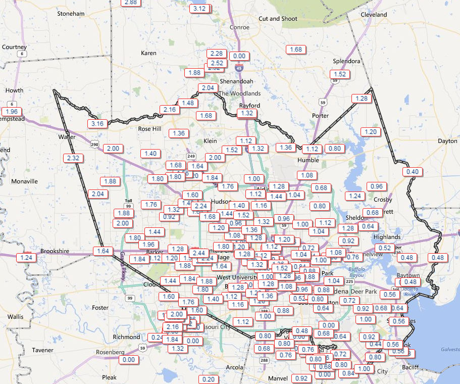
As of 9 a.m. the cool front had made it through Houston, and the strongest storms were moving quickly to the east. Temperatures have fallen about 20 degrees in the wake of the front’s passage, so adjust your thermostat accordingly.

As expected, rain accumulations last night and this morning have brought the greatest amounts north of Houston. (HCOEM)

See full post

Storms tonight, early Sunday, then cooler

Here’s an update on what to expect later today, tonight and Sunday

TODAY

The radar is quiet this morning across Houston and it’s likely to stay that way until early this afternoon. Later on storms may develop to the southwest of the city, in the Matagorda Bay area, and move north-northeast into Houston. Confidence is low in what may happen, but some forecast models show enough instability for some strong storms with this system during the afternoon and early evening hours before about 9 p.m, with some localized heavy rain. I can’t rule it out. Temperatures will remain muggy throughout the day.

TONIGHT

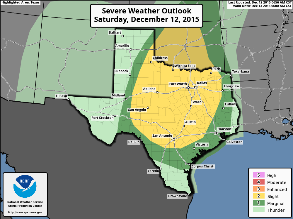
The main storm system will approach from central Texas later tonight in the form of a major squall line. I’d expect these storms to move into the western parts of Houston by around midnight, and affect the region through sunrise. Fortunately for Houston, while there is strong lift associated with the front, the atmosphere isn’t going to be all that unstable. This should limit the potential for very strong storms in the Houston metro area.

Houston should miss the worst of the storm activity, NOAA forecasts. (Storm Prediction Center)

See full post