After a very cold morning we’ll warm up; Easter forecast still in flux

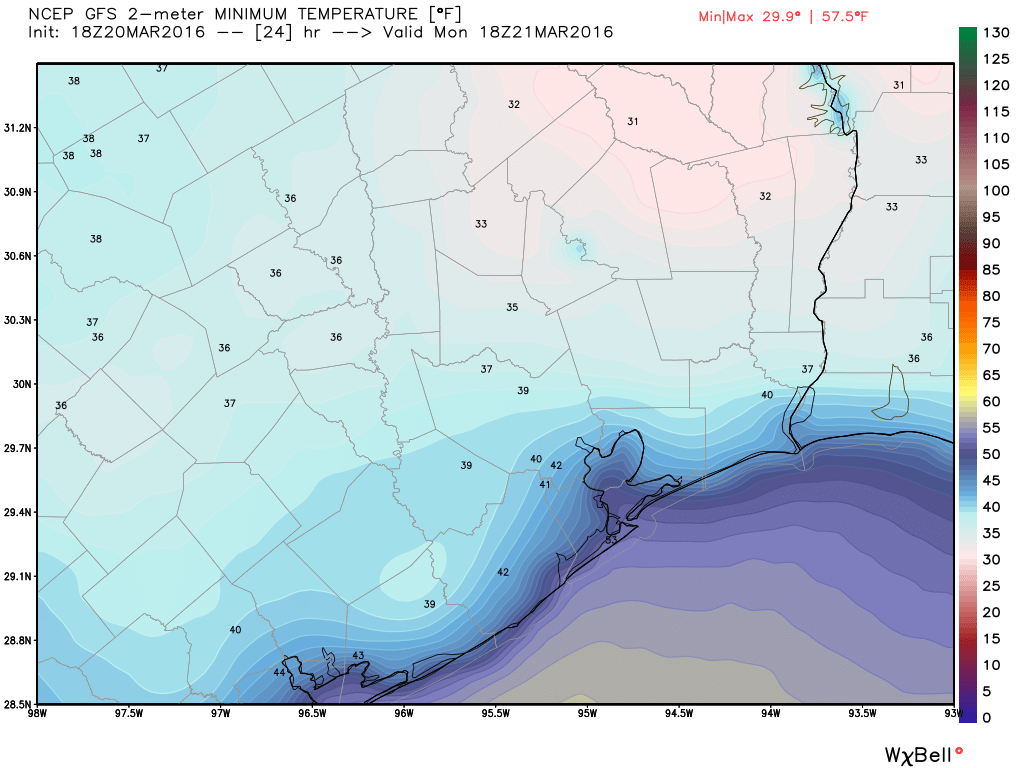
As expected it’s quite cold this morning, with temperatures just below freezing in Conroe and points north, and in the low 40s closer to the coast. It won’t last.

TODAY

Under the influence of high pressure we’ll see cool, sunny and gorgeous weather today with highs in the mid- to upper-60s.
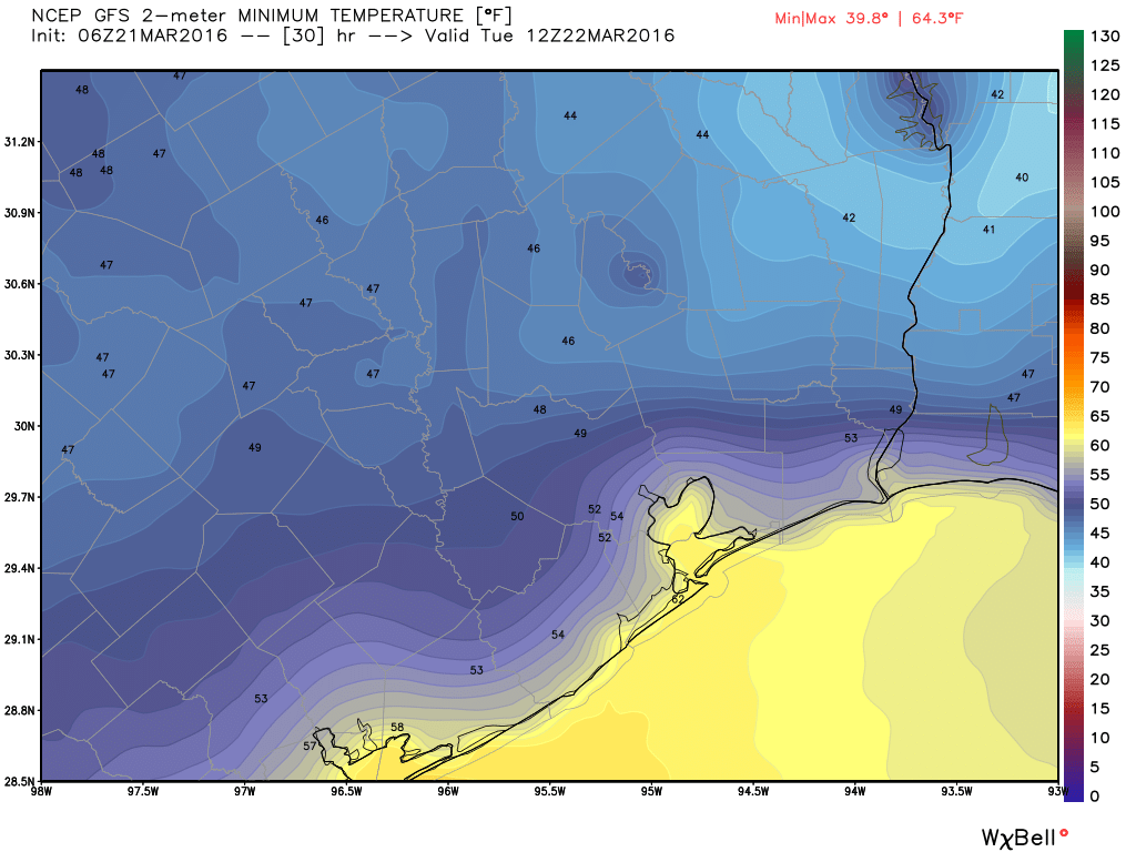
TUESDAY

Another cool morning, but lows will likely fall only into the upper 40s across the metro area. However a fairly brisk wind should pick up out of the south during the day, bringing back that familiar Gulf of Mexico moisture. Highs in the mid-70s

Lows on Tuesday morning will again be cool, but nothing like Monday morning, per this GFS model forecast. (Weather Bell)

See full post

Tonight likely the last really “cold” night until November

Houston certainly hasn’t had a cold winter, which we’ve discussed before, and any vestiges of cold air at this point of the year will be fleeting. But that doesn’t mean we can’t have a few last gasps.

And that’s what we’re going to get tonight. Strong northerly winds on Saturday and Sunday have brought a lot of dry, colder air into the region. And tonight as winds die down we will see ideal cooling conditions under clear skies.

(Weather Bell)
GFS model forecast lows for Monday morning. (Weather Bell)

See full post

After heavy storms in central Houston Friday night, everyone gets winds today

It’s been two weeks since Houston recorded low temperatures near or below normal levels for March, but we’ll finally return to a more winter-like regime for the next few days.

(National Weather Service)
Houston hasn’t had normal lows since March 6. (National Weather Service)


A cold front moved off the coast early this morning, but instead of bringing with it widespread showers, it delivered some intense rains for the central part of Houston, including the Texas Medical Center, during the evening hours on Friday. The rains exceeded 2 inches per hour in some areas and caused flash flooding. But after sunset the atmosphere stabilized over most of the metro area, and storms associated with the front passed well to the south of Houston.

See full post

Heavy storms and flash flooding in central Houston area

Good evening. A particularly intense set of thunderstorms has developed and more or less settled over central Harris County this evening, leading to a number of warnings from the National Weather Service.

Of most concern is a flash flood warning for near downtown and the Texas Medical Center area, where more than 2 inches of rain have fallen in the last hour. The area of the warning is shown below and is in effect until 8:15 pm CT.

A flash flood warning is in effect until 8:15 p.m (National Weather Service)


This area of storms is also producing hail in some locations. Great care should be taken if you’re driving around the city of Houston, inside Loop 610, this evening.

I’d expect more scattered, potentially severe, thunderstorms to develop this evening before a cold front moves through tonight.