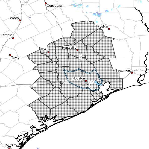
As expected, the National Weather Service has issued a flash flood watch for the greater Houston metro area from noon Tuesday through Wednesday afternoon.
Area of flash flood warning. (National Weather Service)
The National Weather Service forecasts rainfall amounts of 3 to 7 inches for most areas, with isolated totals of up to 10 to 12 inches possible. The main time of concern remains Wednesday morning.
After taking a look at some the latest model guidance here’s an updated look at what to expect on Tuesday and Wednesday, which likely will be the worst times for storm activity in the greater Houston metro area.
TUESDAY
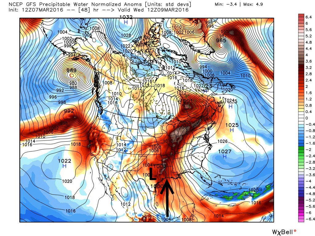
Right now I anticipate light to moderate rainfall on Tuesday afternoon, with most areas seeing between 0 and 1 inch of rain. There should not be too much trouble with the commute home on Tuesday evening. At some point between 6 p.m. and midnight we’ll see an increase in rain showers. Here’s why:
A low-pressure system will act like a vacuum cleaner to draw exceptionally high levels of moisture (seen here in precipitable water standard deviations) into Texas, Louisiana and Arkansas, and points further north. (Weather Bell)
We’ve got lots to discuss about the week of weather ahead, so let’s get right to it this morning.
TODAY
We’ll see mostly cloudy conditions today as the wind ramps up out of the south, gusting as high as 25 mph. Temperatures will climb into the mid-70s. Rain chances will remain fairly low, however, due to a capping inversion. Expect lows tonight in the upper 60s.
TUESDAY
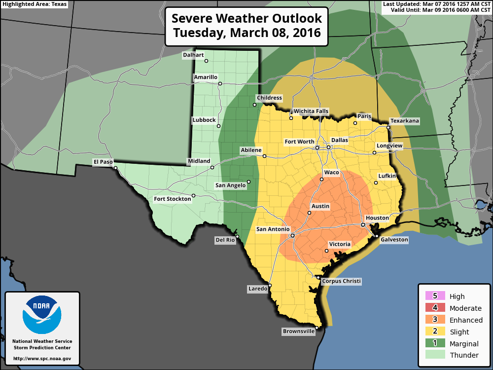
Those southerly winds will continue throughout Monday night and into Tuesday morning, raising moisture levels in the atmosphere. They will also increase tides along the coast by as much as 3 to 4 feet above normal, and the National Weather Service has issued a Coastal Flood Advisory. We should see increasing coverage of light to moderate rain during the afternoon hours on Tuesday, but the bigger threat comes Tuesday night.
NOAA Severe Weather Outlook for Tuesday and especially Tuesday night. (NOAA)
Good morning. We interrupt this lovely Sunday morning to bring you an update on the heavy rain chances we’ve been talking about for some time.
We’ll see fine weather today, and although Monday appears likely to be breezy with gusts up to 25 mph and cloudy, I don’t expect too much precipitation to fall. We’re going to have to wait for Tuesday, and more likely Tuesday night, for the action to begin. But first, a quick word about what’s driving this week’s heavy precipitation.
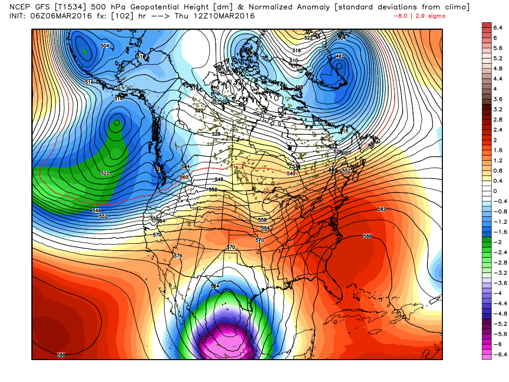
A very strong upper-level trough, an area of low pressure in the upper levels of the atmosphere, will move into Mexico this week. What’s so striking about this system is that it’s forecast to be as much as six standard deviations below normal, so these are really abnormally low pressures for March. Low pressure in the upper atmosphere allows air at the surface to rise. And generally more vigorous rising air leads to strong rain showers when there’s atmospheric moisture.
The GFS model forecast for 500mb pressures, note the 6+ standard deviation low over Mexico shown in bright, Barney-like purple. (Weather Bell)