TS Hermine finally forms in Gulf, bound for Florida and beyond

After what seems like months of build-up, speculation and watching, Tropical Storm Hermine has finally formed in the Gulf of Mexico. The system still looks somewhat ragged, but its wind speeds have come up, and there’s now the potential for further development before it nears the Florida coast in about 36 hours.

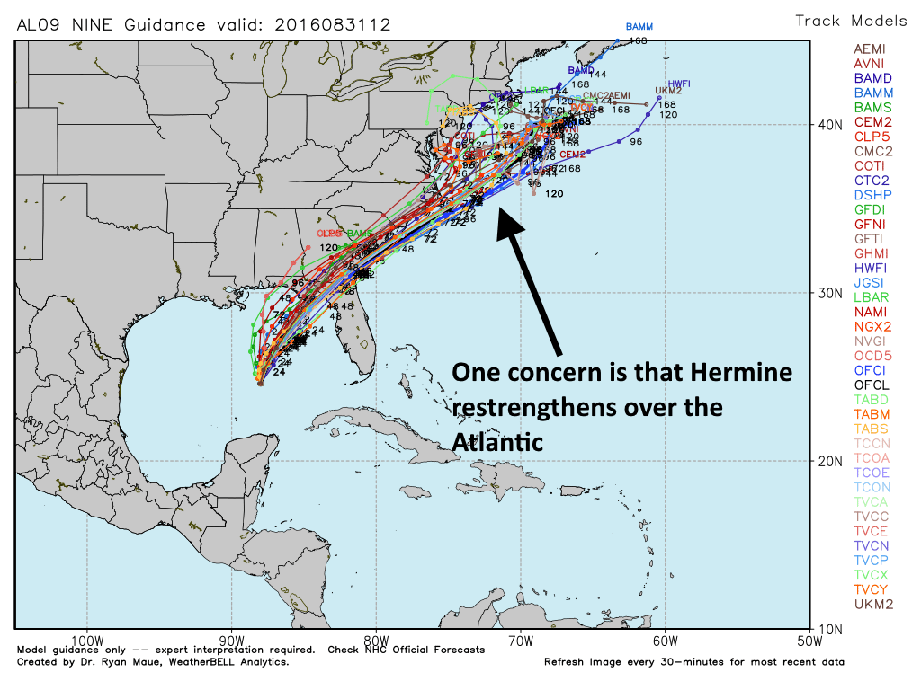
The system has gotten a lot of hype for a mere tropical storm. Part of this is because about a week ago the respected European model really showed strong development (which hasn’t occurred yet), and the fact that it has been nearly three years since a hurricane formed or passed through the Gulf of Mexico. And while this system, formerly known as Invest 99L and Tropical Depression Nine, has been subject to some derision it now should be taken seriously—not only by Florida but much of the east US coast.

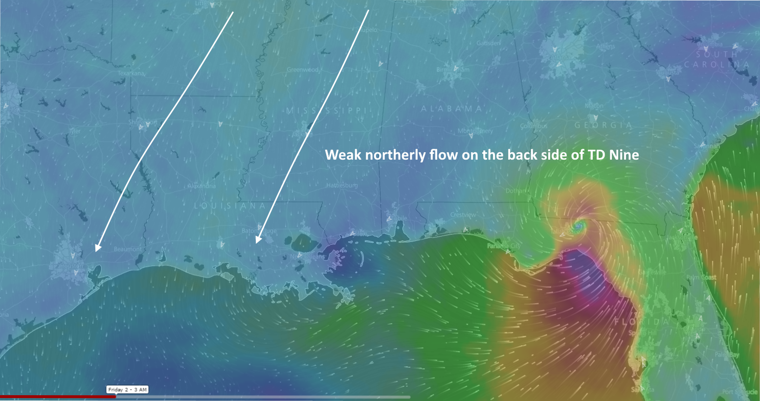
Right now this is a big tropical storm, with tropical-storm force winds out to about 100 miles from its center. Those winds may well intensify as the storm has the potential to strengthen into a Category 1 hurricane before landfall, although this is far from certain. Hermine also is both a rain (10-15 inches for some locations of Florida is possible) and surge threat to the west coast of Florida. The National Hurricane Center has these threats covered in its rainfall and storm surge products.

Track models for Tropical Storm Hermine. (Weather Bell)

See full post

Hotter for a few days before cooling a bit by Labor Day Weekend

An upper-level low pressure system is producing heavy rains down the Texas coast, from Corpus Christi to Brownsville, this morning. But Houston is beginning to feel the effects of high pressure, and will continue to do so for the next couple of days. We’ll eventually be cooler, too.

Today and Thursday

The net effect of the high pressure for Houston will be a return to warmer weather for a couple of days. We can’t rule out a few isolated, briefly heavy showers during the afternoon hours, but for the most part we’re going to see partly to mostly sunny skies, and a likely return of temperatures into the mid-90s. It’s what August is supposed to feel like!

Friday and Saturday

By Friday a weak front will backdoor into the region from the northeast. It’s not going to bring brisk winds or much cooler air, alas.

European model depiction of  surface winds on Friday morning. (Windyty)
European model depiction of surface winds on Friday morning. (Windyty)

See full post

Why hurricanes are strongest on the right side

With talk of invests, depressions, tropical storms, and hurricanes (oh my!), readers have asked about some of the science and processes involved with hurricanes. One question we received this week asked us to look at a hurricane’s structure, and where the worst weather occurs.

Infrared satellite imagery of Hurricane Ike before landfall, September 2008 (courtesy NOAA)

See full post

August’s “great divide,” and a look at Labor Day weekend

It’s been more than two weeks now, but can you remember back to the first part of this month? Very warm nights. Five straight days of 100-degree temperatures. Through the first 13 days of the month, an average high of 99 degrees. Then the big pattern change came, one in which tropical moisture won out over high pressure in August.

This happened:

A tale of two months. (National Weather Service)

See full post