Friday showers foretell a showery weekend

After a few showers yesterday, we should see a few more around today. An unsettled weather pattern is going to remain in control through Saturday night before some more pleasant weather next week. The details…

Today Through Sunday

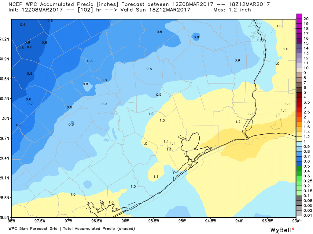
Today will be a bit of a tricky one. There’s going to be a chance of showers anywhere at almost any time today, but exactly how widespread the showers are and where they are will have to be something tackled as the day goes on. A “backdoor” cold front (coming from the northeast) will collide with ample Gulf moisture, some instability, and some upper level energy. The combination will lead to scattered showers and a chance of thunderstorms. The best chances will probably be both northeast and southwest of Houston.

One model solution today shows storms northeast of Houston and scattered showers south of the city. This is a plausible solution. (Weather Bell(


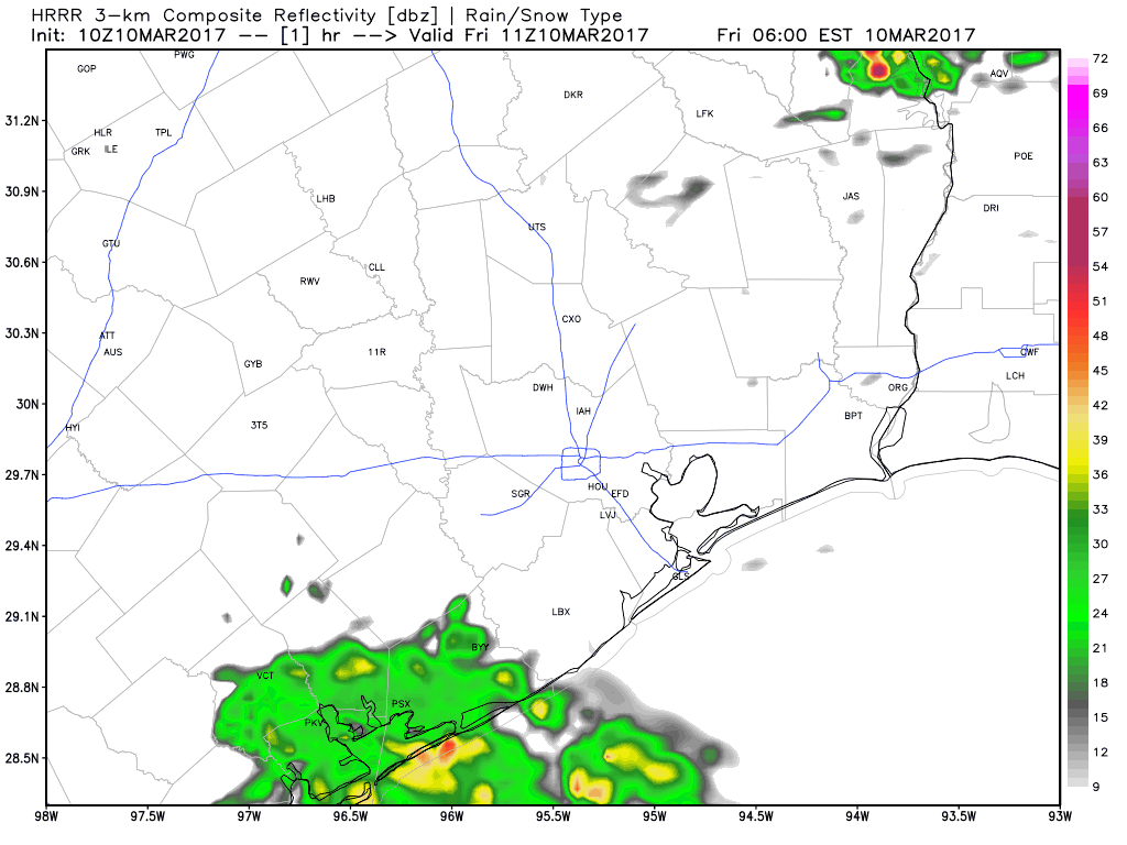
But as you can see, everyone will be at risk for a shower or storm today, so I recommend an umbrella. Severe weather on a widespread scale is unlikely, but there could be a strong storm northeast of the city this afternoon.

Temperatures will be mild, with highs in mid to upper 70s. If you have Friday night plans, the same umbrella advice applies. We should see most activity diminish, but new showers will likely develop in spots. We could also see some steadier rain develop south of Houston toward Saturday morning.

(Space City Weather is sponsored by an anonymous donor this month.)

See full post

It’s official—Texas had its warmest winter

It’s official, both Lousiana and Texas had their warmest winters on record. According to NOAA, Louisiana had an average temperatures 6.8 degrees Fahrenheit above average, and Texas was 5.7 degrees above average. From the graphic below it’s not hard to find the culprit for the warm temperatures—the Gulf of Mexico—heated at least in part due to a warming climate.

Average temperature percentiles. (NOAA)

Now let’s jump into the forecast, which will show a hint of cooler weather for next week, and a mostly pleasant Spring Break week.

Today

Temperatures are in the mid- to upper-60s this morning across Houston, and this is helping to cause some fog over the sea and for areas near the coast. It should clear by mid-morning. Skies should remain mostly cloudy during the afternoon hours, with highs climbing into the upper 70s. With the moisture now coming back and an unstable atmosphere, we’re going to be returning to a pattern where thunderstorms are possible later today, although I think most of the region will probably remain dry.

(Space City Weather is sponsored by an anonymous donor this month.)

See full post

Why do meteorologists use different dates for seasons?

Last week, many meteorologists celebrated March 1 as the beginning of spring. Other than the “wait, did we even have winter?” reaction from some, others wondered why we say spring begins then, and not on March 21 (also known as the Vernal Equinox). The confusion stems from the two ways meteorologists classify seasons: meteorological seasons, versus astronomical seasons. What’s the difference? Why do meteorologists use one instead of the other?

Astronomical Seasons

The earth’s rotation around the sun, as well as the earth’s tilt, create the astronomical seasons. For example, at the Vernal Equinox (March 20-22, depending on the year), both the northern and southern hemispheres face the sun at the same angle. Both hemispheres, therefore, get the same amount of solar energy.

As the earth revolves around the sun, we reach the Summer Solstice (June 20-22), the earth’s tilt causes the northern hemisphere to face the sun more directly. This means longer days, more energy from the sun, and therefore, warmer temperatures. The southern hemisphere receives less direct radiation from the sun, which means shorter days, less energy, and cooler temperatures.That’s why Australia experiences winter when we experience summer.

Three months later, at the Autumnal Equinox (September 21-23), the situation is similar to the Vernal Equinox. Both hemispheres receive equal amounts of energy, and face the sun at the same angle. Finally, at the Winter Solstice (December 20-22), the northern hemisphere faces away from the sun–so the days are shorter, the sun’s energy is less direct, and therefore, the temperatures are cooler. Meanwhile, Australia bakes (more so than usual) during their summer.

Diagram of the astronomical seasons (courtesy NASA)

See full post

Expect more showers Friday and Saturday before Houston clears next week

Let’s face it, Tuesday’s cool front hasn’t done a whole lot of cooling. While some parts of Houston have fallen into the upper 50s, most of the central and southern part of the region have only fallen into the low 60s. We’ll have to wait until this weekend for a somewhat stronger front.

Today

Mostly cloudy skies and an easterly wind should hold temperatures today down to about 70 degrees, but there should be no rain. Clouds and winds shifting to the southeast tonight will preclude overnight lows from falling further than into the mid-60s for all but far inland areas.

Thursday

While we can’t rule out the possibility of some scattered showers on Thursday, as moisture levels rise, it looks like most of the area will remain dry. Skies will again be mostly cloudy, with temperatures rising into the mid- to upper-70s.

Friday and Saturday

A combination of increased moisture levels, and lower pressure systems moving in from the west will lead to the likelihood of rain showers and potentially some thunderstorms on both Friday and Saturday. In terms of accumulations I don’t think the area will be looking at more than 1 to 2 inches of rain—with isolated totals a bit higher than that—during the end of the week.

NOAA rain accumulation forecast for now through Sunday morning. (Weather Bell)

See full post