Flooding threat almost over for upper Texas coast

We have been talking about a potential flooding threat for Houston for quite awhile, and those of us along the upper Texas coast can finally begin to contemplate putting this event in the rear view mirror. Overall, these rains turned out to be pretty much as expected for the Houston area—with most of the region getting 2 to 5 inches of rainfall over the last several days.

However, Houston and Galveston represented a relative calm in the storm. Multiple parts of the Texas coast, such as the Rio Grande Valley, Corpus Christi and Port Arthur, received 12 inches or more of rainfall from a tropical disturbance that moved into Texas this week. The following map of estimated rain totals over the last three days (which you can click to enlarge) shows this. Truthfully, we anticipated the greater rainfall totals in Corpus Christi, but the Beaumont and Port Arthur-area rainfall surprised us. That bullseye could just as easily been Houston.
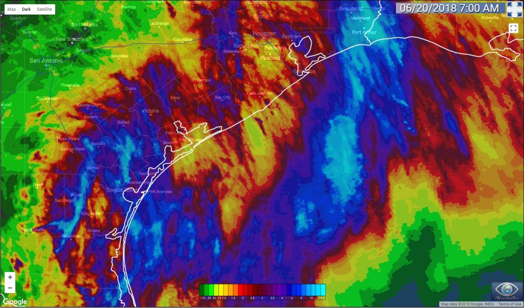
Rainfall estimates for the 72 hours preceding 6am CT Wednesday. (iweathernet.com)

Wednesday

The atmosphere remains very moist over the region, but the axis of heaviest rainfall has moved off to the southwest, from Brownsville, to Corpus Christi to Victoria. The National Weather Service has retained a Flash Flood Watch for Jackson, Wharton, Matagorda, and Colorado counties, but removed the rest of the Houston metro area from these watches.

See full post

Flash flood watch for Tuesday as storms encircle Houston

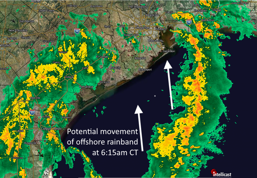
The Houston region missed out on most of the rainfall associated with a tropical disturbance Monday, as the Beaumont area got the worst of it with 5 to 7 inches of rain falling in some areas, and in some cases more. The atmosphere remains pregnant with moisture, however, and while Houston lies between heavy rainfall to the east (near Beaumont again) and to the southwest (near Corpus Christi) this morning, it is likely that one of these long rainfall bands moves over the Houston region eventually today. For this reason, the National Weather Service has placed Harris, Chambers, Galveston, Brazoria, and Fort Bend counties under a flash flood watch through 7pm today.

Radar image at 6:15am CT. (Intellicast/Space City Weather)

Tuesday

The much-discussed tropical disturbance has moved inland, into Texas near the Coastal Bend, but it will continue to serve as a focus of low pressure and atmospheric moisture for a few days. Given the long, banding feature on radar over the Gulf of Mexico on Tuesday morning, it is clear that somewhere along the upper Texas coast is going to get a healthy amount of rain today, probably on the order of 4 to 6 inches as training showers move inland. Whether that’s central Houston, Baytown, or somewhere between Baytown and Beaumont is less clear. For this reason it is probably safest to expect widespread totals of 1 to 3 inches of rainfall if you live in the counties in the flood watch area, but realize there is a chance for considerably more than that. This probably is still just a street flooding issue, although I’m a bit concerned about Baytown and points immediately east of there that received 3 to 4 inches of rain on Monday.

Regardless, today is a day to be aware of weather, anticipate the potential for street flooding, and check conditions before making a drive across town. We will update this site as warranted.

See full post

Lots of rain this week in Houston, but probably not widespread flooding

Sunday marked the beginning of a surge of tropical moisture into Houston, and Monday represents the second day of what is looking like a four- or five-day stretch of wet weather for the region. The good news is that, despite the soggy conditions we anticipate, right now it doesn’t appear as though we are going to see extremely high rainfall rates that will cause significant flooding. Our best guess for conditions through Thursday, therefore, is sporadic street flooding. If you’re wondering how this affects your activities, it should be business as usual in Houston for the most part. (And if you’ve scheduled an outdoor birthday party, you have our apologies).

Monday

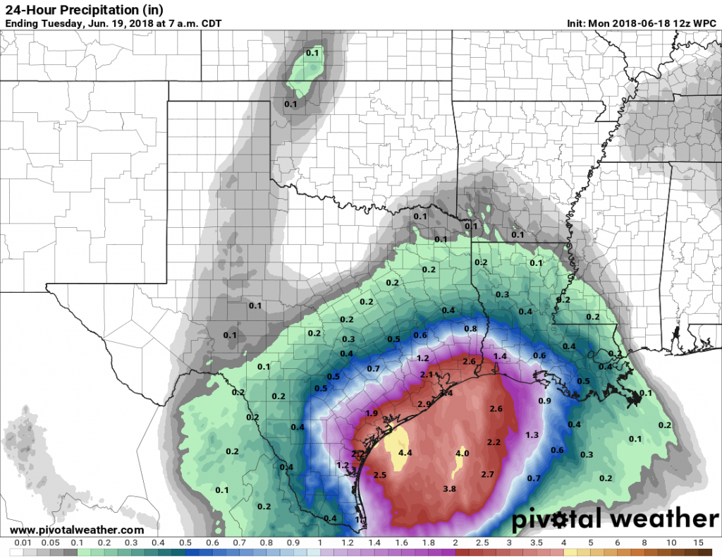
The radar shows scattered, moderate showers streaming into the Houston area this morning, but the heaviest rainfall remains offshore. That should change later this morning and into the afternoon, as a tropical disturbance moves closer to the Texas coast, and inland tonight. We anticipate the greater Houston region will see 1 to 3 inches of rainfall today, with the potential for higher localized amounts under the most intense storms. As you can see in the map below, rain totals will likely be greater near the coast.

NOAA’s 24-hour rain accumulation forecast for 7am Monday through 7am Tuesday. (Pivotal Weather)

Given these conditions, we do not anticipate widespread problems due to rainfall, however if you find yourself in a heavy downpour, the most dangerous thing you can possibly do is drive into high water. Please, don’t do that. Wait a little while, as these storms should progress through the area fairly rapidly and any flooding should be temporary.

See full post

A wet Monday in Houston: Here’s what we know, and what we think

Sunday has gone about as expected—with a smattering of heavy downpours but most of the region receiving 1 inch of rain or less. Monday and possibly Tuesday will almost certainly be different, with the potential for widespread heavy rainfall, and enough uncertainty that we’re going to continue to watch the forecast closely. We will have an update on the site no later than 6am CT Monday.

What we know

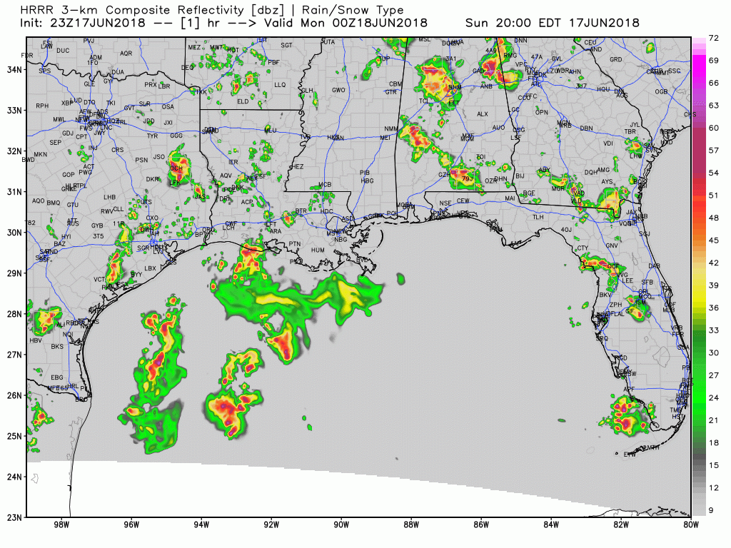
The heaviest rains are remaining well offshore over the Gulf of Mexico as of Sunday evening. The general expectation is that as the tropical disturbance moves west, toward the Texas coast, these showers will slowly move toward Texas and southern Louisiana as well.

HRRR model forecast for 7pm CT Sunday showing storms mostly offshore. Click this file to animate for a forecast through Noon, Monday. (Weather Bell)

This inland movement of heavier storms seems most likely to happen sometime on Monday morning, but whether that’s shortly after midnight or well into the day, we can’t say for sure. I’d guess after sunrise, if I had to.

See full post