Tropical Storm Michael has formed, bound for eastern Gulf

Tropical Storm Michael has formed in the northern Caribbean Sea, and it will move into the Gulf of Mexico and threaten the United States during the coming week. As we have said for several days now, the storm will have no direct effects on Texas—although we will be the beneficiary of some drier air on its back side later this week.

However, Michael now appears likely to become a hurricane, and so I wanted to post for those traveling east this week, or those with family or friends along the northern Gulf of Mexico coast. The models are in good agreement about the track of Michael, and a landfall along the Florida Panhandle on Wednesday seems most likely.
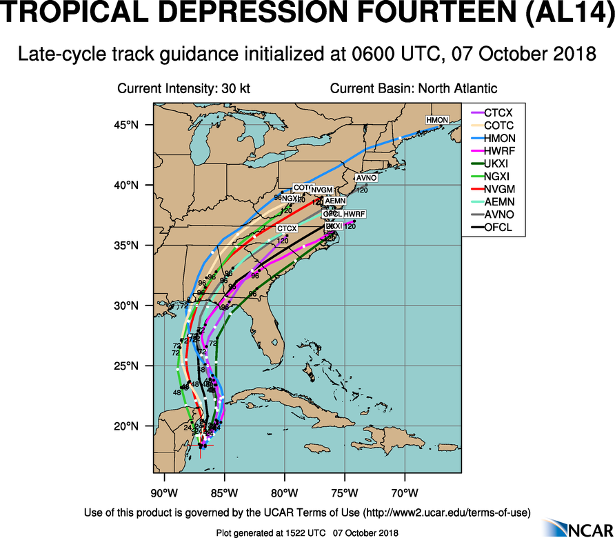
Track model forecast for Michael as of Sunday morning. (NCAR)

The bigger question in regard to Michael is intensity. At present, Michael is a minimal 40-mph tropical storm. However, as it moves away from the Yucatan peninsula, it will have an open ocean instead of land interactions, warmer waters, and lower wind shear. All of this is a recipe for intensification. The official forecast brings Michael to an 80-mph, Category 1 hurricane, but there is a fair amount of uncertainty. The bottom line is that, by Tuesday, coastal interests in Alabama and Florida need to be prepared for a landfalling hurricane—especially popular resorts in the Destin area. This storm will bring the threat of intense winds near its center, a surge to its east, and heavy rainfall.

We’ll be back in the morning with a full forecast for the Houston area. The next two weeks … look pretty amazing.

We think we see some nicer weather in the distance, Houston

The near-term forecast for Houston is not great, with on-and-off rain chances likely throughout the weekend and persisting into early next week, along with muggy weather. But none of these rains should be too extreme. And by the middle of next week the forecast begins to look markedly better for us after a long, long summer.

Friday

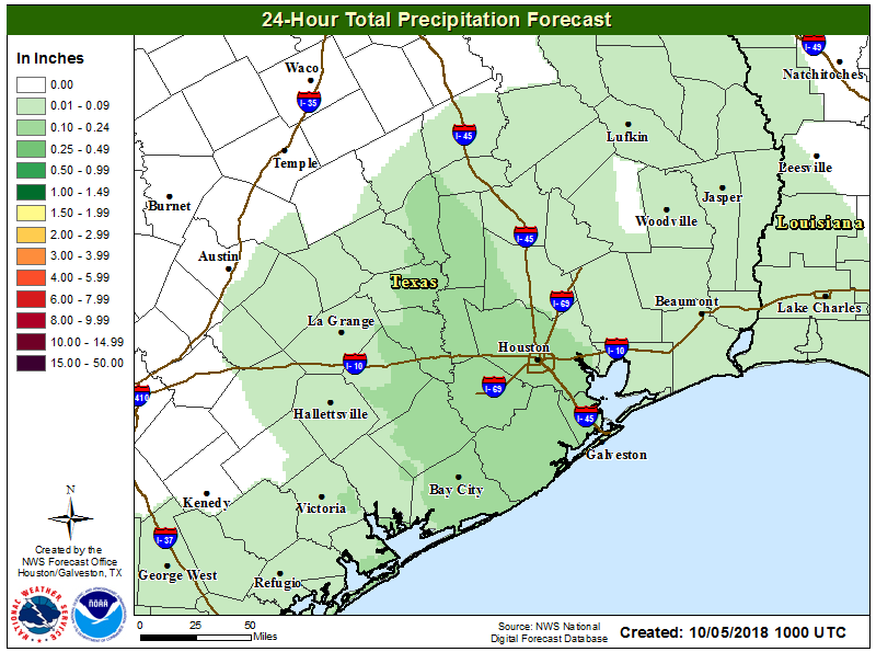
The radar remains largely quiet this morning, with a few rain showers sprinkled offshore. Conditions should be similar to Thursday, with partly sunny skies and scattered showers. As the forecast map below suggests, where rain does fall today it should be fairly moderate in nature, measuring only a few tenths of an inch.

Rain accumulation forecast for now through Saturday morning. (National Weather Service)

Unfortunately, it will be another warm and humid day, with high temperatures pressing up near 90 degrees, and likely hitting that mark under full sunshine.

Saturday

Another day with partly sunny skies, scattered showers, and warm temperatures. However, if you have outdoor activities planned on Saturday I’d be fairly optimistic at this point as forecast models indicate we’ll see some slightly drier air aloft. I’d have a plan for spotty showers that may pop-up, but as of now it does not appear likely that we’ll see too many prolonged showers over the Houston area.

See full post

Rainy pattern for the weekend, eyeing the tropics, and … our first front?

After a couple of modestly drier days, Houston should now return to a wetter pattern over the next week or so as high pressure moves off and the upper-level pattern in the atmosphere becomes more conducive to rainfall. Today, we’ll also discuss some potential tropical activity in the Gulf of Mexico, as well as hints of the region’s first real cold front about eight to 10 days from now.

Thursday

The radar is clear this morning, but with atmospheric moisture levels at reasonably high levels we should see at least some scattered showers this afternoon as temperatures move into the upper 80s. Skies should be partly sunny for what will feel a lot like yet another humid, late summer day.

Friday, Saturday, and Sunday

The weather for this weekend looks unsettled, but not overly stormy. While atmospheric moisture levels will be fairly high, there is no strong forcing for rainfall. So while there will be a healthy chance of rainfall each day (we think 30-50 percent for inland areas north of Interstate 10, and 40 to 60 percent for areas closer to the coast) we don’t expect particularly high accumulations.

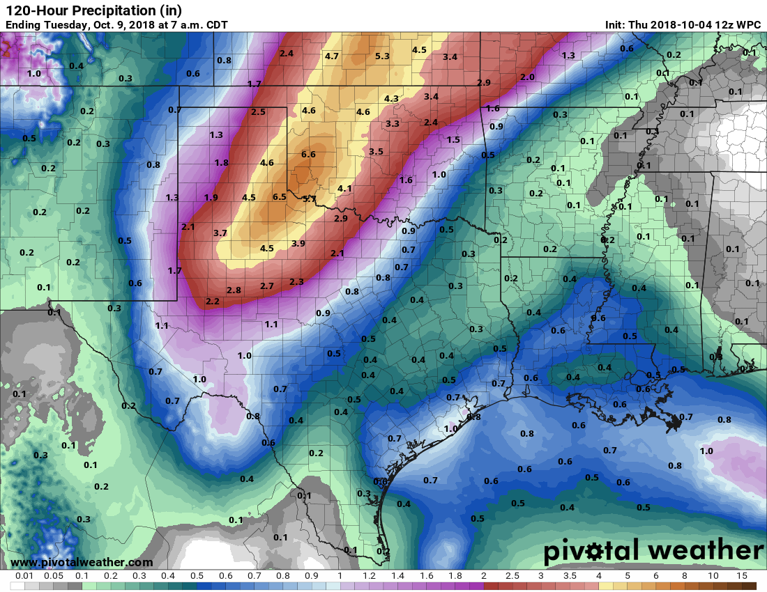
Rain accumulations during the weekend for Houston don’t look too extreme. (Pivotal Weather)

Most of the area will probably see between 0.5 to 1.0 inches of rainfall, with the usual outliers in terms of higher localized amounts. High temperatures will probably range from the mid- to upper-80s depending upon the extent of cloud cover (we’ll see some sunshine), and nights will be sticky, and in the mid-70s.

See full post

Hopefully drier in Houston today, but another wet weekend looms

Houston’s seemingly unending summer continues this week, with little break in the temperatures, humidity, or in a few days, rain chances. We’ll also discuss a tropical blob in the northwestern Caribbean Sea that ultimately shouldn’t have much effect on the region’s weather.

I was asked in a KUHF radio interview on Tuesday about the lack of fronts this year, and I said the most depressing thing about it is that we’re missing out on potentially great weather. October and November often see some of the nicest weekends of the year, and none of these are yet in sight. It’s a rather lousy thing.

Wednesday and Thursday

Some dense fog has developed over central and northern parts of the Houston area, and the National Weather Service has placed an advisory in effect until 10am. After this, weak high pressure should allow for partly sunny skies on Wednesday and Thursday.

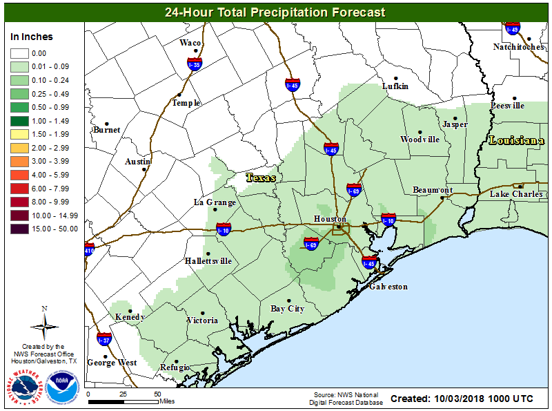
Wednesday’s forecast precipitation, shown here. This will probably be the region’s driest overall day for the next week. (National Weather Service)

Some areas will still see rain showers and possibly thunderstorms over the next two days, but accumulations should not be too significant—likely in the tenths of an inch. Highs will be near 90 degrees both days, and may reach that mark where skies are sunnier for longer.

See full post