After this front, Goldilocks weather for awhile in Houston

A cold front is moving through Houston this morning, heralded by a thin line of showers and thunderstorms sweeping down from northwest to southeast. This front should usher in a period of sunnier, drier weather for awhile, with pleasantly warm days and nights. In fact, the next week or so looks exceptional for those who like spring and fall conditions in Houston.
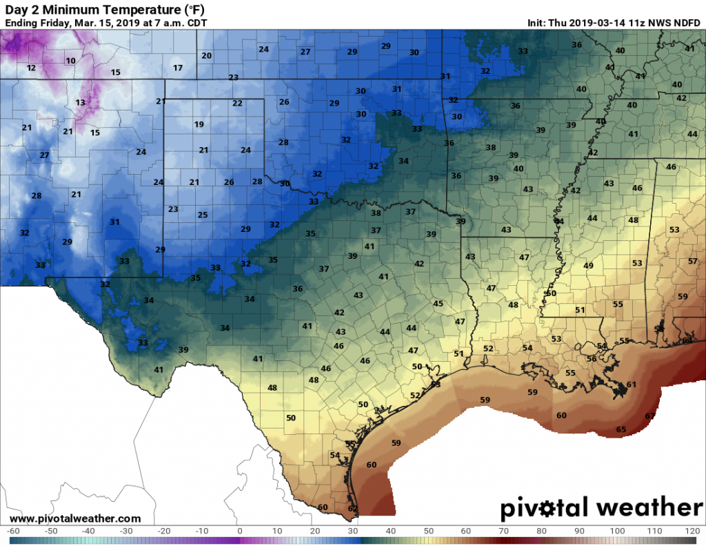
Low temperatures Friday morning will be quite a bit cooler. (Pivotal Weather)

Thursday

The front will push through Houston this morning, with showers ending quickly, and in its wake we’ll see drier and eventually cooler air move in behind. Highs today will be in the mid-70s, with clearing skies this afternoon and rather pleasant conditions. Lows tonight will fall down to around 50 degrees—cooler inland and warmer near the coast.

Rodeo weather

If you’re heading to the rodeo … prepare for nice weather! Pre-show temperatures will be around 70 degrees, with clear skies and low humidity this evening. Walking out of the concert, expect temperatures to have falling into the low 60s. Winds are going to pick up tonight out of the north tonight, but stronger gusts in the 20s probably won’t arrive until midnight or later.

Friday

Significantly cooler and drier air begins to arrive during the overnight hours, and as a result we can expect at least the first half of Friday to be fairly breezy, with partly to mostly sunny skies, and highs only around 60 degrees. Lows Friday night will fall into the upper 40s for most of Houston.

See full post

We’re just a day away from lots of sunshine, Houston

Temperatures have run 10 to 15 degrees above normal this week for the Houston area, and we’ll experience one more warm day before we cool back down to more spring-like weather for awhile. The good news is that, after a long string of cloudy weather, we’ll also see a nice stretch of sunshine.

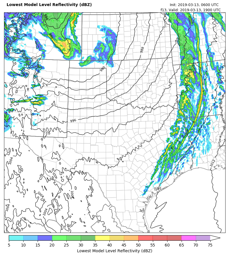
The regional Texas Tech-WRF model shows a broken line of showers approaching Houston at 2pm CT Wednesday. (TTU.edu)

Wednesday

Houston may see some effects from a powerful upper-level low pressure system that is barreling across the plains states today. Fortunately for us, we’re on the southern periphery of this system, which means that we’re likely to see only a broken line of showers and perhaps some thunderstorms move through the area, likely between about noon and 3pm this afternoon. Any storms should not last long as the system moves from west to east. We can’t rule out some briefly strong winds or hail, which will be slightly more likely for areas north of Houston than to the south of the city. Highs today should be in the mid-70s.

Rodeo weather

Rain chances should end by the early evening, meaning that our weather should be dry heading into the show. There might even be some clearing skies for a bit, with temperatures in the 70s. Relative humidity will be high, with some southerly winds at about 15mph, so it will still be one of those hair days. Temperatures won’t have dropped much after the concert.

Thursday

A cold front finally drags into Houston on Thursday, likely before noon. It is possible that we’ll see some brief showers with the front, but they should end fairly quickly. Drier air will follow fairly soon, allowing for clearing skies during the afternoon hours, and mostly sunny skies. Is anyone ready to actually see a sunset?

See full post

Two more very warm days before a cool down arrives

Houston’s abnormally warm weather will continue for a couple of more days before cooler air arrives toward the end of this week. How warm was Monday? Consider the following:

  • Galveston tied its record high for March 11, reaching 78 degrees
  • Houston had its warmest day of 2019, reaching 84 degrees.
  • On average, it is about 10 days early for a high temperature that warm in Houston

A cold front on Wednesday will bring about a significant change in our weather, leading us back into cooler, early spring-like weather, and also finally bringing some sustained sunny skies.

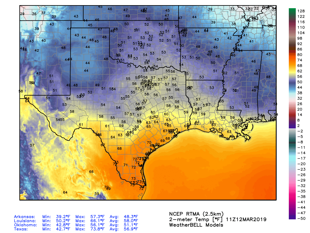
Half of Texas is warm, and the other half cool, as of Tuesday morning. (Weather Bell)

Tuesday

Fog is again a problem, and once it clears after mid-morning, we’ll be left with mostly cloudy skies. Some very light, scattered showers are possible today, but for the most part it should just be warm, with highs near 80 degrees, and humid. If we get a few breaks in the clouds, highs will likely crest 80 degrees in those areas.

Rodeo weather

Temperatures going into the show will be in the mid-70s, with light rain chances. Not much will change afterward, with temperatures falling only a few degrees and southern winds perhaps picking up to around 15 mph. These gusts may be noticeable on your walk back to your car or the metro.

Wednesday

Houston’s weather will turn more dynamic as the aforementioned cold front combines with a saturated atmosphere to produce showers and likely some thunderstorms for Houston and surrounding areas. Rain chances are highest from around 6am to noon, as the system moves through from west to east. Forecast models aren’t indicating anything too extreme, with most areas likely seeing one-half inch of rain, give or take. Can’t rule out some higher totals, however. Rain chances will linger into the evening, with highs near 80 degrees.

See full post

We’re going to say it: Winter is pretty much over for Houston

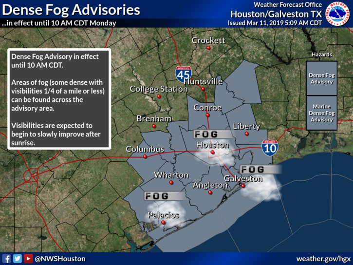
The big story this morning, and for the next couple of mornings, is fog with warm, muggy air lingering over colder waters. A dense fog advisory is in effect until 10am for Monday morning. We’re also ready to declare that Houston will see more no more freezes this season, and that despite some cooler weather during the second half of this week, winter is effectively over for our region.

The fog is back in Houston this morning. (National Weather Service)

Monday

After the fog burns off, today will be a mostly cloudy, warm day with temperatures likely rising to around 80 degrees. Some very light rain will be possible across the region, but chances are only about 10 to 20 percent. Rain chances will be a bit better tonight, but again anything that falls should be light and misty.

Rodeo weather

Temperatures going into the show this evening will be in the upper 70s, and while rain chances aren’t zero, they are quite low. Expect light southeasterly winds and high humidity. Post-show temperatures will be down around 70, with misty rain possible, but unlikely. Don’t expect to see many, if any stars—at least outside NRG Stadium.

Tuesday

Fog will very likely be a problem again this morning. Then, we’ll be in for another warm, mostly gray day, with highs again near 80. Rain chances will be slightly better, again with misty rain mostly likely what falls from the sky. Southerly winds will pick up later in the day, gusting up to 20mph by the evening.

See full post