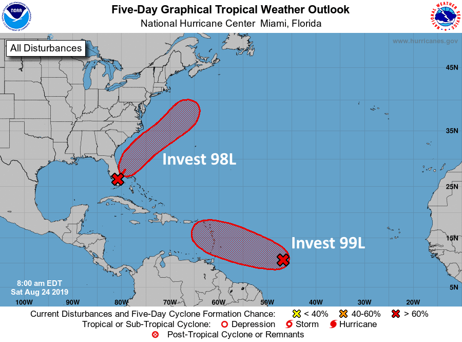
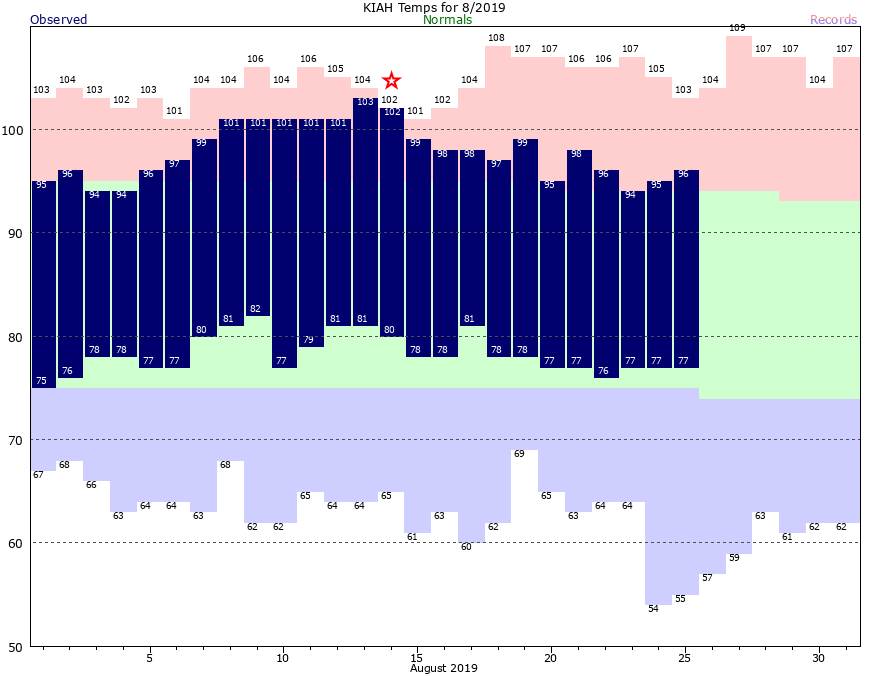
As often is the case, August has been a lousy month for weather in Houston. Certainly, the region did not experience a devastating hurricane this month (ala Harvey), or a massive heat wave (ala August, 2011). However, the average temperature this month has been 88.0 degrees, which is about 3 degrees above normal, and we did have a week straight of 100-degree or warmer days earlier. We won’t be quite that hot during the last week of the month, but we’ll still be plenty warm.
Monday and Tuesday
After a wet Sunday for much of the Houston, pressures are rising and that should bring rain showers to an end for a few days. Skies will be mostly sunny, with highs in the mid- to upper-90s for the region. Lows again will be sultry, falling to only 80 degrees for most of Houston. Any showers that develop should be near the coast, isolated, and briefly lived.
Wednesday and Thursday
A weak front appears likely to stall over north Texas in the middle of the week, and some of the instability related to this could generate some scattered showers across the Houston region. We’re still looking at partly sunny, and warm days with highs in the mid- to upper-90s, however. I’d peg rain chances at about 30 percent both days, with accumulations generally measured in tenths of an inch.