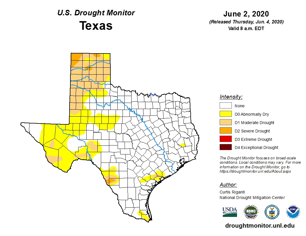
A few areas south of Houston saw some light to moderate showers on Monday, and the region will have one more shot at rain early on Wednesday morning. But after that conditions look really dry for at least a week or 10 days. Fortunately, the entire Houston metro area is at present drought-free. In fact, most of Texas is doing quite well for early June, with just 1.3 percent of the state in a “severe” drought or worse. This is a pretty decent posture in which to head into the hot summer months.
As local residents will know, during the middle of summer Houston often gets stuck beneath domes of high pressure for which it will not rain for days and days. Oftentimes, this pattern will only break with the incursion of tropical moisture. And then we enter the feast-or-famine state in which we can go from a drought to flooding within a couple of hours. So it goes along the Gulf Coast, during the summer. (At present we see no indications of tropical activity in the Gulf after Cristobal).
Tuesday
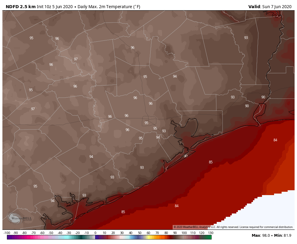
Speaking of heat, today will be hot and humid, so take care this afternoon when temperatures push into the upper 90s and the heat index soars into the 100s. Skies will be partly sunny, with light winds from the south. Weather conditions today will be a “proper” summer day in that it will mirror the kind of weather we typically see at the peak of heating in Houston, during late July and much of August. You’ve been warned.